Geography and History (including the introduction of Christianity and Islam)
Trans-Saharan Trade and the Spread of Islam
Beginning in ancient times, trans-Saharan trade routes united many markets and products, linking the commodities, buyers, and sellers of North and West Africa, the Middle East, and Europe. Trade networks spanned thousands of miles of sea and land and connected the distant trading centers and cities at their far ends. In the Sahara, such cosmopolitan settlements as Awdaghost, Sijilmasa, and Djenné, all part of the Mali Empire, linked desert trade routes. These trading centers made possible not only the widespread distribution of raw materials and finished products necessary for commerce to thrive but also the diffusion of cultural influences, including religion, to other civilizations.
Saharan Trade Routes
Camel caravans from North Africa began trekking across the Sahara Desert in antiquity (the period Before the Common Era, or BCE). The trade reached a peak during the ninth to the fifteenth centuries of the Common Era (CE), when lines of thousands of camels traveled a web-like network of trade routes that spanned the whole of North and West Africa. They moved a variety of goods, including copper, salt, ivory, enslaved people, textiles, and gold, northward from sub-Saharan West Africa to the Mediterranean coast, eastward to the Horn of Africa and Egypt, and southward into the Sahel, the semiarid region between the Sahara Desert and the Sudanian savanna to the south.
Trans-Saharan Trade Routes.The trans-Saharan trade routes of the ninth to fifteenth centuries (red dotted lines) stretched like a web across the vast expanse of North Africa. (attribution: Copyright Rice University, OpenStax, under CC BY 4.0 license)
Long before the trans-Saharan trade route’s golden age, commerce in the Sahara was relatively localized and consisted of the exchange of agricultural products like rice, sorghum, and millet for the products of new technologies such as iron goods or rare commodities such as salt. These early inter- and intraregional exchanges were made possible by pack animals like mules, horses, and donkeys, but trade was limited because these animals were biologically ill-suited for the extremes of the Saharan environment. When the Romans conquered North Africa in the second century BCE, they introduced the camel, which was already a beast of burden in Egypt. Capable of lasting days without water and having feet and eyelashes adapted for travel in sandy environments, camels enabled the people of North Africa to carry on regular long-distance trade across the Sahara for the first time beginning in the eighth century CE. The camel saddle, invented by the Tuareg people of North Africa, enabled camels to be ridden, which furthered their usefulness to trans-Saharan trade. The introduction of the date palm also helped make systematic long-distance trade possible. The fruit of the date palm is high in sugar, a natural preservative, and when dried it provided a high-calorie, easily transportable food supply to fortify traders on long journeys.
Trans-Saharan trade was also critically dependent on highly paid nomadic North African Berber (Amazigh)1 intermediaries and the string of oasis towns that connected distant parts of the network in an otherwise unforgiving landscape. Oasis towns provided traveling merchants with places to rest, water their animals, and acquire provisions for the next leg of their journey. They served the same function as the caravanserais, inns for travelers that existed throughout the Islamic world, including along the Silk Roads in Asia, in the Middle East, and in Egypt and Morocco. The Imazighen’s skills as caravan leaders and go-betweens facilitated the movement of everything from gold ingots to ostrich feathers across thousands of square miles of desert. Yet Amazigh traders were responsible for much more than the movement of goods and commodities. They were also devout believers in Islam who spread Islamic culture, law, custom, and tradition and helped to fuse a network of local and regional trade routes into a truly continent-spanning enterprise.
A Saharan Oasis.This photo shows the Saharan oasis city of Taghit, ringed by sand hills in modern-day Algeria. (credit: “Mountains of sand loom over the oasis village of Taghit in the Sahara” by The Central Intelligence Agency: The World Factbook/Wikimedia Commons, Public Domain)
A principal commodity exchanged during this early stage of trade was salt, which acted as a sort of currency. Not only is salt necessary to human and animal life, but it also helps to preserve foods, an important concern of people in an age before refrigeration technology existed. Communities on the edges of the desert acted as intermediaries in this trade, trading salt to forest tribes to the south that had access to goldfields. Only over time were other highly valuable trading goods introduced, such as gold and copper, which were then passed across the desert from tropical West Africa to the far reaches of the North African coast and beyond.
Trade across the Sahara gradually intensified between the fifth and seventh centuries CE, and in the eighth and ninth centuries, a series of main links became established. These developments were made possible primarily as the result of two important changes. First, the Ghana Empire of West Africa emerged as the earliest large-scale political entity in the region, and second, the Islamic conquest of North Africa led to the rise of Muslim states and a general cultural unification of the region. Combined, these developments brought people with shared interests and similar characteristics together in conditions that enabled them to consolidate and expand their economic interests, particularly as demand increased for gold from the Sudan.
As trade grew, Arab merchants in Morocco and in Islamic states in North Africa began to buy sub-Saharan gold. By the eleventh century, the gold trade was so successful that it was influencing commerce and society in the Mediterranean. For the first time, West African gold was used to mint European coins. This growth in the market for gold spurred the expansion of new links in the trans-Saharan trade route and resulted in the opening of a major trade artery between the towns of Sijilmasa, north of the Sahara, and Awdaghost to the south.
West African Trade Routes.The network of medieval trade routes in West Africa (red dotted lines) as mapped in the 1960s by French historian Raymond Mauny. Although they were not connected directly, Sijilmasa in present-day Morocco and Awdaghost in Mauritania were indirectly linked by routes that united other trading cities in the surrounding region. (attribution: Copyright Rice University, OpenStax, under CC BY 4.0 license)
One of the greatest early Sudanic empires, the powerful states that emerged in the region of West Africa south of the Sahara Desert, was Mali. Mali brought together the key components that had contributed to the earlier expansion of trans-Saharan trade. On the one hand, its rulers were Muslim, and the fact that they shared the same religion with many trans-Saharan traders strengthened the ties between these groups. On the other hand, these rulers exerted direct control over the goldfields at Bure. The vitally important trade centers of Timbuktu and Gao were part of the empire, as were the trading centers of Awdaghost, Oualata (Walata), and Tadmekka. Although both gold and salt remained the principal commodities of exchange, other commodities such as textiles, enslaved people, ivory, precious stones, and shea butter (a vegetable fat from the shea tree nut) were also regular exports.
During the ninth to fifteenth centuries, caravans routinely plied the sands of the Sahara, moving goods from distant West Africa to Egypt and centers of trade in North Africa, and from there onward, either across the Mediterranean to southern Europe or overland by way of the Sinai Peninsula to the region of the Levant in the Near East (modern Syria, Jordan, Lebanon, and Israel). From there, West African commodities could arrive at one of the land-based western terminals of the Silk Roads in such trade centers as the coastal city of Tyre in Lebanon, and farther inland, at Aleppo in Syria. Africa at this time was a key player in the vast commercial enterprise that laid the foundation for the first global economies.
The Spread of Islam
The Arab conquests of North Africa and the gradual advance of Islam into West Africa from the eighth century did much to unify what had been largely regional trade into a truly cross-desert system of commerce. The spread and adoption of Islam by nomads, such as the Tuareg and Sanhaja of the Niger region, helped expand the networks of exchange. Shared values and rules established by Islamic tradition and law engendered a sense of mutual trust and respect among devout Muslim traders and caravanners. African traders and merchants recognized other benefits of conversion beyond the spiritual, which included guarantees afforded by contract law that was based on Islamic law and made possible by widespread Arabic literacy. They also enjoyed the extension of credit and promissory notes between multiple parties, who were all investors in a caravan, and an increasingly extensive information network in which oasis towns acted as centers of communication and exchange.
Africans may also have been led to convert to Islam by other factors. A significant motivation was likely the harsh terms the conquering Muslims imposed on non-Muslims, which included exorbitant taxation as well as demands for hundreds (according to some sources, thousands) of enslaved people. These people, the majority of whom were probably Amazigh, were then shipped to markets in Damascus or Baghdad to be sold or transported onward to other market towns in the east. Since Islamic law forbade the enslavement of fellow Muslims, countless Amazigh people decided to convert to avoid being taken captive.
Once Islam reached the savanna south of the Sahara, ruling African elites adopted it, and in some cases they blended it with their traditional beliefs, a process called syncretism. Muslims, who could read and write Arabic script, were sought after as administrators by rulers whose languages did not have their own alphabets. The tendency of non-Muslim kingdoms to employ Muslim merchant-scholars as advisers and scribes (as, for example, in the kingdom of Ghana) in turn helped raise the profile of Islam among Africans and further encouraged conversion.
As commerce expanded, Islam gradually spread along the trans-Saharan trade routes and created a network of believers who trusted each other, thanks to a common language—Arabic—and shared values, traditions, and customs such as regular daily prayer. These shared social bonds and trust allowed trade to increase among peoples at some considerable distance who were otherwise unknown to one another. Another social interaction crucial to the widespread diffusion of Islam was intermarriage between Muslim traders and local women, who raised their children as Muslims. By the thirteenth century, Islam had spread into the region of Lake Chad and the Kingdom of Kanem by way of trans-Saharan trade.
The Spread of Islam.By the fourteenth century, Islam had spread throughout North and West Africa, including Kanem-Bornu (green area), and had become the state religion in the kingdom of Mali (pink area) and, in time, in Songhai, Mali’s successor. (attribution: Copyright Rice University, OpenStax, under CC BY 4.0 license)
The Mali Empire
Larger political entities emerged in Sudanic West Africa, beginning with the Mali Empire in the early thirteenth century. Around 1235, Sundiata Keita, the founder of Mali, set about consolidating his control over the heartland of the Mande people, a region centered on the well-watered grasslands of the upper reaches of the Senegal and Niger Rivers. Sundiata convinced the other Malinke (also known as Mandinke) kings to surrender their title, mansa (which means “ruler” in the Malinke language), to him. He thus became the sole mansa, the religious and secular leader of all the Malinke people.
Sundiata then moved to expand the Mali kingdom by taking control of all the Soninke peoples. This territory took in much of the former kingdom of Ghana and its nominally independent peripheral vassal states, including Mema and Wagadu. These newly conquered territories were often administered indirectly, leaving in place friendly puppet regimes to do the bidding of the Malian monarch, a political strategy that bred resentment among certain of the Malian vassal states, including Takrur and Songhai. In a few short years, the empire extended from the forested margins of the southwest through the grassland savanna country of the Malinke and the southern Soninke to the Sahel of former Ghana. The kings of Mali were less interested in conquering the various small kingdoms and chiefdoms of the grasslands than in taking the trading towns of the Sahel that linked the regional economy to the vast trans-Saharan trade. These towns were key prizes to the Malian monarchs and included Djenné, Timbuktu, and Gao. Throughout history, economic considerations have often driven political decisions, like conquering neighboring people, made by rulers on all continents.
The Mali Empire.The Mali Empire reached its maximum geographic extent in the fourteenth century, stretching from the mouth of the Senegal River in the west to the borders of present-day Algeria and Niger in the east, encompassing some 478,000 square miles and about four hundred cities. (attribution: Copyright Rice University, OpenStax, under CC BY 4.0 license)
When Sundiata’s successors converted to Islam, Mali became the largest Islamic kingdom in West Africa. Although its heartland was the Niger floodplain, Mali’s capital Niani was located at the Bure goldfields, enabling its rulers to exert direct control over the most valuable of all the raw materials transported along the trans-Saharan trade routes. Mali’s fabulous wealth made it famous, and its rulers used that wealth to attract scholars and jurists from all over the Islamic world. For example, Mali’s most famous ruler, the fourteenth-century Mansa Musa, transformed the trading center of Timbuktu by establishing mosques and schools there that became repositories of Islamic scholarship and learning.
Trans-Saharan commerce also promoted the development of public works in Mali, including the building of social and religious structures. Travelers to West Africa were impressed by the palaces, walled cities, and mosques they saw there and often remarked on them. In the sixteenth century, Leo Africanus, a formerly enslaved Amazigh diplomat and writer (born al-Hasan ibn Muhammad al-Wazzan), visited Songhai and praised the fine architecture of the city of Timbuktu, particularly the walled palace of the king and the temple of “stone and mortar” that dominated the center of the city. While these buildings awed many visitors, none were quite as striking as Timbuktu’s mosques. With its sunbaked brick walls and spiky pyramidal shape, for example, the Sankore mosque presented onlookers with a unique example of West African architecture at this time.
The Sankore Mosque.The fourteenth-century Sankore mosque, shown in this postcard from about 1905, was one of the leading centers of Islamic learning and scholarship in Timbuktu. It is also an example of Sudanese West Africa’s unique architectural style and has long dominated the city’s skyline. (credit: “Fortier 368 Timbuktu Sankore Mosque” by Dogon/Wikimedia Commons, Public Domain)
The fortunes of the Mali Empire were transformed in the fifteenth century, when a host of internal and external challenges combined to fatally undermine the Sudanic kingdom, including rebellions, dynastic disputes, the rise of powerful new neighbors, and the arrival of the Portuguese. These factors, which are explained next, had the effect of weakening Mali economically and politically, setting it up for instability and collapse.
The successors of Mansa Musa, who died circa 1337, tended to be weaker and less influential than their famous predecessor. During the brief reign of his son, Mansa Maghan, Timbuktu was raided and burned by the Mossi, a people who lived to the south of the Niger bend. Although the Malians returned to the city and ruled it for another hundred years, the Mossi raid demonstrated to others that the empire had been diminished. Later, Tuareg nomads raided and caused havoc. They occupied and governed Timbuktu for the next forty years.
The attacks by the Mossi and Tuareg squeezed the enfeebled Malian Empire from the north and east. These raids were followed by rebellions in towns, signaling a more dramatic shift in the region’s geopolitics whereby many of the empire’s most important cities sought to break free of Malian rule. Between 1374 and 1387, uprisings occurred in the salt-producing center of Takedda and in the major trading center of Gao. While Mansa Musa II managed to subdue the Tuareg rebellion at Takedda, he was unable to control the Songhai of Gao, who asserted their independence from Mali. By the 1430s, Mali had lost control not only of Timbuktu but also of vassal kingdoms such as Mema to the north, and critical trading towns such as Djenné had also regained their independence.
THE PAST MEETS THE PRESENT
Preserving Mali’s Past
Who owns a nation’s history? Who decides what constitutes an appropriate expression of religious faith? In Mali, such issues have occasioned much debate in the recent past. Many of the Malian Empire’s most important historical and religious sites are in danger as a result of political conflict. In 2012, members of the Tuareg separatist group, the National Movement for the Liberation of Azawad, which seeks independence for northern Mali, and members of Ansar Dine, a group linked to al-Qaeda, attacked mosques in the city of Timbuktu. Members of these groups believe the mosques violate Islamic prescriptions for religious buildings and are “idolatrous.”
In Djenné, to the south, the preservation of Mali’s Islamic heritage has encountered other problems. Each year since the Great Mosque was built, the residents of Djenné have applied a new layer of mud to replace the coat washed away during the rainy season. As time has passed, the layers have accumulated, damaging the structure. For several years, the practice had to cease while reconstruction of the building took place, angering the worshippers, who believe they acquire religious merit by repairing the mosque. Some residents also have cause to dislike the mosque’s designation as part of a UNESCO (United Nations Educational, Scientific, and Cultural Organization) World Heritage site in 1988; the designation protects not only the mosque but also the surrounding mud-brick houses from alteration. This has prevented those who live there from modernizing their homes.
Do you agree with UNESCO’s position that “World Heritage sites belong to all the peoples of the world, irrespective of the territory on which they are located”?
Who has the right to decide how historical and religious sites should be treated? Why?
As a result of weak rulers, rebellions, and attacks by the Mossi and Tuareg, the trading towns and routes on which the mansas depended for their wealth and power were gradually being stripped away from the Malian Empire when the arrival of the Portuguese in the fifteenth century complicated matters. The first Portuguese slave raids in West Africa took place on the Senegambian coast, the Atlantic coastline of Senegal and the Gambia in West Africa, in 1444. Initially, the raids caught Malian vassal territories off guard, but they soon recovered and effectively resisted further European encroachment. In 1462, the Portuguese were forced to negotiate a peace treaty, which limited them to trading along the Senegambian coast. This new, direct trade between a European power and Mande merchants along the coast was the first of several steps that ultimately rerouted much commerce away from the trans-Saharan trade routes of the West African interior.
As the European threat gradually faded, pressure mounted on the Mali Empire’s eastern and northern frontiers. There, the emergent Songhai Empire under the leadership of Sunni Ali was expanding, and in a series of conquests, it managed to annex the former Malian territory of Mema (1465), capture Timbuktu (1468), and seize Djenné (1473). By the end of the century, nearly all the lands the Mali Empire once ruled had been lost. What remained was little more than the Mande-speaking heartland and surrounding grassland. Mali continued in this diminished state until the late seventeenth century, by which time most non-Malinke people had asserted their independence and reverted to rule by individual mansas.
Footnotes
1There is a growing awareness about the use of the term Berber to describe indigenous North Africans, many of whom self-identify as Amazigh, or Imazighen (plural). With this understanding, although we have introduced the term Berber as the most commonly used name in English, we have generally preferred to use the term Amazigh in this text.
The Indian Ocean Coast and the Rise of the Swahili City-States
Not all of Africa’s trade traversed the Sahara. The east coast of Africa was home to wealthy city-states that engaged in oceanic trade with the Arabian Peninsula, India, and places farther east. Just as the cities of Songhai linked sub-Saharan Africa to North Africa and the Mediterranean by means of trade, the African ports on the Indian Ocean connected Africa to South and East Asia. These city-states were important hubs in the trade between East and West and made some of the world’s most desirable products available to people on three continents.
The Rise of the Swahili City-States
Starting in the seventh century, settlements on the coast of East Africa began to participate in Indian Ocean trade. Geographically, the area was well suited for oceanic trade. In the summer, the prevailing winds blew sailing ships northeast toward the coast of India, and winter winds blew them in the opposite direction. A seasonal trade thus developed, and trading ports grew. The standard ship of the region, called a dhow, was a vessel made of coconut-wood planks sewn together with coconut fiber. It bore a triangular-shaped lateen sail, which was perfectly designed to enable ships to sail both with and into the wind. However, dhows were unable to ride the rougher waves near the southern tip of the African continent, and this limitation, together with the fact that the monsoon winds grew weaker the farther south they went, kept trading ports from extending the full length of the African coast.
Lateen Sails.An early twentieth-century postage stamp from Aden, a city of the Arabian Peninsula, shows a dhow with lateen sails. Ships of this type carried the trade of the Swahili coast. (credit: “Aden half-anna stamp of 1937” by Unknown/Stan Shebs/Wikimedia Commons, Public Domain)
In the eighth century, Arab Muslim merchants began to settle permanently in the region and often intermarried with the African Bantu peoples who lived in the area. Marrying Bantu women enabled Arab merchants to sink roots in African coastal communities, and their wives’ families helped them both establish commercial contacts and transact trade while they were away. In the twelfth century, large numbers of Persians settled on the East African coast as well. Their city-states, inhabited primarily by merchants and artisans, grew in size until a number of large port cities extended southward along the coast from what is now Somalia: Mogadishu, Barawa, Mombasa, Malindi, Pemba, Zanzibar, Kilwa, Sofala, and others . Some of the cities were built on islands, which made it easier for them to engage in maritime trade. The people of the coast came to speak Swahili, which combined the grammar of African Bantu languages with a Bantu and Arabic vocabulary. This common language enabled people from a wide variety of ethnic groups to trade with one another.
City-States of the Indian Ocean Trade.The coastal region immediately south of the Horn of Africa was home to a number of city-states that prospered in the Indian Ocean trade before the arrival of the Portuguese in the late fifteenth century. (attribution: Copyright Rice University, OpenStax, under CC BY 4.0 license)
LINK TO LEARNING
This webpage contains interesting facts about the Swahili language along with the Swahili alphabet, Swahili numbers and phrases, recordings of people reading texts in Swahili, and videos of Swahili being used in everyday life.
The Bantu people who lived along the coast of East Africa converted to Islam over the course of a few centuries. Sharing a religion made it easier for them to interact with the Arab and Persian merchants and sailors who inhabited cities on the coast of East Africa, as well as with Muslim merchants in North Africa, on the Arabian Peninsula, and in India. Mosques and religious schools were built. The first mosques were built in the ninth century. The version of Islam practiced by the people of the Swahili coast, however, made concessions to the pre-Islamic practices of several of the area’s African societies. In this syncretic version of Islam, ancestor veneration continued, for example, as did the use of magical rituals to drive away spirits believed to cause illness. Women also retained a higher status than they did in other Muslim societies, such as Persia.
A large variety of products were traded in the cities of the Swahili coast: gold, iron, copper, salt, valuable hardwoods such as ebony and sandalwood, ivory, tortoise shells for making decorative objects like combs, and animal hides. These goods were brought overland across trade routes from the African interior and then were either purchased by the cities’ inhabitants for their own use or resold elsewhere in Africa or in Arabia, Persia, and India. From these places, the goods might travel even farther to Southeast Asia or China. Artisans in the cities crafted pottery and wove cloth that became part of the trade too and were sold in Africa or overseas. The goods of Asia also flowed into these cities, and the elites of the Swahili coast adorned themselves with glass beads from India, dressed in Chinese silks, and ate from Chinese porcelain. Some merchants embedded pieces of porcelain in the walls of their homes for decoration.
Slavery on the Swahili Coast
Enslaved people were also traded in the markets of East Africa, especially on the island of Zanzibar. East African societies such as the Yao, the Marava, and the Makua regularly made war upon one another and seized captives for sale. People captured in the interior were marched to the Swahili coast and held there until buyers for them could be found, although starvation, exhaustion, and disease killed nearly three-quarters before they could be sold. The primary buyers were Arab Muslims who wanted laborers but were not allowed to enslave fellow Muslims. Most of the enslaved Africans were destined for the Arabian Peninsula and elsewhere in the Middle East or North Africa, there to work as domestic servants or perform other types of labor. Some were sold as far away from their homes as India or China. Women and children were preferred for household service, but men might find themselves forced into service as soldiers, sailors, or agricultural workers.
By the seventeenth century, the slave trade on the Swahili coast had assumed enormous proportions, with an influx of traders from Oman on the Arabian Peninsula. This growth was due partly to the rise in power of European states, which prevented Muslims from capturing and enslaving people from Eastern Europe as they had often done in earlier centuries. Between the beginning and the end of the seventeenth century, the number of enslaved people sold on the Swahili coast quadrupled from roughly one thousand to four thousand per year. Some scholars report that twice that number were sold.
The activities of European slave traders, who arrived in the region beginning in the seventeenth century, quickly dwarfed those of the Muslim slavers. The Dutch East India Company purchased approximately half a million enslaved people in the seventeenth and eighteenth centuries to work in Dutch colonies in the Indian Ocean. The Portuguese purchased enslaved people from the island of Mozambique from the sixteenth to the early nineteenth centuries. The French enslaved more than one hundred thousand people in their Indian Ocean colonies of Réunion, Mauritius, and the Mascarene Islands, of which they took control in the eighteenth century. Even after Britain abolished the slave trade in 1807 and sent its ships to patrol the Indian Ocean to halt other countries’ participation in the trade, the sale of enslaved people continued. People from East Africa were also sold into slavery in the Americas.
The Enslaved in Zanzibar.This London News illustration by the British artist William A. Churchill, brother of the British consul in Zanzibar, shows a group of enslaved people in Zanzibar in 1889, a common sight on the Swahili coast where the slave trade flourished from the seventeenth through the nineteenth centuries. (credit: modification of work “‘A Slave Gang in Zanzibar’ by W.A. Churchill” by London News/Wikimedia Commons, Public Domain)
The Contest for the Swahili Coast
Kilwa, located on an island off the coast of what is now Tanzania, was the most powerful of the city-states of the Swahili coast. According to legend, it was founded in the tenth century by Ali ibn al-Hassan Shirazi, the son of a Persian noble and an enslaved Ethiopian woman. Ali supposedly settled the island after purchasing it from a local Bantu king. Kilwa’s location on an island made it better suited to engaging in the Indian Ocean trade than its rival city to the north, Mogadishu in today’s Somalia, and numerous Arab and Persian merchants came to settle in it.
In the 1180s, the ruler of Kilwa gained control of the port city of Sofala, on the African mainland in what is now Mozambique. Gold from the mines of the Kingdom of Mutapa flowed through Sofala, making it both wealthy and powerful. Control of Sofala enabled the sultan of Kilwa to escape the dominance of Mogadishu, formerly the most powerful city on the East African coast. The gold also allowed Kilwa to establish or assume control of other cities and island states in East Africa, including Mombasa, Pemba, Mafia, Mozambique, Malindi, Imhambane, Comoro, and Zanzibar.
BEYOND THE BOOK
European Views of Sofala
Following are two European views of Sofala on the Swahili coast, the port through which the gold of Mutapa flowed. The first image, made by Portuguese historian Manuel Faria e Sousa, shows seventeenth-century Sofala in the estuary of the Buzi River.
Sofala and Its Environs.This seventeenth-century Portuguese drawing of Sofala shows it, in the upper right, as located at the mouth of the Buzi River. (credit: “Depiction of Sofala (Mozambique)” by Asia Portuguesa, volume 1/Wikimedia Commons, Public Domain)
The second image, created a few years after the first for a world atlas by French cartographer Alain Manesson Mallet, shows a close-up of Sofala. By the time these images were made, very few Portuguese actually lived in Sofala. The city’s marshy environment provided an ideal breeding ground for mosquitoes, and many Portuguese contracted malaria.
Sofala Up Close.This French cartographer’s copperplate engraving of a view of Sofala, also from the seventeenth century, shows a close-up look at the city. (credit: modification of work “View of Sofala, Mozambique, in 1683” by “Mallet”/Wikimedia Commons, Public Domain)
How have the two European artists chosen to depict Sofala?
Do these images indicate that it was a wealthy city of prosperous merchants? Do they indicate that it was a dangerous place for Portuguese to live? Explain your answers.
Why do you think the artists chose to depict it as they have?
In the early sixteenth century, Portugal attempted to seize the wealth of the Swahili coast, aided by internal dissent within the Sultanate of Kilwa. In 1495, Kilwa’s Emir Muhammad, the chief administrator of the city-state, had placed al-Fudail ibn Suleiman on the sultan’s throne. Shortly thereafter, Emir Muhammad died, and his successor Emir Ibrahim engineered the assassination of al-Fudail ibn Suleiman. Emir Ibrahim then seized power for himself, claiming to rule on behalf of an absent prince. The rulers of several cities within the Kilwa Sultanate were not willing to accept Ibrahim as their overlord, however, and regarded the Portuguese as potential allies in their attempts to claim their independence. The Sheikh of Malindi had already signed a trade agreement with Vasco da Gama, a Portuguese explorer, in 1498 in order to compete in trade with both Kilwa and the rival city of Mombasa. Sheikh Isuf, the ruler of Sofala, also signed an agreement with the Portuguese in 1502 in hopes of breaking free of Kilwa’s dominance. The Swahili coast city-states had long been trade rivals, and their history of competition with one another prevented them from unifying in the face of the threat of Portuguese domination.
Although counselors had encouraged Emir Ibrahim to agree to trade with the Portuguese, he initially rebuffed them. In 1505, Francisco de Almeida, another Portuguese explorer, landed five hundred Portuguese soldiers on the island of Kilwa and replaced Emir Ibrahim with a Kilwan aristocrat called Muhammad Arcone, who was more amenable to dealing with the Portuguese. The following year, Muhammad Arcone was assassinated by supporters of Emir Ibrahim and succeeded by a ruler whom they favored. Fearing that the new Sultan Micante would not be easy to control, the Portuguese removed him from power and gave the throne to Arcone’s son, Hussein ibn Muhammad.
Many Kilwans resented Portuguese interference in the governing of their city-state. They also disliked Portugal’s requirement that Kilwans ship goods only on Portuguese-owned ships, a practice that financially harmed many Kilwan merchants. Supporters of Sultan Micante and embittered merchants rose up and did battle in the streets with Portuguese soldiers and followers of Sultan Hussein. Residents fled the city as gangs set fire to buildings. The Portuguese supported Hussein but also wisely chose to change the policy regarding shipping, and gradually merchants returned to the city.
Portugal extended its control along the rest of the Swahili coast as well, establishing trading posts. Because the coastal city-states had never before experienced attacks from the sea, their ports were not fortified and could not easily defend against the Portuguese. The Portuguese were not interested in trading with East African merchants on equal terms, and as they had in India, they looted and sank the ships of rival traders, most of whom were Muslims. Many merchants left the region and moved northward, resulting in a decline in trade. On the southern part of the coast, the Portuguese hoped to exploit the wealth of Mutapa and took control of the kingdom in 1633, but the gold deposits were largely exhausted by this point, and their efforts to convert the population to Roman Catholicism resulted in conflict. Some individual Portuguese did well, marrying African women and receiving land and the right to trade from local African chiefs. For the most part, though, constant conflict with city-states and the effects of tropical diseases such as malaria made it difficult for Portugal to exploit the area.
Both the Ottomans and Somalis from the region of Mogadishu feared and resented Portuguese intrusion in East Africa. Joint Somali-Ottoman attacks beginning in the second half of the 1500s wreaked havoc on Portuguese efforts to control the region. These assaults were followed in the 1650s by attacks by the Omani Sultanate. Portugal had established control over the coast of Oman in 1507. However, in the 1650s, the Omani tribes united to drive the Portuguese out, and soon they began to challenge the Portuguese in East Africa as well. In 1698, Fort Jesus, the Portuguese garrison at Mombasa, fell to Omani forces. (Fort Jesus is now a UNESCO World Heritage site.) Soon thereafter, Portugal lost control of all its remaining colonies on the Swahili coast except Mozambique. The Omani Sultanate had brought the Portuguese attempt to dominate the region to an end.
Ottoman Fleet at Aden.An Ottoman fleet patrols the Gulf of Aden between Somalia and the Arabian Peninsula in this sixteenth-century Turkish painting, which shows Aden as the three hills in the lower left. The Somali inhabitants of cities on the northern Swahili coast turned to the Ottomans for help against the Portuguese. (credit: “Ottoman fleet Indian Ocean 16th century” by Aramco World/Wikimedia Commons, Public Domain)
With the arrival of the Omanis, the city-state of Zanzibar grew to even greater prominence. The Omanis continued the profitable slave trade as well as the thriving trade in elephant ivory that had long been part of Zanzibar’s economy. Land on the island was redistributed to Omani Arabs, and spice plantations growing primarily cloves were established, earning Zanzibar and the surrounding islands the nickname of Africa’s Spice Islands.
Europeans had long known that there were three ancient trade routes through the Saharan Desert. In the western Sahara, the route ran from Taghaza to Timbuktu. Farther east, a second route connected the oasis town of Ghadames with trade centers in Hausaland. Finally, there was a route connecting the major Mediterranean port city of Tripoli with Bornu in the Central African interior. Centuries of caravan trade along these routes had not, however, made them any less hazardous. Thus, those who knew the routes and the location of key cities and oases, and who appreciated the inherent risks of Saharan weather patterns, were in the best position to control and profit from trans-Saharan trade. It was therefore in the best interest of the Muslim and Arab travelers and caravanners who possessed this knowledge to monopolize it. To share it would undercut their profits. Consequently, European maps of the African interior remained sketchy; distances were mere estimates, and the locations of important cities such as Timbuktu and Kano were a matter of guesswork. Add to this the threat of raids and the possibility of a hostile merchant population, and to Europeans the undertaking of a trans-Saharan journey by themselves seemed likely to be disastrous.
In the fifteenth and sixteenth centuries, however, pressures mounted on European powers to boost their sources of national wealth—an urgency inflamed by the discovery of the Americas and the expense of traveling and setting up competing colonies there. Increasingly, European states desired to circumvent the intermediaries who controlled the trade in exotic luxury goods and vital raw materials, such as Chinese silk, Indonesian spices, and African gold. It was no easy matter to wrest control from these merchants, whose monopolies were often supported by kingdoms and states that benefited from it. The challenge was quite severe for poorer European states, such as Portugal.
When the Portuguese began their voyages along the West African coast, their immediate goal was not to discover a new trading route to India; rather, it was to secure West African gold. Europeans had been aware of the region’s goldfields since the fourteenth century, when Sudanic gold had been imported as a raw material to mint European coins. By the mid-fifteenth century, the Portuguese had made inroads along the Senegambian coast, raiding Amazigh settlements on the island of Arguin (an extension of the trans-Saharan trade routes), taking captives to be enslaved on Iberian plantations, and exploring along the Senegal and Gambia Rivers in search of sources of gold. These ventures mark some of the earliest attempts at direct European involvement in trans-Saharan trade.
The Portuguese monarchy also hired explorers such as Alvise Cadamosto, a Venetian slaver sent to scout the region of Senegambia. These efforts gave the Portuguese an opportunity to develop a clearer sense of the scope of trans-Saharan trade, including interactions with the Wolof, who sold enslaved people along the interior trade routes in West Africa. A few decades after Cadamosto had met the vassal kings of Mali in the Gambia region, the Portuguese established Elmina (“the mine”), a fort on the African coast south of the Akan goldfields. Located in present-day Ghana, Elmina was a fortified trading post from which the Portuguese traded copper, brass, and cloth with Africans for Akan gold. The mines at Akan also relied on enslaved workers, whom the Portuguese bought from Benin and then sold to Mande-speaking Dyula traders. By the turn of the sixteenth century, the Portuguese had also entered West Africa’s cowrie-shell currency market, providing shells along with luxury goods to the regional market in exchange for still more gold. Progressively, they diverted traffic away from the centuries-old trans-Saharan trade routes and along the West African coast.
The Portuguese first laid eyes on São Tomé and Príncipe, a pair of islands in the Gulf of Guinea, in the 1470s. By 1500, they had successfully settled both, which were prized for their strategic location off the West African coast and for their tropical climate and volcanic soil, ideal for planting and harvesting sugar. It was not long before large-scale sugar plantations sprang up on the islands and the Portuguese entrenched themselves in the Gulf of Guinea. The production of sugar is a notoriously labor-intensive process and requires a huge workforce. African chiefdoms and coastal intermediaries had demonstrated to the Portuguese their willingness to sell captives whom the Europeans could enslave as laborers where needed. Indeed, as the plantation economy on São Tomé expanded, its need for slave labor grew. By the early sixteenth century, the island was Europe’s single largest sugar supplier and home to a vast enslaved workforce, which the settlers obtained from Elmina.
Less than forty years elapsed between the Portuguese settlement of São Tomé and Príncipe and the first trans-Atlantic voyages of African captives who were sold into slavery in the Americas. Recognizing an opportunity to profit, chiefs on the African mainland engaged in raids against their neighbors to generate captives they could sell to the Europeans—first to the Portuguese and later to the Dutch, Spanish, French, and English. As competition rose among the European powers to establish trading posts along the West African coast, tensions flared among African polities as they either engaged in or resisted the growing trade in enslaved people.
Then, when Songhai, the largest and most powerful of the Sudanic kingdoms in the sixteenth century, was shattered by the Moroccan army at the Battle of Tondibi (1591), the situation in West Africa was permanently altered. Without a powerful central authority, a host of small states emerged whose chiefs saw the benefits of dealing directly with wealthy Europeans rather than through the centuries-old system of caravan trade. These developments resulted in a dramatic change in the size and scope of the trade in enslaved Africans, from a few thousand people in the sixteenth century to tens of thousands in the seventeenth, and for much of the next century, an average of about forty-five thousand people per year.
LINK TO LEARNING
Learn more about the trans-Atlantic slave trade as presented by National Museums Liverpool. Also learn about the role played by Europeans in the trade and life in West Africa before the trade.
The Later Trans-Saharan Slave Trade
Africa was transformed during the eighteenth century. This period witnessed the emergence of expansionist new states in West Africa, such as Dahomey and Segou, whose wars of conquest generated captives for European slavers. It also saw a sharp rise in conflict between African states and related growth in the trade in enslaved captives. Such growth came at the expense of the historical trans-Saharan trade network, which was disrupted and reoriented to prioritize the traffic in captive human cargo destined for coastal slave markets. While the overall numbers varied by location, the general trend was an increase in the number of captives being moved along the trans-Saharan corridors during the eighteenth century. This trade did more than benefit merchants; in many instances, it provided a boon to businesses and firms related to the slave trade that were located at trans-Saharan trading centers. The societies as a whole did not benefit, however, nor did the people who were enslaved. As a result of this altered state of affairs, the scope of the trans-Saharan trade in enslaved people doubled between the seventeenth and eighteenth centuries to an estimated 900,000 enslaved people.
The development of the trading state of Whydah provides a unique window into these dynamics. Situated in the Bight of Benin on the Gulf of Guinea, along what came to be called the Slave Coast, Whydah was transformed with the arrival of the Europeans in West Africa in the fifteenth century. By the seventeenth century, the French West India Company had moved its main trading site to Whydah, making it one of the region’s most important slave ports, second only to Luanda in Angola. By the end of the century, the Dutch West India Company, the English Royal African Company, and the Portuguese all had moved their slave markets to Whydah. Several of these European powers went on to establish coastal trading forts there. Between 1650 and 1690, the number of captives brought to Whydah in caravans increased dramatically, from about one thousand people per year to about ten thousand. It is estimated that in the quarter-century between 1700 and 1725, fully a third of all captives coming from Africa—approximately 378,000 of them—were taken out of Whydah.
Crowning a King on the Slave Coast.The kings of Whydah had a very close relationship with the European slavers who established trading centers along the Gulf of Guinea. In this French etching from about 1725, a new king is crowned before an audience that includes Europeans. (credit: “Coronation ceremony for the King of Whydah” by Gallica/Wikimedia Commons, Public Domain)
Whydah’s flourishing trade in enslaved people did not result from wars waged by its own rulers, but from its location at the end point of trade routes between battling factions. One route originated from the former Mali Empire. Some captives from there wore Muslim clothing and had been in transit for three months before arriving in Whydah. Another route originated in the Yoruba kingdom of Oyo, which was engaged in a series of wars against the neighboring kingdoms of Nupe and Borgu. The value of enslaved captives passing through Whydah was enormous, and the slave trade benefited both the African slave merchants and the state, which was entitled to customs duties and taxes. From providing porterage services to supplying food and other necessities that made the trade possible, local businesses also profited from the sale of enslaved people. As elsewhere, the transport and sale of captives into slavery produced a profitable economy for virtually everyone involved, except for the enslaved people.
In 1727, King Agaja of Dahomey conquered the kingdom of Whydah and incorporated it into his own. The fall of Whydah was part of a larger campaign by Agaja to restore traditional social and political controls over the region, which was then home to several smaller Aja kingdoms including Dahomey. By 1737, Agaja had conquered the entire Slave Coast and brought it under Dahomey’s control. However, initially Dahomey was reluctant to continue the practice of selling Africans to Europeans. This was not to the liking of the kingdom of Oyo, whose foreign trade depended on it. By the middle of the century, near-constant warfare against Oyo, which disrupted interior trade routes and hurt both kingdoms economically, convinced the rulers of Dahomey to abandon their reluctance. They opted instead to exercise strict royal control over the Slave Coast trade. Dahomey went on to become one of the major exporters of enslaved captives, which the state traded in exchange for firearms. By the end of the century, Dahomey had become one of the most heavily armed and militarized states in West Africa.
The Slave Coast.New states like Whydah and Dahomey emerged along the Gulf of Guinea coast in the eighteenth century. These states were formed primarily as a result of the European slave trade, which is why this coastal region was known as the Slave Coast. (attribution: Copyright Rice University, OpenStax, under CC BY 4.0 license)
As Agaja and his successors extended their control over the Gulf of Guinea, the frontier of the slave trade on the West African coast was pushed deeper into the African interior, beyond the kingdoms that ranged along the Senegambia. It is estimated that well over half the captives taken and sold during the eighteenth century came from the far interior, many from the Kingdom of Segou, located southwest of Djenné on the Middle Niger in Mali.
IN THEIR OWN WORDS
Olaudah Equiano Describes the Slave Trade
Olaudah Equiano was born in the eighteenth century in what is now Nigeria. When he was a child, he and his sister were kidnapped and sold to European slave traders. After many years of enslavement in the Caribbean and the southern British mainland colonies, he obtained his freedom, settled in London where he advocated for abolition, and wrote an account of his life. In the excerpts that follow, he describes what he knew of slavery as a child in Africa. As you read, note how people came to be enslaved and the place of enslaved people in Equiano’s society.
[The markets] are sometimes visited by stout, mahogany-colored men from the southwest of us; we call them Oye-Eboe, which term signifies red men living at a distance. They generally bring us fire-arms, gunpowder, hats, beads, and dried fish . . . . These articles they barter with us for odoriferous woods and earth, and our salt of wood-ashes. They always carry slaves through our land but the strictest account is exacted of their manner of procuring them before they are suffered to pass. Sometimes indeed we sold slaves to them but they were only prisoners of war, or such among us as had been convicted of kidnapping, or adultery, and some other crimes which we esteemed heinous . . . .
When our people go out to till their land they not only go in a body but generally take their arms with them for fear of a surprise, and when they apprehend an invasion they guard the avenues to their dwellings by driving sticks into the ground which are so sharp at one end as to pierce the foot and are generally [dipped] in poison. From what I can recollect of these battles, they appear to have been irruptions of one little state or district on the other, to obtain prisoners or booty. Perhaps they were incited to this by those traders who brought the European goods I mentioned among us . . . . Those prisoners which were not sold or redeemed we kept as slaves but how different was their condition from that of the slaves in the West Indies! With us they do no more work than other members of the community, even their master. Their food, clothing, and lodging were nearly the same as theirs, except that they were not permitted to eat with those who were free born, . . . Some of these slaves have even slaves under them as their own property and for their own use . . . .
Generally, when the grown people in the neighborhood were gone far in the fields to labor, the children assembled together in some of the neighbors’ premises to play, and commonly some of us used to get up a tree to look out for any assailant or kidnapper that might come upon us, for they sometimes took these opportunities of our parents’ absence to attack and carry off as many as they could seize . . . .
—Olaudah Equiano, The Interesting Narrative of the Life of Olaudah Equiano, or Gustavus Vassa, the African: Written by Himself
According to Equiano, how did Africans come to be enslaved?
How common was it for Africans to enslave other Africans? How did Africans treat the people they enslaved?
What role did Europeans play in the trade?
Founded by Mamari Kulubali in 1712, Segou made warfare a way of life. The Segou kingdom’s economy was trade based, and its essential trade good was enslaved people the state acquired through raiding and warfare waged against its neighbors. These incursions reached as far as north as the Niger Bend and Timbuktu, which the Segou briefly occupied. Once captured, those seized by the Segou military faced two possible fates: they could be sold to desert nomads as part of the trans-Saharan slave trade, or they could be sold to caravan merchants who dealt with European slave traders on the Slave Coast.
Although perhaps most pronounced in West Africa, the altered dynamics of trans-Saharan trade in enslaved people in the eighteenth century were also apparent in North Africa. Scholars have estimated that the Maghreb, encompassing Morocco, Algeria, Tunisia, and Libya, received an average of six thousand enslaved Africans every year between 1700 and 1799. About fourteen hundred enslaved people a year passed through Ghadames and the oases center of the Fezzan in Libya, both historically vital to the trans-Saharan trade between Central Sudan and Tripoli. But by midcentury, these centers—also the destination points for some caravans from West African trade centers such as Timbuktu—were sending larger caravans of captives to the markets at Tripoli. By the end of the eighteenth century, the numbers of the enslaved bound for market along the Mediterranean coast had increased by as much as a quarter, making the trade in enslaved Africans through Tripoli a key component of the region’s economy.
North of the Sahara is a thin strip of forest and scrubland hugging the southern shores of the Mediterranean Sea. Like other parts of the Mediterranean world, it has a relatively mild climate with sufficient rainfall, wet winters, and dry summers. For this reason, the arable land there is suitable for growing grains like wheat and barley, originally domesticated in the Fertile Crescent and disseminated around the sea over thousands of years. Likewise, this northern African region has had a long history of cultural contact with other Mediterranean cultures like the Greeks, Phoenicians, and Romans. As a result, the cultural practices, religions, and languages of the larger Mediterranean world have had, and continue to have, a huge impact on this region.
South of the Sahara is the Sahel, a semiarid belt of land that separates the desert in the north from the savanna in the south. The Sahel is a transitional zone that stretches some 3,300 miles across the continent. The farther south, the longer is the rainy season (four months on average), the more temperate is the climate, and the greater is the abundance of pasturage and forage plants for livestock (especially cattle and sheep), including grasses, thorny shrubs, and baobab trees. The word Sahel is derived from the Arabic sahil, meaning “shore.” This is a reference to the view held by many that the Sahara was a vast sea of sand that could be navigated only with great difficulty.
The Sahara’s extremely dry conditions are hostile to both plants and animals, so only small-scale human settlements are possible. These are clustered around the desert’s oases, which amount to a fraction of a percentage of its total landmass. During the Middle Ages, these oases were crucial hubs connecting trade routes across the desert, nowhere more so than in West Africa, where medieval kingdoms competed for control over markets and the movement of goods across the region.
During the medieval period, the Sahara provided powerful West African kingdoms with a vital commodity: salt. Almost completely unobtainable in the inland regions south of the Sahara, salt was mined from sites such as Taghaza and transported in enormous slabs on the backs of camels in caravans that crossed the desert to West African villages and beyond. Salt became the second most prized good traded across the Sahara—the first being gold. Indeed, salt was such a valuable commodity that the king of Ghana stored it in the royal treasury alongside gold nuggets.
A Precious Commodity: Salt.This early twentieth-century photograph shows a caravan of camels laden with sixty-pound slabs of salt crossing the Sahara near Timbuktu. In medieval Africa, salt was second only to gold in value and was transported in much the same way. (credit: modification of work “Tombouctou-Arrivée d’une caravane de sel (AOF)” by Collection particulière/Wikimedia Commons, Pubilc Domain)
The southern frontier of the Sahel is marked by the transition to grasslands and tropical woodlands of the savanna. While the Sahara is dry and arid, the savanna is more temperate and wetter, carpeted with grasses and studded by scattered trees. At its extreme end near the West African rainforests stretching from modern-day Sierra Leone to Ghana, the savanna can see as much as forty-eight inches of rain per year (the rainy season lasts from May to October), which is similar to the average annual rainfall of New York City in the United States. Alongside a greater abundance of vegetation, the savanna is also home to a wider range of wildlife, including cattle, antelope, and giraffes. Endowed with a hospitable environment, climate, and geography, the plains of the savanna have historically been the region with the greatest concentration of human settlement in Africa.
Winding through the savanna and Sahel regions of West Africa is the Niger River. Along its fertile banks, people have grown staple crops like sorghum, African rice, and millet for hundreds of years. Approximately 2,500 miles in length, the Niger is West Africa’s longest river. It was critical to the development of medieval West African kingdoms, both for its ability to sustain intensive agriculture and as a crucial transport conduit for goods and commodities . It was in the areas drained by the Niger River where West Africa’s great empires emerged, profiting from the flows of salt from the north and gold from the south. In this way, these empires grew fabulously wealthy.
The Niger River. From its source in the Guinea Highlands, the Niger, the third-longest river in Africa (after the Nile and the Congo), travels through a great part of the interior of West Africa before emptying into the Atlantic Ocean in southern Nigeria. As the major source of water for both the western Sahara and Sahel, the Niger was crucial to the establishment and development of trading centers at Gao and Timbuktu. (attribution: Copyright Rice University, OpenStax, under CC BY 4.0 license)
To the south of the savanna lies the tropical rainforest, Africa’s third major environment alongside the desert and the savanna. Relative to the Sahara, the African rainforest covers a far smaller geographic footprint: some two million square miles, or roughly 10 percent of the continent’s total landmass. Nevertheless, the rainforest is rich in biodiversity, including pygmy hippopotamuses, giant forest hogs, canopy monkeys, and chimpanzees, as well as thousands of species of plants. In West Africa, dense stretches of rainforest can be found in Sierra Leone, Liberia, and Côte d’Ivoire. In this area, the Bantu initially encountered the Nok people, from whom they acquired the metallurgical knowledge that enabled them to move into and later emerge from the equatorial rainforest between 500 and 1000 CE. The gradual dispersal of the Bantu throughout much of southern Africa followed.
Bantu speakers had been migrating from this area possibly since as early as 3000 BCE. But with the adoption of ironworking technology from the Nok, these ironworking farmers were able to travel throughout much of the eastern, western, and southeastern regions of the subcontinent. Their Iron Age economy was dominated by farming, mostly of sorghum and millet, with some livestock including cattle, pigs, and chickens, although animal husbandry tended to be secondary to farming. Because the regions into which they moved were only thinly populated by roving bands of hunter-gatherers, the Bantu were able to choose the most suitable land for farming. Early Iron Age Bantu settlements tended to be small, typically consisting of a dozen or so round houses encircling a livestock pen of cattle or goats. Larger settlements (sometimes in the range of several hectares) could be found in regions such as Natal, favored by large Bantu kinship groups because of the combination of rich biodiversity and sparse population. Settlements were placed close to iron ore and wood for the smelting of carbon steel. The early Iron Age Bantu economy necessarily focused on self-sufficiency with little potential for trade, although some small-scale trade did take place, particularly of sought-after commodities like copper and salt in regions of the Congo and Tanzania.
Until about the eighth century CE, the Bantu developed and exploited the resources of the more favorable areas and adapted the local environments. Throughout, they remained a stateless society organized along kinship lines. Women tended crops, prepared food, and minded the smaller children, while men tended livestock, hunted for meat and for animal skins for clothing, and engaged in trade with other villages. Women leaders were the exception; archaeological evidence of male dominance is considerable. Authority was decentralized in any case, with no rigidly hierarchical power structure to exercise central authority.
From the tenth century, relatively powerful Bantu kingdoms began to appear in the savanna to the south of the Central African rainforest, and in the plateau between the Zambezi and Limpopo Rivers in the interior of southern Africa. Their large settlements displaced the region’s earlier inhabitants. This revolution in the ancient African political landscape was the combined result of the introduction of Neolithic cultivation and animal husbandry on the one hand, and the adoption of Iron Age technologies, tools, and weapons on the other. The succession of medieval Bantu kingdoms that emerged dominated these regions economically, politically, and culturally.
Migrating originally from West Africa, the Bantu would have recognized much of the geography and climate of southern Africa: there is desert, such as the Kalahari and Namib in southwest Africa, and vast savanna. Entire regions of the modern countries of Angola, Democratic Republic of the Congo, Zimbabwe, Zambia, Tanzania, and Mozambique are blanketed by grassland, as is a large area that extends from southern Mozambique into northeastern South Africa. Both the vegetation and wildlife of the southern African savanna resemble that of West Africa in many ways. The southern African climate also has much in common with that of West Africa, encompassing everything from semiarid to temperate zones, with each experiencing varying amounts of rain. Broadly speaking, the eastern area of the region (including Mozambique and eastern South Africa) is wetter than the western area. The west is sapped of moisture, in part by the Atlantic Ocean’s cold Benguela Current. The resulting dryness of western South Africa was a key factor in the development of the Kalahari and Namib Deserts.
The Kalahari Desert.Parts of the Kalahari Desert are especially dry, making life there quite a challenge. (credit: modification of work “Kalahari” by Quinn Norton/Flickr, CC BY 2.0)
Throughout the Middle Ages, the river systems of southern Africa were exploited by the large civilizations developing there. For example, the Limpopo River basin spreads across the southern reaches of today’s Mozambique and Zimbabwe, the northern extreme of South Africa, and the eastern edge of Botswana. The basin’s temperate climate and well-watered landscape encouraged the migration of San hunter-gatherers from southwestern Africa and the settlement of Bantu peoples. The Bantu, who arrived from the north, brought with them the knowledge of ironworking, farming, and livestock herding they had acquired over generations of migrations throughout sub-Saharan Africa. From the tenth century onward, they used this knowledge to cultivate farms across extensive field systems along the basin and to accumulate large herds of cattle.
As the settlements around the Limpopo River grew, so too did the need to manage the basin’s resources and govern the affairs of the people there. As a result, centralized systems of governance emerged among the Bantu peoples in the region, particularly in the Iron Age culture of Leopard’s Kopje in Zimbabwe. This cattle-keeping culture, whose name derived from the site where it was identified (kopje means “small hill”), dominated the area for nearly two centuries, but by the thirteenth century, it had given way to an even larger and more complex state, Great Zimbabwe.
The Expansion of Christianity in Africa
Throughout its history, North Africa’s fate and fortunes have been connected to the Mediterranean Sea and the peoples who share its borders. Whether economic, political, or spiritual, changes and innovations occurring in this region have had lasting and important consequences for Africa. These changes often went hand in hand; as the Roman Empire grew and expanded, for instance, so did Christianity.
Christianity emerged as a distinct religion in the second half of the first century and soon spread into communities around the Roman-controlled Mediterranean world. Being part of the Roman Empire, North Africa became home to some of the world’s earliest Christian communities. According to Christian tradition, Saint Mark traveled to the Egyptian city of Alexandria and founded the first Christian community in Africa there around the middle of the first century. Regardless of whether we accept this tradition as factual or not, it is indisputable that by the third century Alexandria was a major center of Christianity. By that time, the influential School of Alexandria was an important center for theological research, and the bishop of the Church of Alexandria was held by Christians to be as important as the pope (the bishop of Rome). It was from Alexandria that Christianity spread south along the Nile, penetrating the reaches of Upper Egypt.
The growth of the church in Africa mirrored its expansion across the Mediterranean and drew the attention of Roman officials. In general, the Roman Empire was not interested in persecuting the followers of the many religions practiced around the empire, even members of new religions like Christianity. However, some actions of early Christian communities were seen by Roman officials as disruptive to peace and stability in the empire. For example, Christians refused to participate in the state cults that honored the Roman gods and protected Roman society. Such refusal was interpreted as treason and occasionally punished accordingly, such as under Emperor Nero, who ruled from 54 to 68. But during the reign of Emperor Decius in 250, official empire-wide persecution noticeably increased, reaching its height under Emperor Diocletian in 303. During this time, Rome undertook a series of official persecutions meant to restore the primacy of ancient pagan religious worship and practice throughout the empire.
In Africa, these persecutions prompted many orthodox Christians to flee the relative security of the Nile and seek refuge in the western desert. There, some chose to dwell in solitude as hermits while others chose to build monasteries and live as part of communities of the faithful. One of the latter was Antony of the Desert, who, around the year 300, chose to end his life of isolation and welcomed the company of those who wished to live with him and follow his teachings. Soon, numerous religious settlements cropped up throughout the desert.
The Early Spread of Christianity.The Christian faith spread widely throughout the Mediterranean world, including in northern Africa, from the first through the sixth centuries. (attribution: Copyright Rice University, OpenStax, under CC BY 4.0 license)
Within a hundred years, three distinctive forms of monasticism had emerged in northeast Africa. Many isolated hermits continued to dwell in northern Egypt. In southern and northwestern Egypt, however, religiously devout men and women preferred to live a communal existence. Monks in southern Egypt gathered together as bands of “brothers” who lived together and shared their daily work. Another type of monasticism emerged in northwestern Egypt. West of the Nile delta monasteries were more hierarchical in structure. At the head of the monastery was a man known as the abbot (“father”). Around him he gathered other men willing to live according to his directions and his teachings. Religious women also chose to engage in the monastic lifestyle. Like men, some chose to live in communities of the faithful, where they sometimes assumed leadership roles. Others, like Amma (Mother) Sarah, preferred a more solitary existence. According to legend, for sixty years Amma Sarah lived a severely ascetic existence in a small dwelling beside a river, probably the Nile, at which she never looked because she was so focused on the state of her soul that little else held interest for her. The way of life pioneered by the devout men and women of North Africa would be imitated by Christians in Europe and elsewhere.
Christianity quickly spread beyond Egypt southward to Ethiopia. The eventual rise of the Christian Kingdom of Aksum was due in large part to the efforts of the missionary Frumentius. Shipwrecked on the Eritrean coast, Frumentius was brought to the royal court and in the role of tutor converted King Ezana, then a devout polytheist. Following his baptism, Ezana sent Frumentius to Alexandria to ask that the head of the Christian Church in Egypt name a bishop for Ethiopia. The bishop of Alexandria, Athanasius, duly appointed Frumentius, who assumed the name “Selama.” It was likely Bishop Selama who founded Ethiopia’s first Christian monastery.
It was also from Egypt that Christianity spread westward in the second and third centuries along the North African coast to the Maghreb, the region of northwest Africa lying between modern-day Morocco and Libya and encompassing a vast tract of the Sahara. One of the places in this region where Christianity appears to have flourished was Carthage. Like Christians in Egypt, the community in Carthage was also subject to Roman persecution during the third century. Most of the evidence we have of this community comes to us in the form of martyr stories. One such story, passed down through a diary, tells of the life of Perpetua, a young Christian mother imprisoned along with her infant and her pregnant servant Felicitas, who gave birth while in prison. Perpetua and Felicitas were executed with other Christians in the arena at Carthage.
To avoid a similar fate, many Christians in North Africa chose to renounce their faith openly while still practicing it in safety. Often the Roman authorities would be satisfied if church leaders simply handed over their scriptures. While this practice seemed preferable to execution for some Christians, others found the refusal to accept martyrdom for their faith an inexcusable offense. Once the persecutions ceased in 313 with the Edict of Milan, which granted religious toleration to Christianity throughout the Roman Empire, many in North Africa refused to recognize those who had renounced their faith as leaders. They further held that any sacramental acts performed by these leaders after they had renounced the faith were invalid, including baptisms, weddings, and even the consecration of clergy. This caused a huge rift in the North African Christian community that became known as the Donatist controversy, named after a Carthaginian bishop named Donatus who led the movement. The problem grew to such proportions that Emperor Constantine had to intervene. Yet even after Donatus was exiled to Gaul (modern France) in 347, the controversy in North Africa continued.
The man who ultimately brought an end to the Donatist rift was one of Christianity’s most influential thinkers, Augustine of Hippo. Augustine was born to a Roman colonist father and indigenous African mother in Tagaste, Roman Numidia (present-day Souk Ahras, Algeria). At the age of seventeen, he took up his studies in Carthage and then went on to become a teacher of rhetoric at the imperial court in Milan. During his time in Italy, Augustine read an account of the life of Antony of the Desert, the famous Egyptian hermit, and was inspired to convert to Christianity.
St. Augustine. An influential Christian philosopher and theologian who was later made a saint, Augustine was born in Roman Numidia in the fourth century. This image from a sixth-century fresco, the earliest known of him, shows him as darker skinned, an acknowledgment of his origins as a Romanized African. (credit: “Augustine Lateran” by Unknown/Wikimedia Commons, Public Domain)
Augustine returned to North Africa and was appointed bishop of Hippo (present-day Annaba, Algeria) in 395. By this time, the Donatist controversy had been roiling North Africa for approximately a century. A fierce critic of the Donatist view, Augustine was determined to wipe it out. He was the chief opponent of the Donatists at the 411 Council of Carthage, assembled by the emperor to finally resolve the thorny issue. As a result of Augustine’s efforts, the council ordered the Donatists expelled from the church. Despite this fatal blow, elements of the Donatist sect persisted in North Africa until the seventh century.
In addition to his success in combating the Donatists, Augustine left an indelible mark on the early church by writing hundreds of works about Christian doctrine. Perhaps the most influential of these was TheCity of God, which he wrote in response to the Visigoths’ sack of Rome in 410. In this work, Augustine argued that any kingdom created by humans—including Rome—could fall, but the Kingdom of God, composed of the people who embraced the Christian faith, would persist forever. In effect, Augustine was reassuring the Christians who had witnessed the near-destruction of Rome that it was not the end of the world. The Christian society that had been created over the centuries—the Kingdom of God—would carry on.
Learn more about Augustine’s concept of the two cities—the earthly and the heavenly—by reading excerpts from his early work of Christian philosophy, The City of God
Augustine was a major force in helping Christianity assume a more uniform character across the empire. Also, as the Roman Empire became more Christian, religious persecution by Christians against pagans became more common throughout the empire. One of the most violent acts of Christian persecution occurred in Alexandria. In 415, a mob of Christians set upon Hypatia, a pagan philosopher, as she traveled the streets of the provincial capital in her chariot. Pulled from the cart, she was dragged to a nearby temple where she was tortured, flayed alive with shards of roof tiles, and then dismembered. Her body parts were carried to a nearby site and burned. Hypatia’s murder in Roman North Africa was a signal event in the assertion of Christian dominance in the empire, which had witnessed a dramatically violent shift in the tide of persecution throughout the Mediterranean world. So recently pagan, the Christian Roman state now embarked on pogroms and persecutions of pagans and unbelievers meant to eradicate every semblance of the ancient Roman belief systems. An essential feature of this program was the fact that violence against pagans was both actively and passively tolerated by the central administration and provincial governors, leading to the abuse and murder of pagans and the destruction of their temples, altars, and sanctuaries by Christians across the Roman world.
The persecution of pagans in the empire coincided with efforts by the church leadership to reel in aspects of the faith that some considered unorthodox. This process culminated with the Council of Chalcedon in 451 and its decision concerning the nature of Christ. Since the early years of the church, the faithful had been of two minds about the precise nature of Jesus. Some believed he was both fully divine and fully human—the Dyophysite position—while others believed Jesus’s humanity was inseparable from his divinity—the Monophysite position. The Monophysite position dominated in Egypt, but the council decreed it heretical, triggering a schism that brought the ejection of monks and church members throughout Egypt. From that point, the Christian Church in Egypt followed a more independent path and gradually became more isolated from the wider Christian world. It became known as the Coptic Church, reflecting the acceptance of Coptic as both the major literary language and the language of public worship in Egypt at the time.
By the eighth century, following the direction of the patriarch of Alexandria, the Coptic Church had uniformly adopted Monophysite Christianity and was flourishing in the upper reaches of the Nile valley. The Christian Kingdom of Aksum thrived until its final destruction by the Zagwe queen Gudit in the tenth century. Queen Gudit and her descendants established the Zagwe Kingdom with its capital at Roha. Later, under King Lalibela, who ruled from 1181 to 1221, Roha became a major pilgrimage center for Christians, styled “the new Jerusalem.” Lalibela renamed the stream flowing through his capital the River Jordan and built new churches by having them carved out of solid rock. By the thirteenth century, Monophysite Christianity was well-established in northeastern Africa.
The Expansion of Islam in Africa
By the start of the seventh century, Christianity seemed firmly entrenched across Egypt and the Maghreb. But by the end of that century, the situation had changed dramatically as the religion of Islam swept across the region. Founded in the early seventh century, within a few decades, Islam had gathered armies that consolidated control of the Arabian Peninsula and the region of the Levant and established a bridgehead in Byzantine Egypt from which to launch the conquest of North Africa. As Muslim conquerors advanced across the region, they established settlements that eventually developed into the towns and cities that would house the officials of the Islamic Caliphate, the area ruled over by the leader of the Islamic state, the caliph.
The Spread of Islam. This map shows the spread of Islam over time and across North Africa, the Iberian Peninsula, and the Near and Middle East. (credit: modification of work “Age of the Caliphs (version with more surrounding space)” by Brian Szymanski/Wikimedia Commons, Public Domain)
In 661, the Umayya family of Mecca assumed control of the caliphate and combined the previous conquests into a functioning state with a capital at Damascus in Syria. Under their rule, the position of caliph changed from being a family member or close associate of the prophet Muhammad into a dynastic, heritable position passed from father to son. The Umayyad dynasty extended the reach of the caliphate through military conquest until it encompassed all of North Africa’s Mediterranean coast. With Egypt as its launching pad, the Muslim conquest of Byzantine-controlled territories in the Maghreb region of North Africa proceeded in three stages between 642 and 709.
The earliest Arab accounts of the conquest date from some two hundred years later and are not very detailed, although they serve as the basis of our understanding of these events. After Egypt was conquered, the Islamic advance across North Africa stalled because of the thousand-plus miles of desert between the Nile delta and the Byzantine province of Africa centered on Carthage. But by 647, tens of thousands of Muslim soldiers had begun their march to the Maghreb. That same year, they engaged with and defeated the forces of the Byzantine governor at Tripolitania (in modern-day Libya).
By 665, a second invasion of North Africa was underway. Once again, an army of tens of thousands of Arab soldiers marched from Egypt, this time determined to take Carthage. Reinforced later by forty thousand soldiers from Damascus, the Islamic advance established a beachhead at Kairouan in modern-day Tunisia. Kairouan, which became the capital of the Islamic province of Ifriqiya, was the center of Islamic operations that plunged Arab armies into the heart of North Africa, including Libya, Tunisia, and Algeria. After prolonged campaigns against indigenous tribes and the forces of the Byzantine provincial government, Carthage finally fell to a third Arab invasion in 698.
After taking Carthage, Arab armies continued their sweep across North Africa. Along the way, their numbers were swelled by African soldiers. Many were forced to join the Arabs while others volunteered, hoping to share in the spoils that would result from a planned invasion of Spain, which took place in 711. That year, armies of the Umayyad Caliphate sailed across the Strait of Gibraltar and invaded the Iberian Peninsula. A few years later, Islamic forces had occupied all the major towns in the peninsula and advanced as far north as Narbonne, France. In less than a century, Islam went from being a novel religious movement centered on the Arabian Peninsula to an empire that stretched from Iraq in the east to the Atlantic coast of North Africa in the west. Despite its spectacular success, however, the Umayyad dynasty was unable to hold onto power and fell to revolution in 750. That year, the Abbasid family from Mecca seized control of the Islamic Caliphate and relocated its capital from Damascus to Baghdad, where it would remain for five centuries.
The Islamic military conquest of North Africa might have ended in the eighth century, but the spread of Islam did not. Islam was diffused throughout West, East, and sub-Saharan Africa primarily by merchants, traders, scholars, and missionaries. Muslim Berbers (Amazigh) carried the ideas of Islam from North Africa along the many trans-Saharan trade routes they used. In this way, the ideas of the religion penetrated the arid desert and reached West African trading towns like Gao and Koumbi Saleh, the capital of the Ghana Empire. Over time and through increased exposure, some ruling sub-Saharan African elites began to adopt it, and in some cases, they blended it with their traditional beliefs. Although the Ghanaian kings themselves did not convert, they recognized the importance of the Muslim-led trans-Saharan trade to their economy and so tolerated Islam. In acknowledgment of this fact, they allocated a second town of their capital to Muslim merchants and traders. This district took on a distinct Islamic character, a fact borne out by the presence of mosques within it.
By the eleventh century, the broader Islamic world extended across North Africa and the western Sahara into Ghana in the western Sudan. However, even by this late date, Islam had made only a limited impact in West Africa, and many Amazigh groups tended to mingle both Islamic traditions and native African religious practices. Some more orthodox Muslims in the region found this less than satisfactory and sought to rectify the problem. What emerged were reformist Islamic kingdoms in West Africa. The earliest was the Almoravid state, which arose in the eleventh century. Centered in Morocco and led by a radical Islamic scholar, the Almoravid state grew rapidly through Islamic fervor and military conquests. By the 1070s, the Almoravids controlled a vast portion of West Africa from the Mediterranean coast of Morocco to the edges of the Ghana Empire. In the process, many groups in these areas were more thoroughly Islamized. In this period, Islam truly began to expand among the people of Ghana.
By the middle of the twelfth century, the religious enthusiasm of the early Almoravid conquests had largely died down. The descendants of the early founders preferred the peace and luxuries of settled life in Morocco to jihad (war on behalf of Islam). This situation was unsettling to some of the Amazigh, who then launched a successful war of religious reform against the Almoravids and established their own reformist West African kingdom, the Almohad Kingdom. The empire forged by the Almohad Caliphate was short-lived, however, and by the thirteenth century, it had been fatally weakened by internal rebellions.
As the geopolitical configuration of the West African kingdoms changed, the center of the regional economy shifted away from Ghana. By the thirteenth century, the kingdom of Mali had become the dominant political and economic force in the region. Unlike the rulers of Ghana, the Malian elite—including the mansa or king—converted to Islam. Mansa Musa, perhaps the most famous ruler of Mali, drew the attention of observers from Arabia to Spain when he went on pilgrimage to Mecca in 1324–1325. Renowned for the wealth of his kingdom, Mansa Musa distributed so much gold during a stopover in Cairo that the Egyptian economy suffered high inflation for more than a decade according to some reports. On his return to Mali, Mansa Musa brought with him Muslim scholars, architects, and books, all of which helped deepen the Islamic character of Mali. At Timbuktu, for example, the Djinguereber Mosque was built, and schools and universities specializing in the study of the Quran were established, cementing that city’s growing international status as a place of Islamic scholarship and learning.
The Djinguereber Mosque.(a) (b) Fourteenth-century Timbuktu was a great center of learning specializing in Islamic law, philosophy, and science. These photos show two views of the famous Djinguereber Mosque, built there in 1327. (credit a: modification of work “Djinguereber Mosque, Timbuktu” by “upyernoz”/Flickr, CC BY 2.0; credit b: modification of work “Timbuktu Mud Mosque, Mali, W. Africa” by Emilio Labrador/Flickr, CC BY 2.0)
By the end of the fourteenth century, West African rulers from Mali to Hausaland (present-day Nigeria) had adopted Islam and completed the Islamic encirclement of sub-Saharan Africa. Islam also spread throughout East Africa, although its progress there was checked by entrenched Christianity among the kingdoms of Nubia and the Ethiopian Kingdom of Aksum. By the 1200s, however, such resistance had been severely weakened, and many Christian kingdoms had become Muslim. An important exception was the Kingdom of Abyssinia, the Christian successor state of Aksum and Zagwe. Farther east, in the African Horn, the Muslim sultanates of Ajuran and eventually Adal rose.
Islam faced less competition farther south. In the eighth century, Muslim traders from Arabia and Egypt began to settle in towns and trading centers along the Swahili coast, the part of eastern Africa that stretches along the Indian Ocean. By this time, it was home to countless settled Bantu communities, many of which prospered thanks to their role in connecting regional and burgeoning international trade. The Arab incomers intermingled and mixed with the Bantu peoples, creating a unique blended language and culture in an urban, trade-based society.
By the tenth century, the Swahili coast was acknowledged as an important commercial center. Writing in 915, the Arab traveler al-Masudi described the area’s vigorous trade, which included exports of everything from ambergris and ivory to gold and leopard skins and such imports as stone bowls, Islamic pottery, and glass vessels. By the 1200s, a distinct Swahili civilization had emerged, speaking a distinct Arabic-Bantu dialect, oriented toward the sea rather than the African interior, dominated by independent city-states that specialized in trade, and Islamic in faith. This Swahili language and culture had a powerful influence in the towns of the east African coast. Yet despite Islam’s success along the coast during the medieval period, it made virtually no impact on the peoples of the East African interior until many centuries later.
The spread of monotheistic belief systems like Christianity and Islam throughout Africa proceeded along many fronts, including military conquest, commercial exchange, and cultural diffusion. At no time was the process straightforward and uncomplicated, and conquerors and merchants alike confronted unique challenges. While people adopted these religions for different reasons, whether a firm belief in a better afterlife or the tangible commercial benefits that accompanied conversion, the medieval period of African history nevertheless witnessed a revolution in the nature of belief. This is not to say that ancient African belief systems were eradicated. Indeed, while Christian missionaries and Muslim teachers had little respect for traditional religious practice in Africa, the adoption of Christianity or Islam was often the product of adaptation to the traditional practices and rituals of African peoples.
The Africanization of these faiths was largely circumstantial, of course. For example, whereas Christianity emphasized monogamy, Islam allowed a man to take several wives. Thus, Islam would find a more receptive audience among African societies that already practiced polygamous marriages, which were otherwise forbidden in the Christian tradition. The cross-pollination of religious tradition helped to perpetuate ancient African belief systems in both rural and urban communities. Indeed, the Africanization of Islam among the peoples of the Swahili coast produced a distinctive form of the faith, one that included ancestor worship and the appeasing of spirits, as well as the development of unique grave-marking habits and the placement of traditional offerings in mosques.
For nearly seven hundred years, medieval empires and kingdoms dominated the economies and politics of West Africa and southern Africa. The wealth of these states and thus their power came from their control of trade in commodities such as gold, ivory, salt, silk, horses, and enslaved people. In West Africa, the empires of Ghana and Mali moved these goods along a sprawling network of trade that stretched across North Africa, eastward into Ethiopia, and southward as far as the grassland savanna, connecting West Africa to the Mediterranean world, Europe, the Near East, southwest Asia, and beyond. In southern Africa, Mapungubwe and then Great Zimbabwe consolidated their control over local and regional trade and connected their economies with the coastal civilization of the Swahili peoples through a network of waterways that included the Limpopo and Zambezi Rivers. In so doing, they linked the southern African interior with the distant and overlapping nodes of oceanic commerce that connected East Africa with Asia and Arabia.
The Ghana Empire
By the turn of the ninth century, Arab rulers in Morocco were minting gold coins called dinars on behalf of the Islamic Caliphate. The official currency of the Muslim world since the end of the seventh century, the dinar was an important link connecting the sprawling Arab empire then centered on Baghdad. The gold used to mint those coins in Morocco came from a kingdom south of the Sahara known as Ghana, a realm the Arab governor of Morocco attempted and failed to conquer (and not to be confused with the modern nation-state of Ghana).
The Ghana Empire dominated the region between western Mali and southeastern Mauritania from the sixth to the thirteenth centuries. Although ancient trade-based societies had existed in the region for some time by enriching themselves on the area’s lucrative salt and gold, the introduction of the Arabian camel by the Romans between the third and fifth centuries CE, and the consequent regularization of trade between Morocco and the Niger River, allowed larger political entities to emerge. Until then, the development of farming and ironworking technology had supported West African clan-based societies in small, simple villages. Sometime around the fifth century, however, a group of chiefdoms in the Sahel grassland south of the Sahara formed a loosely knit empire—that is, the empire or kingdom of Ghana.
Ghana and the Trans-Saharan Trade.The growth and development of Ghana, the first of the great medieval West African empires, were tied to its trade in goods and commodities across North Africa. (attribution: Copyright Rice University, OpenStax, under CC BY 4.0 license)
Although the origins of the Ghana Empire are shrouded in mystery, one theory holds that it was founded by Soninke speakers from Senegal who referred to their kingdom as Wagadu (Ghana, the name by which it was known to outsiders, was one of the titles of its king). Soninke oral tradition tells us that the kingdom was founded by Diabe Cisse, a powerful figure whose father Dinga, a nomadic mystic, was said to have conquered a female water genie. Dinga subsequently wed the genie’s daughters. Sons resulted from the union of these women and Dinga, and their descendants established important Soninke families. Cisse’s arrival as a son of Dinga, an outsider, marked a turning point in the history of the region, then subject to the destabilizing effects of nomadic raids.
With the drying out of the Sahara, the Sanhaja people of southern Morocco pressed deeper into the Sahel in their search for water and seasonal grazing land. During drought years, their migrations took the form of violent raids on settled agricultural communities, including those of the Soninke. In response, Soninke cavalry commanders turned to Cisse; tradition holds that Cisse unified the Soninke in a loose federation to combat the raiders and to expand the kingdom.
The early growth of Ghana was a slow process of conquering independent chiefdoms and kingdoms and then absorbing them into the empire. At the empire’s core were four central provinces established by Diabe Cisse when he first unified the Soninke. Conquered vassal chiefdoms and kingdoms occupied the periphery of the kingdom. Some of these vassal states operated fairly independently of the central administration and paid only a small amount of tribute; other states were controlled to some extent by the capital. As the kingdom expanded, so too did its military. When Ghana reached the apex of its power in the early eleventh century CE, its king had some 200,000 soldiers at his command.
The Soninke response to nomadic raiders was only one factor that may have stimulated unification during the early period of Ghanaian history. Historians believe Ghana’s position with regard to trade was another. Ghana grew powerful, and its kings became wealthy on the strength of the trans-Saharan trade, which the Soninke were ideally placed to exploit. Situated in the western Sahel, they stood halfway between the desert—the principal source of salt—and the territory of Bambuk—where goldfields were located along the upper reaches of the Senegal River. Initially, the Soninke had exchanged their gold surplus for salt harvested by the Taghaza people of the Sahara, but soon cross-desert traffic by camel allowed North Africans access to West African gold. As the trans-Saharan demand for gold increased, the Soninke were able to act as intermediaries, passing Saharan salt to the gold producers of the savanna woodland to their south.
Despite stories that celebrate Ghana as a “land of gold,” its kings’ control over the Bambuk goldfields was tenuous. Located far to the south, the goldfields were beyond Ghiyaru, the kingdom’s southernmost trading post. The chief of the nearest village had local authority over the mining area, and while Ghanaian rulers were able to enforce a strict monopoly on gold nuggets above an ounce in weight, the difficulties of digging mine shafts up to sixty feet deep and transporting the gold to the capital at Koumbi Saleh (southern Mauritania today), which could take upward of eighteen days, made Ghanaian dominance precarious. Yet the empire’s wealth was legendary, and its reputation spread throughout North Africa and into Europe and reached Muslim scholars as far away as Baghdad.
Eleventh-Century Islamic Eyewitnesses to the Ghana Empire
Arab writers and Soninke oral tradition emphasize that the Ghana Empire derived much of its power and wealth from gold. Al-Hamdani, a tenth-century Arab scholar, described Ghana as having the richest goldmines on earth. al-Bakri, his near-contemporary who spent most of his life in Cordova and Almeria in Islamic Spain, wrote about Ghana after gathering information from merchants and visitors. In the following excerpt from the Book of Roads and Kingdoms (1067–1068), al-Bakri describes Koumbi Saleh and the appearance and customs of the king and the court.
Ghana consists of two cities situated on a plain. One of these, which is inhabited by Muslims, is large and possesses twelve mosques, in which they assemble for the Friday prayer. There are salaried imams [prayer leaders] and muezzins [prayer callers], as well as jurists and scholars. In the environs are wells with fresh water, from which they drink and with which they grow vegetables. The king’s town is six miles distant from this one [. . .] In the king’s town, and not far from his court of justice, is a mosque where the Muslims who arrive at his court pray. Around the king’s town are domed buildings and groves and thickets where the sorcerers of these people, men in charge of the religious cult, live. In them too are their idols and the tombs of their kings. [. . .]
The king’s interpreters, the official in charge of his treasury, and the majority of his ministers are Muslims. Among the people who follow the king’s religion, only he and his heir apparent (who is the son of his sister) may wear sewn clothes. All other people wear robes of cotton, silk, or brocade, according to their means. All of them shave their beards, and women shave their heads. The king adorns himself like a woman, wearing necklaces and bracelets, and he puts on a high cap decorated with gold and wrapped in a turban of fine cotton. [. . .] When the people who profess the same religion as the king approach him they fall on their knees and sprinkle dust on their head, for this is their way of greeting him. As for the Muslims, they greet him only by clapping their hands . . . .
—al-Bakri, Book of Roads and Kingdoms
Ghanaian wealth derived from other commodities as well, including copper (on which the king levied a hefty custom duty) and captives. Many captives were often prisoners of war. Others had been seized in enslavement raids. In the twelfth century, the Moroccan geographer al-Idrisi, recounted a Ghanaian slave raid on a region named Lamlam: “The people of . . . Ghana make excursion in Lamlam bringing natives into captivity, transporting them to their own country and selling them to merchants.” Al-Idrisi’s observations were confirmed by his contemporary, al-Zuhri. Scholars have estimated that during the height of the Ghana Empire, some five thousand captives were transported across the Sahara to slave markets in North Africa every year.
During the eleventh century, the Ghanaians’ tolerance was sorely tested, however. The people welcomed Muslim traders, but radical reformist Islamic sects in Morocco threatened their peace and prosperity. Early in the century, the kingdom had expanded to take over the Islamic town of Awdaghost, an oasis north of the capital. At about the same time, a militant Islamic Almoravid movement emerged among the Sanhaja people of the southern Sahara, who soon established an empire centered on Morocco. In 1055, they captured Awdaghost, and in the ensuing religious strife and sectarian warfare, the Soninke Ghanaians converted to Islam. The wider destruction caused by violence had so weakened Ghana’s trading links that by the end of the twelfth century, it had lost its dominant position over the region’s trade. Having been thoroughly Islamized, Ghana began to produce Muslim scholars, lawyers, and Quran readers of some repute, many traveling to Islamic Spain to study or going on pilgrimage to Mecca.
The eleventh and twelfth centuries were a transitional time in the history of the kingdoms of West Africa. As Ghana expanded and was in turn conquered, new goldfields were opened at Bure in the woodland savanna south of Bambuk, well beyond Ghana’s commercial reach. Itinerant Soninke traders transported the gold from Bure to the Middle Niger region on new trans-Saharan trade routes east of Awdaghost that bypassed the Ghanaian capital and shifted the caravans of North Africa to Oualata (Walata). These changes provided the southern Soninke and Malinke chiefdoms the chance to assert their independence. In the early 1200s, the southern Soninke chiefdom of Sosso took over most of former Ghana as well as the Malinke people. This set the stage for a struggle for Malinke independence against the Sosso, which ultimately led to the creation of the Sudanese kingdom of Mali.
The Mali Empire
The kingdom of Sosso benefited the most from the dissolution of the Ghana Empire, a process furthered by the collapse of the Islamic Almoravid state in present-day Morocco in the mid-twelfth century. Yet the Sosso Kingdom was short-lived; it was defeated by Sundiata Keita in 1235. Five years later, Prince Sundiata (also spelled Sunjata) captured Koumbi Saleh, laying the foundation for the great Mali Empire, the largest and richest that medieval Africa had yet seen.
The Ghana and Mali Empires. This map shows the extent of the two great medieval West African empires: Ghana and Mali. At its height, Mali extended farther west and south than Ghana. (attribution: Copyright Rice University, OpenStax, under CC BY 4.0 license)
In the twelfth century, the main source of gold in West Africa had shifted from Bambuk to Bure, located to the southeast in the savanna country. This shift not only ended Ghanaian control over trans-Saharan trade, it also brought new groups into the great Sudanese trading network of West Africa, notably the southern Soninke and Malinke-speakers of the savanna. The Sosso, a branch of the southern Soninke, were the first to take full advantage of these changed circumstances. Sometime around 1200, they broke away from Ghana and established a successor state under Soumaoro, their sorcerer-king. During its brief existence, their Sosso Kingdom earned a grim reputation for violence by raiding and conquering neighboring kingdoms, killing their rulers, and seizing tribute. During the 1220s, the Sosso army made raids on the Malinke-speaking Mande people to the south and then attacked the northern Soninke of Ghana, sacking their capital in about 1224.
In response to the incursions against the Mande, Prince Sundiata of the Keita clan, a survivor of one of Soumaoro’s raids, rallied several of the region’s small Mande kingdoms and united them against the invaders. The exploits of Sundiata Keita, a near-mythical figure in the Mande oral tradition, have been passed down by generations of bards. Beginning around 1235, Sundiata set about consolidating his control over the heartland of the Mande people, a region centered on the upper reaches of the Senegal and Niger Rivers. He then moved to expand the kingdom of Mali by taking control of all the Soninke peoples recently conquered by the Sosso. Their territory comprised much of the former kingdom of Ghana and its nominally independent vassal states, including Mema and Wagadu. These newly conquered territories were often administered indirectly, leaving friendly puppet regimes in place to do the bidding of the Malian monarch (a political strategy that bred resentment among certain of the Malian vassal states, including Takrur and Songhai).
When forming alliances against the Sosso, Sundiata convinced the other Malinke kings to surrender their title, mansa, to him. He thus became the sole mansa, the religious and secular leader of all the Malinke people. In a few short years, he had built up a vast realm. Its imperial capital was advantageously situated at Niani, in the southern savanna country of the upper Niger valley near the goldfields of Bure. Within Sundiata’s lifetime, the Mali Empire extended from the forested margins of the southwest through the grassland savanna country of the Malinke and southern Soninke to the Sahel of former Ghana.
Awdaghost, the one-time trade center at the western extreme of trans-Saharan trade, remained in the hands of nomads, and its role was taken by the more easterly commercial center of Oualata, now the main southern desert port for trade traversing the Sahara. The kings of Mali were less interested in conquering the various small kingdoms and chiefdoms of the grasslands than in taking the Sahelian trading towns that linked the regional economy to the vast trans-Saharan trade. These towns were key prizes and included Oualata, Gao, Timbuktu, and Djenné.
Control of the towns and the trade routes they connected was one of several components in Mali’s diverse economy, which included access to the Bure goldfields and the agriculturally rich rural areas, particularly those around Niani in the south of the country. Unlike in Ghana, rainfall in Mali, located in the southern savanna, was more abundant, and the farmers of Mali had no difficulty growing enough food to sustain the population. Different areas of the empire specialized in different crops. For example, sorghum and millet grew on the savannah, and rice flourished in the Gambia valley and around the upper Niger floodplain. Meanwhile, the more northerly and drier Sahelian grasslands specialized in the grazing of camels, sheep, and goats.
Control over the gold-producing towns could present challenges for Mali’s rulers. When a king conquered a region and attempted to spread Islam, the gold producers who refused to convert ceased mining operations, thereby threatening the Malian gold supply. This posed a serious risk to the imperial economy, so Malian rulers allowed gold areas to remain quasi-independent vassal states. Mali’s gold trade was bolstered by events taking place elsewhere in the world. European kingdoms were again producing gold coins as the medieval economy improved. To meet the new demand, merchants from southern Europe sought to buy gold from their counterparts in North Africa. At the same time, new southerly trade routes were opened into the goldfields of the Akan forest (in present-day Ghana), from which sellers brought gold to the settlements of the Middle Niger. These developments to the north and south of Mali allowed the trans-Saharan gold trade to attain its greatest heights in the fourteenth century.
Perspectives on Mali
What was life like for the people living and trading in West Africa in the fourteenth century? These two excerpts describe life in the Mali Empire. In the first, al-Umari, a Syrian scholar employed by the Mamluk sultan in Cairo, describes an aspect of Malian rule. In the second, Arab traveler Ibn Battuta describes the salt-mining center at Taghaza.
[The kingdom] is square, its length being four or more months’ journey and its width likewise. It lies to the south of Marrakesh and the interior of Morocco and is not far from the Atlantic Ocean. . . . Under the authority of the sultan of this kingdom is the land of Mafazat al-Tibr. They bring gold dust [tibr] to him each year. They are uncouth infidels. If the sultan wished he could extend his authority over them, but the kings of this kingdom have learned by experience that as soon as one of them conquers one of the gold towns and Islam spreads and the muezzin calls to prayer, there the gold begins to decrease and then disappears, while it increases in the neighboring heathen countries. When they had learned the truth of this by experience, they left the gold countries under the control of the heathen people and were content with their vassalage and the tribute imposed on them.
—al-Umari, Corpus of Early Arabic Sources for West African History, translated by J. F. P. Hopkins
After twenty-five days, we arrive at Taghaza. . . . One of its marvels is that its houses and mosque are of rock and salt and its roofs of camel skins. It has no trees, but is nothing but sand with a salt mine. They dig in the earth for the salt, which is found in great slabs lying one upon the other. . . . A camel carries two slabs of it. No one lives at Taghaza except the slaves of the Massufa tribe, who dig for the salt [. . .] The people [of Mali] possess some admirable qualities. They are seldom unjust and have a greater abhorrence of injustice than any other people. Their sultan [the mansa] shows no mercy to any one guilty of the least act of it. . . . Neither traveler nor inhabitant in it has anything to fear from robbers or men of violence.
—Ibn Battuta, Travels in Asia and Africa
The pilgrimage of Mansa Musa to Egypt and Mecca in 1324–1325 represents the golden age of the Mali Empire. Mansa Musa, the most famous of the Malian kings and reputed to be fabulously wealthy, arrived in Cairo at the head of a huge caravan that accounts tell us included sixty thousand soldiers, five hundred captives, and a hundred camel-loads of gold. Received with great respect by the sultan of Egypt as a fellow Muslim, Mansa Musa spent lavishly, giving away so many gifts that the value of gold in Cairo fell and did not recover for twelve years.
LINK TO LEARNING
At the ARCGIS website, trace the caravan route of Mansa Musa and consider the legacy of his pilgrimage to Mecca.
Mansa Musa’s journey captured the attention of people from Spain to Syria, including the Muslim geographer Ibn Battuta, who, after years traveling throughout Asia, visited Mali during the reign of Mansa Musa’s brother Mansa Suleyman. Ibn Battuta’s account has become a major source of our knowledge about fourteenth-century Mali.
As a marker of Mali’s enduring fame in the fourteenth century, the Majorcan mapmaker Abraham Cresques featured it in The Catalan Atlas in 1375. One of the maps, which in part depicts the trade routes of North Africa, shows Mansa Musa enthroned. His royal status is proclaimed by his gold crown and scepter. In one hand he holds an immense piece of gold, proof of his kingdom’s wealth. The caption reads, “The black lord is named Mussa Melly, lord of the Blacks of Guineas. This king is the richest and most noble lord of all this country by reason of the abundance of gold taken out of his land.”
The strength and success of the Mali Empire depended on its ruler. During the late fourteenth century, a series of weak rulers, brief reigns, and dynastic civil wars opened the empire to conquest. With their power weakened, the mansas of Mali were unable to maintain unchallenged control of the trade routes on which they depended. Opposition from the Mossi people in the country south of the Niger, coupled with attacks from the Tuareg to the north of the Niger bend and regular uprisings by the Songhai people who controlled the city of Gao (on the edge of the empire), led Mali to abandon both Gao and Timbuktu in 1438. At the same time, Mema, one of the kingdoms that had formed an alliance with Sundiata, broke away and became independent once more. Although weakened, Mali retained control of the Mande heartland and the nearby southern grasslands. However, the emerging Songhai Empire centered on Gao was beginning to take control of the lucrative trade across the Sahara.
Mansa Musa
Mansa Musa was the emperor (mansa) of Mali during the 14th century. He became emperor in 1312. He was the first African ruler to be famous in all of Europe and the Middle East.
Historians say he was the richest person to have ever lived. Today, his wealth would be worth more than 400 billion USD.[1]
Mansa Musa came to power in 1312 CE after the previous ruler, Abu Bakr, disappeared at sea while exploring the Atlantic Ocean and never came back. Mansa Musa’s new trade works made the already wealthy country the wealthiest in Africa, which mostly came from gold, ivory, and unique salt. He is known for being the richest man in history with his large amount of gold, and what he did to make Mali memorable.
Mansa Musa was the great-nephew of Sundiata Keita, who started the Mali Empire. He is famous for his Hajj (1324–5). His caravan may have had 60,000 people carrying supplies and bags, 500 slaves each carrying a gold staff, and 80 to 100 camels each carrying 300 pounds of gold dust. On his journey, he is said to have given out millions of dollars worth of gold. He gave out so much gold in Cairo that the price of gold went down and stayed low for many years. Mansa Musa stopped in many places on his way to Mecca for his Hajj. These places include Timbuktu and Gao. He stopped every Friday at a destination and left enough gold for a mosque to be built.
The Mali Empire at the time of Mansa Musa’s death
Mansa Musa made Timbuktu a center of trade, culture and of Islam, which also helped increase the spread of Islam throughout Western Africa. He was a devoted Muslim, and built many schools based on the teachings of the Qur’an. He sent students to Islamic universities in northern Africa.
Mansa Musa was mostly known for his Hajj pilgrimage to Cairo, Egypt. Several authors from Arab claimed that he traveled with tens of thousands of people and a dozen camels carrying 136 kgs of gold each. In Cairo, Mansa Musa refused to meet the Sultan, claiming that he was only here for his religious purposes. Before Mansa Musa left, he gave the people of Cairo so much gold that the price of it decreased for 12 years. When he returned to Mecca, Mansa Musa built many mosques and buildings in cities similar to Gao and Timbuktu.
After his Hajj, European cartographers began to draw Mansa Musa on maps. As the empire of Mali fell apart, Mansa Musa’s reputation did as well; he was no longer drawn as a noble king on maps. Instead, artists drew him to look uncivilized. He was drawn as a parody of European royalty and a normal person with a crown.
Mansa Musa was married to Inari Kunate.
Source: Wikipedia (accessed July 6, 2024) https://creativecommons.org/licenses/by-sa/4.0/
Catalan Atlas, Elisha ben Abraham Cresques, 1375, Majorca, 25.3 x 118.1 inches (Bibliothèque Nationale de France). (For annotated images see Panels 1-2, Panels 3-4, Panels 5-6)
What did Europeans know of the geography, politics, and peoples around the globe in the late 14th century? A celebrated Jewish mapmaker in Majorca, Elisha ben Abraham Cresques, with his knowledge of Catalan, Hebrew, and Arabic, visualized his conception of the universe and the inhabited world in his remarkable 1375 Catalan Atlas. Measuring nearly ten feet in width and spread across six parchment leaves mounted on wooden boards, the map he created represents the height of medieval mapmaking in Majorca—an island off of the eastern coast of the Iberian peninsula (today Spain and Portugal) and a territory of the Crown of Aragon, which, in the 14th century, dominated much of the Mediterranean basin.
Combining various approaches to mapmaking, Cresques created a visual encyclopedia of the world, containing extensive commentary in captions and images designed to encompass all known geographical, historical, and human knowledge. In its ambitious geographic scope, covering lands from the Atlantic to China and from Scandinavia to Africa, the Catalan Atlas presents a highly connected medieval world. By examining the imagery of his Catalan Atlas, we can see how one 14th-century Jewish man understood the political and ethnic realities of his world.
Panels 1 and 2, Catalan Atlas, Elisha ben Abraham Cresques, 1375, Majorca (Bibliothèque Nationale de France)
The map’s rich and colorful imagery are exceptionally well-executed; it is not surprise that Cresques, a gifted painter and scribe, worked as the mapmaker to the King of the Crown of Aragon. In fact, he was the only mapmaker of his generation known and documented in the service of the Crown, and his Catalan Atlas was likely a royal commission by King Peter IV of Aragon possibly as a gift to King Charles V of France. [1] The images in the map are oriented in every direction, suggesting that the Atlas would have been prominently displayed on a table to be seen from all sides when viewed by the king and his privileged guests. The Catalan Atlas served as a visualization of the King’s power and worldview. As expected, Cresques imbued the map with the desires of his royal patron, but if we look closely we see that he imbued it with his own worldview as well.
A visual encyclopedia
The first two panels of the Catalan Atlas (see above) contain lengthy texts and diagrams charting contemporaneous scientific knowledge of the universe. The content of these panels belongs to a genre of popular astronomy and astrology, known throughout Europe, including charts of the days of the month, systems for determining the course of the tides, and models for calculating the dates of Easter and other Christian holidays. Although this data was compiled by Cresques from Islamic and Jewish astronomical and astrological treatises, they were not intended for practical use. For its royal patron, they instead present a vision of an organized cosmos—a reflection of his stable rule.
Left: seated scholar with quadrant, Catalan Atlas (Sheets 2A-B), Elisha ben Abraham Cresques, 1375, Majorca (Bibliothèque Nationale de France); right: Christ in Majesty presiding over the earth at the center of the spheres of the universe, Gossuin de Metz, L’image du mode, 13 century (Bibliothèque National de France)
At the center of Sheet 2, we see a much-damaged rendering of a seated scholar holding a quadrant. Surrounding him are richly colored concentric circles featuring calendars of the sun, moon, planets, seasons, and the zodiac. This calendar-wheel, along with the accompanying texts and diagrams on Sheet 1, convey a sense of an ordered and structured universe. This diagram echoes contemporaneous representations of the cosmos, but crucially departs in the rendering of the seated scholar. Whereas most medieval manuscripts, as in a thirteenth-century copy of Gossuin de Metz’s Image of the World, often depicted the universe within a Christian worldview, showing God as creator, overseeing and protecting the world, in the Catalan Atlas, God is absent. In God’s place, sits a man with his quadrant, emphasizing that through study and scholarship comes knowledge and power. These introductory panels provide a framework for and a fitting opening to the map of the inhabited world which follows, one befitting its royal patron and audience.
Medieval maps: Visualizing the world
Maps can tell us about the way people conceive of the world around them. They are not merely navigational tools, but also cultural documents, expressing in visual form their owners’ imagination and knowledge of the world. To understand the significance of Cresques’s Catalan Atlas, we first need to look at mappaemundi (literally, cloths or charts of the world), medieval European maps which typically portrayed the world through a Christian lens to reflect the perfection of God’s creation and chart the history of human salvation, both in space and time.
The Map Psalter, 1262–1300, London or Westminster, England (The British Library)
Let’s take, for example, a late thirteenth-century map included within a psalter. The world map prominently places the city of Jerusalem—considered especially holy as the site of Jesus’s crucifixion and resurrection— at the center of the depicted world. The faces of Adam and Eve appear ensconced in the earthly paradise, the Garden of Eden, on an island at the top of the map. The biblical whale that swallowed the prophet Jonah swims in an ocean while Noah’s ark rests atop Mount Ararat.
Gazing over the world, Christ stands flanked by angels. He raises his right hand in a gesture of blessing while in his other hand he grasps a small globe of the world—a sphere resembling a T-O map of the world. With Christ presiding over the world below him, the represents the totality of human history from the Garden of Eden to the Heavenly Jerusalem.
Portolan chart attributed to Angelino Dulcert, mid-14th century (British Library)
This religious worldview is absent from Cresques’s Catalan Atlas. Not only does Cresques remove the image of God and most biblical scenes from the cosmological charts and the map itself, but further breaking with medieval conventions for creating a world map, he modeled his Atlas on rectangular portolan charts, nautical maps used by sailors for coastal navigation and maritime exploration. With their attention to detail, portolan charts aided Cresques in rendering regions of the world well-traveled and documented by Europeans (such as the territories surrounding the Mediterranean Sea). As in portolan charts, a complex web of lines called windrose lines (or rhumb lines) crisscross the Atlas. Likewise, coastlines are densely populated with city names. The Catalan Atlas stands out for its geographical realism, accuracy, and the sheer amount of data included.
Portolan chart attributed to Angelino Dulcert, mid-14th century (British Library)
To define landmasses and fill in the details of more distant territories not yet been mapped in portolan charts or explored as extensively by European travelers, Cresques relied on other Hebrew and Arabic sources. Living in the medieval city of Majorca (then a multilingual and multi-religious society populated by Christians, Muslims, and Jews), Cresques was well-positioned to work across these languages. Moreover, along with access to the library of his royal patron, through ongoing connections between the Jewish populations of Majorca and nearby North Africa, Cresques was likely also able to seek out resources in the cultural arena of the Maghreb. He was not only fluent in Occitan (the language used in Catalonia and Majorca), but he was also fluent in Hebrew, and likely also in Arabic. As a result, he could turn to travel narratives written by Europeans (such as the 13th-century journey of Venetian merchant and explorer Marco Polo along the Silk road), as well as rely on Arabic sources, such as the riḥla (travelogue) of Moroccan-born Muslim traveler Ibn Battuta in the lands of Afro-Eurasia in the 14th century. He further utilized Arabic geographic and scientific treatises and maps produced by Arab cartographers. Cresques’s use and placement of Arabic city names as well as the spatial organization of his map suggest that he had access to the world map created by famed Arab cartographer Muhammad al-Idrisi.
Despite this multicultural atmosphere, over the course of Cresques’s life, the Jewish community of Majorca and across the Iberian Peninsula faced increasing harassment, persecution, and at times forced conversion. These challenges shaped the way Cresques viewed and chose to represent the world around him in his Atlas.
Representing the patron’s power: the Crown of Aragon
Given that his patron was the King of Aragon, it comes as no surprise that Cresques emphasized the Crown of Aragon’s spheres of political and commercial influence. Since their rise to power in the mid-thirteenth century, the Aragonese pursued a policy of maritime expansion. By the 14th century, they controlled much of the central and western Mediterranean basin, including modern-day northeastern Spain, the islands of Majorca, Sicily, Minorca, Ibiza, and Sardinia, as well as southern Italy up to Naples and parts of Greece and Asia Minor. Although never truly unified as a single entity, these territories were loyal to the Crown of Aragon.
The Crown of Aragon, Catalan Atlas, Elisha ben Abraham Cresques, 1375, Majorca (Bibliothèque Nationale de France)
On the Catalan Atlas, Aragonese-ruled territories are marked using the gold and ruby senyera(the Catalan flag) which often appears larger and more prominent than other flags on the map. The island of Majorca, the home of Abraham Cresques, is entirely colored with the senyera, creating an impression of a powerful political presence. Likewise, the large islands of the Mediterranean under Aragonese sovereignty are also distinguished in their ornament, marked entirely in gold with disk and scroll patterns in green, blue, and red. Together, the senyera and the gold-ornamented islands give the impression of a unified Mediterranean dominated by Aragonese political and commercial interests, an image that would have particularly appealed to the Atlas’s patron.
Ruler portraits from left: nameless Ottoman ruler in Anatolia (Sheet 4B); Jani Beg (d. 1357) of the Jochid Mongol Khanate (Sheet 5A); Queen of Sheba (Sheet 5A). Catalan Atlas, Elisha ben Abraham Cresques, 1375, Majorca (Bibliothèque Nationale de France)
Ruler portraits: documenting power and race
Moving south and east from the Mediterranean, into Africa, and West and East Asia, Cresques again diverged from earlier medieval maps by populating his map with images of rulers. Although often described as portraits, these images are not accurate renderings of the historical individuals, but visual markers of distinct political groups. The rulers are shown using a combination of royal imagery popular in European visual culture, such as scepters and crowns, and costumes and attributes more commonly seen in Islamicate imagery, such as turbans and cloth headcoverings, robes ornamented with tiraz armbands, and attributes such as a sword or shield. Contemporaneous European texts often characterized the Islamic world and its non-European, non-Christian rulers not only as exotic and different, but also as threatening enemies. For the patron of the Catalan Atlas, Peter IV of Aragon, the Islamic world was associated with the centuries-long enemy of the Reconquista and the Crusades, or with new rising threats, such as the emerging Ottoman power. However, through the use of European and Islamicate royal vocabulary, the rulers are rendered not as foreign or menacing, but rather as respected, powerful, and prosperous political rivals.
Africa south of the Atlas Mountains (Sheets 3A-B, 4A), Catalan Atlas, Elisha ben Abraham Cresques, 1375, Majorca (Bibliothèque Nationale de France)
Mansa Musa (Sheet 3B), Catalan Atlas, Elisha ben Abraham Cresques, 1375, Majorca (Bibliothèque Nationale de France)
Perhaps the most famous ruler portrait in Cresques’s map Mansa Musa, is the 14th-century ruler of the Mali Empire known for its abundant resources in gold. In 1324, 50 years prior to the production of the Catalan Atlas, Musa embarked on the hajj, traveling throughout the Islamic lands of West Asia. During his journey in Cairo, Mecca, and Medina, he spent so much gold that the overall value of gold decreased in Egypt for over ten years, causing severe inflation and crippling the local economies.
Whereas Africa often appears on the margins of medieval European maps, Cresques’s depiction of Mansa Musa represents Africa as a powerful economic center. He is shown seated cross-legged atop a cushioned, golden throne, and he wears a golden crown and carries an orb and scepter, traditional emblems of medieval European kings. A turbaned nomad riding on a dromedary approaches Mansa Musa, who gazes at him and extends a piece of gold in his hand, a monetary transaction reinforced by the golden adornments on the nomad’s tents.
Nomad and his tents (Sheets 3A-B), Catalan Atlas, Elisha ben Abraham Cresques, 1375, Majorca (Bibliothèque Nationale de France)
Together, they highlight the pivotal role played by the region of Mali in trans-Saharan trade. Since antiquity, networks of exchange had connected Africa and Europe, with commerce in gold and other materials bringing inhabitants of both continents into frequent contact. Gold mined south of the Sahara, along with salt, ivory, and enslaved peoples, was transported to the north by caravans of Saharan traders, reaching the shores of the Mediterranean and its maritime trade networks. The Catalan map pays special attention to this area of trade in both images and written legends, noting not only the abundance of gold, but also knowledge of the region’s fertile soil, settlements along caravan routes, and the production of leather goods.
The Muslim jouster’s blue skin and sneering expression make him appear not only foreign, but also monstrous. Luttrell Psalter, jousting scene between Muslim leader Salah al-din and English crusader King Richard I325–40 (British Library)
The imagery of Mansa Musa and the Saharan camel-traders also visualizes 14th-century European notions of race and cultural difference. While skin color could denote geographical regions known or believed to be inhabited by Black people, color symbolism in medieval imagery was predominantly tied to Christian theology, whereby lightness or brightness was associated with virtue, and darkness with sin. For example, during the Crusades, a period of increased anti-Muslim sentiment, Muslims were frequently depicted as dark-skinned by European artists, despite the fact that most Muslims they encountered would have had medium or light complexions. Rather than physiognomic accuracy, color denoted a perception of violence and religious error. In contrast, the majority of the rulers depicted in the Catalan Atlas are shown with fair skin, as political rivals of the Atlas’s patron, but not necessarily as monstrous others. The light complexion of the Muslim rulers as well as accompanying legends praising them as great and powerful may also have related to Cresques’s own positive associations with Islamic culture.
Left: Nomad, Catalan Atlas (Sheet 3B), right: Black African camel trader, Catalan Atlas (Sheet 4A), Catalan Atlas, Elisha ben Abraham Cresques, 1375, Majorca (Bibliothèque Nationale de France)
In contrast, the representation of Africa denotes Cresques’s keener awareness with respect to geopolitical diversity and racial difference. The image of King Mansa Musa, although employing common features of European stereotypes of Africans, including tightly curled hair and beard, a low-bridged nose, and full lips, appears mostly to mark geographical distance (rather than blackness as an exotic other). However, in his rendering of the adjacent figures (the nomadic rider to the left and a camel-trader to the right), Cresques’s image takes on a more insidious tone. On the one hand, the distinction between the light skin of the nomadic North African tribes and the dark skin of the Black African camel-trader from further south, suggests accurate knowledge of the region, likely drawn from contemporaneous Islamic maps and treatises. At the same time, the depiction of the black-skinned camel-trader renders the figure as primitive. Represented with his mouth ajar and nude (both often associated in medieval art with barbarism or sexual sin), the figure embodies racist interpretations found in some contemporaneous Islamic and Jewish texts. Perhaps such an image would have promoted Africa as a region ripe for colonization to its Aragonese patron.
From left: pearl fishers (Sheet 5B), siren (Sheet 6B), and icthyophagi (raw fish eaters) (Sheet 6B), Catalan Atlas, Elisha ben Abraham Cresques, 1375, Majorca (Bibliothèque Nationale de France)
Mythical space
Where most medieval mappaemundi incorporated fantastical elements, including mythical beasts or the so-called “monstrous races” (legendary peoples), such as Cynocephali (men with dog’s heads) and Sciapods (one-legged creatures), Cresques attempted to provide as realistic as possible a rendering of both geography and political realms. Most challenging in this respect was his depiction of East Asia. Despite the presence of Europeans in several cities in China, such as Yangzhou, and even after Marco Polo’s famous expedition, East Asia still remained largely unknown to Europeans in the fourteenth century. Here, Cresques could not use portolan charts to accurately plot the region, as European sailors had not yet navigated the area. Cresques relied heavily upon Marco Polo’s travel narrative to fill in the details, including figures that would have appeared almost life-like to medieval viewers, such as sirens in the Indian Ocean, as well as pearl fishers in the Persian Gulf, who Marco Polo noted chant incantations to protect themselves from dangerous fish.
Gog and Magog, Catalan Atlas, Elisha ben Abraham Cresques, 1375, Majorca (Bibliothèque Nationale de France)
Cresques also incorporated two mythical figures who appear frequently on the easternmost edges of medieval mappaemundi, the nations of Gog and Magog that figured prominently in the Christian vision of the apocalypse (the destruction of the world and the end of time). According to one of these traditions, Alexander the Great enclosed Gog and Magog, fierce and threatening man-eaters, behind mountains to await the arrival of the Antichrist, at which time they would leave their enclosure and bring death and destruction just before Christ’s Second Coming. By the twelfth century, these vicious peoples were often identified in Christian texts with Jews. Cresques’s depiction is in part faithful to this narrative.
Left: Alexander the Great facing Satan; right: the nations of Gog and Magog with their ruler on horseback, Catalan Atlas, Elisha ben Abraham Cresques, 1375, Majorca (Bibliothèque Nationale de France)
We see Alexander the Great facing Satan and pointing to an enclosure in which he will confine the nations of Gog and Magog, represented within a mountainous enclosure. However, rather than appearing as wild nations, they appear as a well-organized army led by a dignified ruler on horseback beneath a large blue canopy. Moreover, the mountains that surround them are distinguished from all other mountains on the map by their use of a wavy border on both sides, rather than only on one side. This pattern more closely resembles the representation of the map’s rivers. The curving lines of the mountain ranges may have subtly represented the legendary River Sambatyon, behind which, according to Jewish narratives, live the ten lost tribes of Israel who dwell under divine protection, isolated from any outside influence, until the arrival of the Jewish messiah. Cresques was likely familiar with several fourteenth-century Jewish texts, that associated the lost tribes with a hope for a messianic future in which Jews were not subordinated by Christianity. By conflating Christian and Jewish mythical imagery, the map communicates different messages depending upon who viewed it. For the map’s patron, it plotted a well-known apocalyptic motif of Gog and Magog onto the map of the world, while at the same time, for Cresques, living in a period of increased persecution under Christian rulers, it highlighted a messianic hope for the lost tribes to cross the River Sambatyon and herald the coming of a Jewish messiah and an independent Jewish future.
In the centuries that followed Cresques’s completion of The Catalan Atlas, religious persecution of the Jewish community of Majorca gravely increased. Within four years of his death in 1391, Majorcan Jews suffered under anti-Jewish riots, at which point, Cresques’s entire family converted to Christianity under severe duress. The more favorable renderings of the Islamic world and a Jewish messianic future in the Catalan Atlas, may suggest that he hoped for a better future for himself and his family in the face of Christian persecution.
Born around 1210, Sundiata Keita (also known as Sunjaata or Sunjata) is credited by oral tradition with founding the powerful and wealthy Mali Empire in West Africa. Sundiata was the “lion prince” of the Malinke people of West Africa and the various oral traditions, collectively known in English as the Epic of Sundiata, describe him variously as a warrior, able administrator, magician, and hunter––themselves considered to possess supernatural powers “through their communication with the spirits of the bush.”1
Sundiata’s legend is passed down through the efforts of griots, or professional storytellers who in different periods of Malian history also served as important political advisors and official historians. While a legendary figure, Sundiata’s existence is corroborated by the famous traveler and writer Ibn Battuta in the following century.
According to the tradition transmitted by the Epic of Sundiata, Sundiata selected a capital city at Niani and the leaders of clans also decided that Mali’s rulers would be drawn from Sundiata’s new dynastic line. The stability of this new empire meant that it could enrich itself by taking advantage of local gold deposits and trans-Saharan trade networks.
By drawing a comparison from the same region just a century and a half earlier, we can get a better sense of how religious syncretism––the practice of different traditions simultaneously––could work in medieval West Africa. The ruler of Malal, a predecessor state to what would later become known as Mali, Wâr-Djâbî ibn Râbîs (d. c. 1040), was among the first rulers in the region to convert to Islam and received religions instruction from one Alî, a member of his court. Rulers of Ghana would become Muslim in the middle of the next century: through missionary work and the efforts of the ulamas (or Muslim clergy) “these conversions affected the top of society: the king covnerted first, then his entourage, while perhaps waiting for the rest of his subjects.”5 According to the later Arabic sources on this incident, apparently at least some of the king’s subjects begged him, “do not change our religion” even though the elite had decided to convert. In the analysis of François-Xavier Fauvelle,
“This certainly allowed the converted monarch, even if he himself rejected the idols, to listen to his subjects when they said, ‘Do not change our religion’––to remain, in their eyes, the protector of the traditional cults. There was no contradiction here, either for him or for hte population that remained ‘pagan’: in Malal’s case, it was precisely the efficacious intercession of the God of the Muslims that allowed the king to preserve his traditional role as guarantor of the rain and the harvests. As the sovereign’s legitimacy was everyone’s concern, . . . it was particular important that the monarch was a good Muslim, even if Islam was not the religion of his subjects.”6
In other words, the king’s Muslim faith was an admirable addition to the region’s religious traditions as long as the harvests remained adequate. We probably have good reason to see this as an instructive parallel to the conversion of Sundiata, who continued to be a protector of Mali’s indigenous faith traditions.
By 1255 Sundiata was dead but his legacy was cemented. Future kinds (or “Mansas”) would draw from his legacy to bolster their own legitimacy, as is especially the case with the fabulously wealthy and pious Mansa Musa, whose hajj of 1324 took him through the greatest cities of the Islamic world and put Mali near the center of that world’s map.
Themes and Contents of the Text
African historian Michael Gomez details three central themes in the Epic of Sundiata7
The Epic, while a legend similar to the Iliad or Odyssey, contains discussions of some “historical developments corroborated by independent sources yielding high probability.” These include an early connection to Islam and a general outline of the career of Sundiata.
The Epic concerns itself mainly with “dynastic rivalry and troubled familial relations, problematic aspects of Sunjata’s character, and the acceleration of gender-dominated political office.” This includes the treatment of Sogolon, Sundiata’s mother, as well as the trope of rejection/exile.
The Epic focuses on “Mande values and perspectives featuring extensive, everyday interactions between the physical and noumenal, social stratification, interclan relations, gender protocols, parenting, and the etiquette of power.” These include Sundiata’s relationship with his own disability, Sogolon’s struggles at the court of Nare Maghan, the Mande king, as well as descriptions of the wars Sundiata wages against (what he sees as, and what the audience of the Epic should see as) the illegitimate rule of his relatives.
The Epic of Sundiata is meant to be performed with musical accompaniment and while “there was necessarily drift over time in content and performance . . . the need to faithfully reproduce the songs remained a priority, placing constraints upon intentional emendation while reducing susceptibility to improvisation.” In other words, “the songs police the process.” [F = Gomez, Dominion, 64] While the earliest written versions of the Epic are from the seventeenth century, the form and tradition of this oral epic practically ensure that the main messages, values, and plot points would remain in place across the centuries.
The account of the travels of the Muslim legal scholar Ibn Battuta in the first half of the 14th century reveals the wide scope of the Muslim world at that time.
The Abode of Islam
During the life of Ibn Battuta (sometimes spelled Battutah), Islamic civilization stretched from the Atlantic coast of West Africa across northern Africa, the Middle East, and India to Southeast Asia. This constituted the Dar al-Islam, or “Abode of Islam.” In addition, there were important communities of Muslims in cities and towns beyond the frontiers of Dar al-Islam. People in the whole “umma,” or community of people believing in one god and his sacred law (“shari’a”), shared doctrinal beliefs, religious rituals, moral values, and everyday manners. In the early 1300s this community was expanding dramatically.
Background
Ibn Battuta was born in Tangier, part of modern-day Morocco, on February 25, 1304. This port city on the coast of the Atlantic Ocean lies 45 miles west of the Mediterranean Sea, close to the western side of the Strait of Gibraltar — where Africa and Europe nearly collide.
The men in Ibn Battuta’s family were legal scholars and he was raised with a focus on education; however, there was no “madrasa,” or college of higher learning, in Tangier. Thus, Ibn Battuta’s urge to travel was spurred by interest in finding the best teachers and the best libraries, which were then in Alexandria, Cairo, and Damascus. He also wanted to make the pilgrimage to Mecca, called the “hajj,” as soon as possible, out of eagerness and devotion to his faith.
An interactive display at the Ibn Battuta Mall in Dubai, Dubai Construction Update, Imre Solt
On June 14, 1325, at the age of 21, Ibn Battuta rode out of Tangier on a donkey, the start of his journey to Mecca. Unlike the young Marco Polo, he was quite alone, as illustrated by this passage from The Travels of Ibn Battuta, his detailed account of his wanderings:
I set out alone, having neither fellow-traveler in whose companionship I might find cheer, nor caravan whose party I might join, but swayed by an overmastering impulse within me and a desire long-cherished in my bosom to visit these illustrious sanctuaries. So I braced my resolution to quit all my dear ones, female and male, and forsook my home as birds forsake their nests. My parents being yet in the bonds of life, it weighed sorely upon me to part from them, and both they and I were afflicted with sorrow at this separation.
— from The Travels of Ibn Battutah
Travels
Ibn Battuta’s solitude did not last long, according to his chronicles. The governor of one city gave him alms of gold and woolen cloth, as almsgiving was considered a pillar of Islam. Ibn Battuta stayed at madrasas and at Sufi hospices as he made his way to Tunis. By the time he left Tunis he was serving as a paid judge, a qadi, of a caravan of pilgrims who needed their disputes settled by a well-educated man. Alexandria and Damascus were two highlights on the part of the trip that followed.
Ibn Battuta entered Mecca in mid-October 1326, a year and four months after leaving home. He stayed a month, taking part in all the ritual experiences and talking with diverse people from every Islamic land. While his writings don’t provide much detail about what this experience meant to him, after it was over he set out for Baghdad instead of returning home. He traveled in a camel caravan of returning pilgrims, and this is when his real globetrotting began.
Ibn Battuta led a complete life while traveling. He studied and prayed; he practiced his legal profession; he had astonishing outdoor adventures; he married at least 10 times and left children growing up all over Afro-Eurasia. A few examples of these activities provide a good picture of his life’s journey.
In Alexandria, Ibn Battuta spent three days as a guest of a locally venerated Sufi ascetic by the name of Burhan al-Din the Lame. This holy man saw that Ibn Battuta had a passion for travel. He suggested that Ibn Battuta visit three other fellow Sufis, two in India and one in China. Of the encounter with Buurhan al-Din, Ibn Battuta wrote in his Travels, “I was amazed at his [Burhan al-Din’s] prediction, and the idea of going to these countries having been cast into my mind, my wanderings never ceased until I had met these three that he named and conveyed his greeting to them.”
Ibn Battuta visited another saint who lived a quiet life of devotion in a town near Alexandria. It was summer and Ibn Battuta slept on the roof of the man’s cell. There he had a dream of a large bird that carried him far eastward and left him there. The saint interpreted this to mean that Ibn Battuta would travel to India and stay there for a long time, echoing what Burhan al-Din had said.
In Damascus, Ibn Battuta boarded in one of the three madrasas. During his 24-day stay he settled down into some formal studies. Damascus had the largest concentration of famous theologians and jurists in the Arab-speaking world. They taught by reading and commenting on a classical book, then testing their students’ knowledge of it and issuing certificates to those who passed their tests.
Ibn Battuta then fulfilled the prophesies of the various seers he’d met by traveling to India via Afghanistan, where he had to cross the Hindu Kush Mountains at one of several high passes. His group crossed at the 13,000-foot (4,000-meter) Khawak Pass. “We crossed the mountains,” Ibn Battuta re-called in Travels, “setting out about the end of the night and traveling all day long until sunset. We kept spreading felt clothes in front of the camels for them to tread on, so that they would not sink in the snow.” Upon arriving in Delhi, Ibn Battuta sought an official career from the Muslim king of India, Muhammad Tughluq.
The king of India made a practice of appointing foreigners as ministers and judges. As Ibn Battuta traveled to the court in Delhi, 82 Hindu bandits attacked his group of 22; Ibn Battuta and his men drove them off, killing 13 of the thieves. King Tughluq appointed him judge of Delhi, but since Ibn Battuta did not speak Persian, the language of the court, two scholars were appointed to do the work of hearing cases. After eight years, Ibn Battuta was eager to escape the political intrigue. The king agreed to send him as an ambassador to China, and made him responsible for taking shiploads of goods to the Yuan emperor, in return for the emperor’s previous gifts of 100 slaves and cartloads of cloth and swords.
Ibn Battuta was set to sail from Calcutta with one large ship holding the goods for the Chinese emperor and a smaller ship filled with his personal entourage. Everything and everybody was loaded for departure, but Ibn Battuta spent the last day in the city attending Friday prayers. That evening a storm blew in, and the large ship with the presents ran aground and sank.
The smaller one, with Ibn Battuta’s servants, concubines, friends, and personal belongings, took to sea to escape the storm. Reduced to his prayer rug and the clothes on his back, Ibn Battuta could only hope to catch up with the ship carrying his group.
Thus Ibn Battuta’s travels continued, with narrow escapes and dramatically varying fortunes. Eventually he learned that his ship had been seized by a non-Muslim ruler in Sumatra. He decided to go to China anyway, but stopped on the way at the Maldives, an island group 400 miles southwest off the coast of India.
In the Maldives, Ibn Battuta enjoyed the company of women even more than usual. Usually, he married one at a time and divorced her when he left on further travels. He often had concubines, too, purchased or given as gifts. In the Maldives he married four women on one island, the legal limit under Muslim law. As he wrote in his Travels:
It is easy to marry in these islands because of the smallness of the dowries and the pleasures of society which the women offer… When the ships put in, the crew marry; when they intend to leave they divorce their wives. This is a kind of temporary marriage. The women of these islands never leave their country.
From there, Ibn Battuta continued on to China. Battuta’s narrative about China occupies less than 6 percent of his whole story. It is so sketchy and confusing that some scholars doubt that he even went to China and believe he merely fabricated this part of his account. He claims to have gone as far north as Beijing, but his description of that is even vaguer than the rest, so perhaps he only got as far north as Zaitun, now Quanzhou. In any case, he admits in the Travels that in China he was unable to understand or accept much of what he saw; it was not part of his familiar Dar al-Islam:
China was beautiful, but it did not please me. On the contrary, I was greatly troubled thinking about the way paganism dominated this country. Whenever I went out of my lodging, I saw many blameworthy things. That disturbed me so much that I stayed indoors most of the time and only went out when necessary. During my stay in China, whenever I saw any Muslims I always felt as though I were meeting my own family and close kinsmen.
Ibn Battuta returned home in 1349 to Tangier, where he visited the grave of his mother, who had been carried off by the Black Death (plague) only a few months before his return. (During his return, he learned in Damascus that his father had died 15 years earlier.) Ibn Battuta stayed in Tangier only a few days before leaving to visit North Africa, Spain, and West Africa (Mali).
He returned from that trip in 1354 to Fez, Morocco, where the local sultan commissioned a young literary scholar to record Ibn Battuta’s experiences. The scholar had to compose the whole story into literary form, using a type of Arabic literature called a rihla, indicating a journey in search of divine knowledge. The two men collaborated for two years, with Ibn Battuta telling his story and drafting notes about it. Ibn Battuta possessed an extraordinary memory, but he also misremembered some facts and dates.
All we know about Ibn Battuta’s life after the writing of his book is that he held the office of judge in some town or other. Since he was not yet 50 when he stopped traveling, he is thought to have married again and to have had more children. He died in 1368 or 1369; the place of his death is not known, nor the location of his grave.
The legacy of Ibn Battuta’s Travels
Unlike the impact of the Travels of Marco Polo on the European world, the account of Battuta’s travels had only modest impact on the Muslim world before the 19th century. While copies circulated earlier, it was French and English scholars who eventually brought The Travels of Ibn Battuta the international attention it deserved.
How does Ibn Battuta’s account compare with that of Marco Polo’s? Each traveler lived by his wits — they had that in common. Each took joy in discovering new experiences, and each exercised amazing perseverance and fortitude to complete extensive travels and return to their home country.
Yet there were many differences. Ibn Battuta was an educated, cosmopolitan, gregarious, upper-class man who traveled within a familiar Muslim culture, meeting like-minded people wherever he went. Polo was a merchant, not formally educated, who traveled to strange, unfamiliar cultures, where he learned new ways of dressing, speaking, and behaving. Ibn Battuta told more about himself, the people he met, and the importance of the positions he held. Marco Polo, on the other had, focused on reporting accurate information about what he had observed. How fortunate we are to have accounts from two contrasting intercontinental travelers from more than 600 years ago.
by Father Columba Stewart, OSB and Dr. Beth Harris
A conversation with Father Columba Stewart, OSB, executive director of the Hill Museum & Manuscript Library (Collegeville, Minnesota) and Dr. Beth Harris
A heroic effort to save and preserve Mali’s long manuscript tradition.
The kora (Manding languages: ߞߐߙߊkɔra) is a stringed instrument used extensively in West Africa. A kora typically has 21 strings, which are played by plucking with the fingers. It combines features of the lute and harp.
Description
The kora is built from a gourd, cut in half and covered with cow skin to make a resonator with a long hardwood neck. The skin is supported by two handles that run underneath it. It has 21 strings, each of which plays a different note. These strings are supported by a notched, double free-standing bridge. The kora doesn’t fit into any one category of musical instrument, but rather several, and must be classified as a “double-bridge-harp-lute.” The strings run in two divided ranks, characteristic of a double harp. They do not end in a soundboard but are instead held in notches on a bridge, classifying it as a bridge harp. The strings originate from a string arm or neck and cross a bridge directly supported by a resonating chamber, also making it a lute.
The sound of a kora resembles that of a harp, though when played in the traditional style it bears resemblance to a guitar played using the flamenco or Delta blues technique of plucking polyrhythmic patterns with both hands (using the remaining fingers to secure the instrument by holding the hand posts on either side of the strings). Ostinato riffs (“kumbengo”) and improvised solo runs (“birimintingo”) are played at the same time by skilled players.
Kora players have traditionally come from jali families (also from the Mandinka tribes) who are traditional historians, genealogists and storytellers who pass their skills on to their descendants. Though played in Guinea, Guinea-Bissau, Mali and Senegal, the instrument was first discovered in the Gambia. While those from neighbouring Guinea were known to carry the lute, Senegalese Griots were known as carriers of a hand drum known as the ‘sabar’. Most West African musicians prefer the term “jali” to “griot,” which is the French word. “Jali” means something similar to a “bard” or oral historian.
Traditional koras feature strings, eleven played by the left hand and ten by the right. Modern koras made in the Casamance region of southern Senegal sometimes feature additional bass strings, adding up to four strings to the traditional 21.[4] Strings were traditionally made from thin strips of hide, such as cow or antelope skin. Today, most strings are made from harp strings or nylon fishing line,[5] sometimes plaited together to create thicker strings.
A vital accessory in the past was the nyenmyemo, a leaf-shaped plate of tin or brass with wire loops threaded around the edge. Clamped to the bridge, or the top end of the neck[7] it produced sympathetic sounds, serving as an amplifier since the sound carried well into the open air. In today’s environment, players usually prefer or need an electronic pickup.
By moving the konso (a system of leather tuning rings) up and down the neck, a kora player can retune the instrument into one of four seven-note scales. These scales are close in tuning to western major, minor and Lydian modes.
Sambou, jali of Niantanso, Mali, with a Kamalengoni (a relation to the Kora) in 1872. By Eugène Mage – New York Public Library [1] from Voyage dans le Soudan Occidental by Eugene Mage, between pages 34 and 35, Public Domain, https://commons.wikimedia.org/w/index.php?curid=6248955
Kora players in Sénégal, 1900. The koras are straight-necked, with handles, carrying cords, tacked skins and small, square soundholes. (This image is available from the New York Public Library’s Digital Library under the strucID 1103891 This tag does not indicate the copyright status of the attached work. A normal copyright tag is still required. See Commons:Licensing for more information.)
Kora players in Sénégal, 1900. The koras are straight-necked, with handles, carrying cords, tacked skins and small, square soundholes.
Scores
Kora sheet music (fragment of the score of One Thousand Sources, for solo kora, by Jacques Burtin).
As part of the oral tradition of West Africa, music for the kora was not written until the 20th century. Ethnomusicologists were the only ones to record some traditional airs in the normal grand staff method, using the G clef and the F clef.
Today, kora scores are written on a single G clef, following the Keur Moussa notation system. This notation system was created for the kora in the late 1970s by Brother Dominique Catta, a monk of the Keur Moussa Monastery (Senegal). The seven low notes that should be written on the F clef are replaced by Arabic or Roman numerals and written on the G clef.
While jali still compose in the traditional way (without writing scores), some Western musicians began to write partitures for the kora and adopted the Keur Moussa notation system at the beginning of the 1980s. More than 200 scores have already been written for kora solo or kora and Western instruments. Two notable Western composers for the kora are Brother Dominique Catta and Jacques Burtin [18] (France), who wrote most of these scores, though composers like Carole Ouellet (Canada), Brother Grégoire Philippe (Monastère de Keur Moussa) and Sister Claire Marie Ledoux (France) have also contributed with their own original works.
Derek Gripper (Cape Town, South Africa) has transcribed a number of West African kora compositions by Toumani Diabaté and others for performance on western-style classical guitar, and has performed some of these transcriptions on two recordings and in concert from 2012 through 2017
Home of the prestigious Koranic Sankore University and other madrasas, Timbuktu was an intellectual and spiritual capital and a center for the propagation of Islam throughout Africa in the 15th and 16th centuries. Its three great mosques, Djingareyber, Sankore, and Sidi Yahia, recall Timbuktu’s golden age. Although continuously restored, these monuments are today under threat from desertification.
In the Later Iron Age (c. 900–1600), the Bantu who migrated to southern Africa developed several polities around the Zimbabwean plateau. These included the kingdoms of Mapungubwe and Great Zimbabwe. Although scholars debate which aspects of these societies are derived from the Bantu, the region’s linguistic heritage and archaeological record (in the form of ironwork, enclosure walls, and burial customs) show clear links to the eastern Bantu subgroup.
The Kingdom of Mapungubwe
The precise relationship between them remains controversial, but Mapungubwe, which flourished between the eleventh and thirteenth centuries, is often considered the initial stage in the development of Great Zimbabwe. It has been called southern Africa’s first state. The origins of Mapungubwe date to around the tenth century with a cattle-keeping culture known as Leopard’s Kopje. In a region of relatively high rainfall near present-day Bulawayo in Zimbabwe, the people of Leopard’s Kopje developed a complex mixed economy of livestock-keeping and herding and agriculture. Like other kingdoms in southern Africa, theirs produced ample food and a surplus they traded for other goods. A unique feature of their farming was a method of terracing the hillsides on the southern slopes of the large sandstone plateau to prevent soil erosion. One such site was Mapela Hill, where during the twelfth century extensive hillside terracing featured dry stone-walling (without mortar) for housing, defense, and cultivation.
Mapungubwe. This map shows the location of Mapungubwe and Great Zimbabwe in the interior of southern Africa. (credit: modification of work “Topographic map of Africa” by NASA/JPL/NIMA/Wikimedia Commons, Public Domain)
Archaeological investigation of the region has revealed the presence of large cattle herds from around the ninth century. Because cattle were the traditional source of wealth and political power in southern Africa, the finding is suggestive of the influence the people of Leopard’s Kopje could exercise. In the tenth century, the economy underwent several important changes, including significant growth in the number of cattle, the development of cotton cultivation and weaving (as indicated by the discovery of spindles), and the introduction of gold mining. The western plateau was rich in gold-bearing rock and was worked intensively by Later Iron Age miners. Narrow shafts were sunk deep into the ground, following the course of seams some ninety feet down. The rock was cracked by alternating use of fire and water and broken out with iron wedges.
Although little is known about the organization and control of this mining work, it is probable that it was largely forced labor. The mining of gold led to a flourishing production of goods for local consumption by elites as well as trade farther afield. A unique type of gold ornamentation found at Mapungubwe (and elsewhere only at Great Zimbabwe) is beaten gold sheets. Decorated with geometric patterns, the sheets seem to have been used to cover wooden pieces, although these have long since rotted away. Other gold objects found at the site include beads, bangle bracelets, and animal figurines.
Despite its setting in the southern African interior, Mapungubwe engaged in long-distance trade. Large finds of ivory splinters and animal hides indicate these were being stockpiled for trade (elephants were plentiful in the region). The most probable route for trade was up the Limpopo River to the coastal areas toward Sofala, one of the southernmost regions of the Swahili coast. Other finds, including glass beads from India and fragments of brightly colored India cloth and Chinese celadon (green-glazed) pottery, support this connection with the Swahili coast and its seaborne trade with Arabia, China, and East Asia. While it is possible that Mapungubwe was a terminus for this type of international trade, it was certainly a hub for interregional trade in southern Africa.
Because the Mapungubwean people left no written record, scholars rely on the physical remains of the site to glean hints of its social structure. Mapungubwe is thought to be the first class-based social system in southern Africa, with sharp distinctions between wealthy rulers and their subjects. Commoners lived in mud and thatch dwellings in low-lying areas, district leaders occupied small hilltops on the outskirts of the capital, and the chief or king resided with his court in a stone enclosure at the capital atop Mapungubwe Hill, an imposing structure some 98 feet high and 328 feet in length. The royal wives lived in separate dwellings removed from the king, and the entire royal complex was surrounded by a wooden palisade.
Mapungubwe Hill. Mapungubwe Hill became the center of the Mapungubwe kingdom in the eleventh century, after the population outgrew the earlier center at Leopard’s Kopje. (credit: modification of work “Mapungubwe, Limpopo, South Africa” by South African Tourism/Flickr, CC BY 2.0)
Mapungubwe fell into terminal decline around the end of the thirteenth century. The precise cause is a matter of speculation, though evidence suggests that the region was subject to a dramatic period of climate change at this time that led to a series of intense droughts. As weather patterns changed and rainfall became less predictable, it caused the land to dry and lose fertility. Pasturage used for livestock dwindled, and the surrounding agricultural farmland, which had once supported a large population, shrank. The failure of crops meant that the once-abundant farms could no longer support the same number of inhabitants, leading to overpopulation and resource scarcity. Around the turn of the fourteenth century, the center of medieval southern African civilization shifted northward where a new polity emerged: Great Zimbabwe. In Bantu, Zimbabwe (dzimba dzamabwe) means “stone buildings,” a telltale marker of the debt the Zimbabweans owed to their southern Mapungubwean neighbors, who had a tradition of building in stone.
Great Zimbabwe
Great Zimbabwe was founded by the Shona, an Iron Age Bantu-speaking people who first migrated to southern Africa around the second century CE. As at Leopard’s Kopje and Mapungubwe, the first settlers were livestock-herders drawn to the location by its abundant natural resources and location on the southwestern edge of the Zimbabwean plateau. Here, amid temperate grasslands ideal for seasonal grazing, the Shona found ample supplies of timber for firewood and for building, as well as well-watered fertile soil for cultivation. There is some evidence that they had domesticated goat, sheep, and cattle as early as the third century. The Shona were not the first inhabitants of the region; that distinction belongs to the small bands of hunter-gatherers who stalked game and foraged the plain in the centuries before the Bantu speakers’ arrival. Despite having superior iron technology, the Shona were unable to completely dislodge these hunter-gatherers, resulting in tension and conflict that persist to the modern era.
The five hundred years between the fourth and ninth centuries witnessed the development of Bantu communities that farmed the valley and mined and worked iron. They lived in reed thatch or mud houses and represent the earliest Iron Age settlers in the area so far identified by archaeologists. During this period, the Shona manufactured simple pottery and produced leather for clothing, jewelry from copper and gold, and weapons and farming tools from iron. Many of these goods they traded with members of coastal settlements for commodities like salt, glass beads, and seashells. By the eleventh century, the society of the Zimbabwean plateau was thriving, and drystone buildings—that is, buildings constructed using interlocking stones rather than mortar—began to emerge. The people had established a prosperous mixed farming economy, engaging in animal husbandry and hunting the region’s abundant game.
Above all, trade was the most important factor in Great Zimbabwe’s wealth and power. Situated at the head of the Sabi River valley, the capital was ideally positioned for exploiting the long-distance commerce between the goldfields of the western plateau and Sofala, a Swahili center that connected Zimbabwean trade goods to the island of Kilwa. Zimbabwean gold made Kilwa the wealthiest of all the Swahili city-states. In exchange for gold, copper, and ivory, Swahili merchants bartered such exotic luxury goods as Chinese Ming porcelain and carved faience (ceramicware) from Persia at the markets and fairs established on the Zimbabwean plateau.
Construction of major stone buildings began sometime in the eleventh century and continued for about three hundred years. These stone structures are the most famous ancient ruins in southern Africa. The oldest is the Hill Complex. Located on a natural rise approximately 260 feet high, this citadel likely provided the Shona people with a space to perform rituals and find safety in uncertain times; however, the exact purpose of the site is still a matter of debate. Some scholars have suggested it functioned as a religious site for ancestor worship, while others have suggested it was a burial ground for chiefs or possibly even the site of a royal palace. Whatever its intended purpose, the site is an impressive one, and its prominence certainly ties it to some important aspect of Zimbabwean culture.
The ruins of Great Zimbabwe have impressed visitors for centuries. The Great Enclosure at the heart of the civilization dates from the thirteenth to fourteenth centuries and is still partially intact today, a massive elliptical building with drystone walls thirty-five feet high and as much as seventeen feet thick. Located in the area of the valley below the Hill Complex, it is the largest ancient monument in Africa south of the Sahara. Upon seeing the ruins, the sixteenth-century Portuguese explorer Vicente Pegado wrote, “Among the gold mines of the inland plains between the Limpopo and Zambezi rivers there is a fortress built of stones of marvelous size, and there appears to be no mortar joining them [. . .] This edifice is almost surrounded by hills, upon which are others resembling it in the fashioning of stone and the absence of mortar, and one of them is a tower more than twelve fathoms high. The native of the country call these edifices Symbaoe, which according to their language signifies court.”
Figure 15.15 The Great Enclosure. The Great Enclosure at the heart of the Zimbabwean civilization, which dates from the thirteenth to fourteenth centuries and is still partially intact today, is the largest ancient monument in Africa south of the Sahara. (credit: “Photo of the Great Enclosure from the hilltop Great Zimbabwe” by Amanda/Flickr, CC BY 2.0)
Between the thirteenth and fourteenth centuries, the Great Enclosure underwent major renovation, most notably the addition of its elliptical drystone wall. The wall pitches slightly inward at the top and is punctured by a main entrance doorway that looks out across the valley toward the Hill Complex. The existence of multiple other doorways suggests the wall was not a fortification. Inside the Great Enclosure, a subsidiary wall forms a corridor and channels visitors to a conical stone tower some sixteen feet across and thirty-two feet high. The purpose of the Great Enclosure, which has a total circumference of 820 feet, is unknown, although its size suggests it was a royal residence and the tower was a granary (grain was a common form of tribute used by Shona rulers). Between these two sites—the Hill Complex and the Great Enclosure—archaeologists have found the most impressive and luxurious artifacts, including figurines made of soapstone, elaborately worked ivory, copper ingots, and bracelets.
Numerous other stone buildings lie in the valley between the Hill Complex and the Great Enclosure. These ruins are enclosed by high stone walls, along with the remains of imposing circular mud houses approximately thirty-two feet in diameter and nearly twenty feet high. The existence of these Valley Ruins suggests that the settlement along the valley floor grew significantly as Great Zimbabwe flourished. All told, the three sites cover some 1,700 acres, and the spatial organization of their structures suggests a hierarchical civilization of around eighteen thousand people ruled by an elite class or some type of central authority.
Architecture and Urban Design in Great Zimbabwe
The ruins of the massive stone structures of Great Zimbabwe are among the largest and oldest in sub-Saharan Africa. Much debate surrounds the identity of those who built the sprawling complex and why they did so. Some scholars have suggested that the site was used for religious purposes, while others believe it was a military fortification or even a palace. Whatever the reason, the drystone technology used to erect these magnificent structures is deceptively simple. The structures are enormous and have stood for hundreds of years.
The walls of the Great Enclosure, the structure at the heart of the settlement, measure dozens of feet in height and encircle an area some 820 feet in circumference. A second set of walls on the interior of the enclosure traces the outside wall, creating a channel that directs visitors toward a massive tower some thirty feet high. In addition to the Great Enclosure, the older Hill Complex includes ruins of mud houses with stone foundations and an enclosing wall; a further valley settlement, with remains of mud houses measuring as much as thirty-two feet in diameter, radiates away from the Great Enclosure and Hill Complex. All told, it is an impressive site.
Great Zimbabwe Walls.(a) The Zimbabwean plateau features many impressive ancient structures constructed of drystone, that is, walls that do not rely on mortar. (b) The interior of the Great Enclosure can be seen in this photo of the entrance to the main enclosure. (credit a: modification of work “Great Zimbabwe 8” by Mike/Wikimedia Commons, CC BY 2.0; credit b: modification of work “Great Zimbabwe, Main enclosure entrance” by “damien_farrell”/Flickr, CC BY 2.0)
What do you believe the Great Enclosure’s purpose was?
What evidence leads you to this conclusion?
What additional evidence might be useful in helping you interpret the site?
LINK TO LEARNING
Watch the video clip about Great Zimbabwe titled “The City of Great Zimbabwe: Africa’s Great Civilizations,” and consider what the archaeological remains of Great Zimbabwe suggest about Zimbabwean culture and the organization of its society.
Great Zimbabwe flourished between the thirteenth and sixteenth centuries. Like many other aspects of the civilization, the exact makeup and nature of its government and society are unclear. Scholars have argued that it was male dominated, and that male heads of family competed for power and influence based on the size of their cattle herds. Herd size also correlated to the number of wives and thus the amount of labor at a man’s disposal. Women in this society were expected to tend and harvest crops, prepare food, and get water. Single men hunted, herded animals, and made clothing. Males without property often became dependent on the wealthier men in the society.
Politically, Zimbabwean society was led by a chief or a king who was also likely the wealthiest member, although Shona tradition held that the position was hereditary, so being chief may not have indicated great wealth. That the chief had no army suggests that he had to govern by reaching consensus with the community’s leading male figures and whatever subordinated chiefs may have existed. All this is speculative, but the existence of grandiose stone monuments is indicative of some sort of political authority—at least the kind that could organize and control resources and labor.
Medieval African society developed along similar lines in both West Africa and southern Africa. Beginning in the sixth century, regions with small groups of livestock-herders and keepers became home to growing and increasingly complex political entities. Agricultural and metallurgical innovations supported societies around the Niger River in West Africa and the Limpopo River in South Africa. The growth of these settlements was linked to the expansion and exploitation of trade, beginning with localized segments of trade routes connecting trading centers and culminating in control over vast territory. Although some of these kingdoms were short-lived (Mapungubwe, for example, lasted only about eighty years), they were vitally important to the development of medieval Africa, connecting it to peoples, places, and cultures thousands of miles away. In the end, these kingdoms linked local and regional African economies to a network of trade and commerce that touched Europe, Asia, and Arabia.
Great Zimbabwe has been described as “one of the most dramatic architectural landscapes in sub-Saharan Africa.” [1] It is the largest stone complex in Africa built before the modern era, aside from the monumental architecture of ancient Egypt. The ruins that survive are a four-hour drive south of Zimbabwe’s present-day capital of Harare. It was constructed between the 11th and 15th centuries and was continuously inhabited by the Shona peoples until about 1450. But Great Zimbabwe was by no means a singular complex—at the site’s cultural zenith, it is estimated that seven comparable states existed in this region.
The word zimbabwe translates from the Bantu language of the Shona to either “judicial center” or “ruler’s court or house.” A few individual zimbabwes (houses) have survived exposure to the elements over the centuries. Within these clay structures, excavations have revealed interior furnishings such as pot-stands, elevated surfaces for sleeping and sitting, as well as hearths. Taken together, the settlement encompasses a cluster of approximately 250 royal houses built of clay, which in addition to other multi-story clay and thatch homes would have supported as many as 20,000 inhabitants—a exceptional scale for a sub-Saharan settlement at this time.
Plan of Great Zimbabwe showing the different constituent enclosures. Adapted from Chirikure & Pikirayi Shadreck Chirikure and Innocent Pikirayi, “Inside and outside the dry stone walls: Revisiting the material culture of Great Zimbabwe,” Antiquity 82 (December 2015), pp. 976–993.
The stone constructions of Great Zimbabwe can be categorized into roughly three areas: the Hill Ruin (or Hill Complex, on a rocky hilltop), the Great Enclosure, and the Valley Ruins (or Enclosures). The Hill Ruin dates to approximately 1250, and incorporates a cave that remains a sacred site for the Shona peoples today. The cave once accommodated the residence of the ruler and his immediate family. The Hill Ruin also held a structure surrounded by 30-foot high walls and flanked by cylindrical towers and monoliths carved with elaborate geometric patterns.
Between two walls, Great Enclosure, Great Zimbabwe (photo: Mandy, CC BY 2.0)
The Great Enclosure was completed in approximately 1450, and it too is a walled structure punctuated with turrets and monoliths, emulating the form of the earlier Hill Ruin. The massive outer wall is 32 feet high in some places. Inside the Great Enclosure, a smaller wall parallels the exterior wall creating a tight passageway leading to large towers. Because the Great Enclosure shares many structural similarities with the Hill Ruin, one interpretation suggests that the Great Enclosure was built to accommodate a surplus population and its religious and administrative activities. Another theory posits that the Great Enclosure may have functioned as a site for religious rituals.
The third section of Great Zimbabwe, the Valley Ruins, include a number of structures that offer evidence that the site served as a hub for commercial exchange and long distance trade. Archaeologists have found porcelain fragments originating from China, beads crafted in southeast Asia, and copper ingots from trading centers along the Zambezi River and from Central African kingdoms. [2]
A monolithic soapstone sculpture of a seated bird resting on atop a register of zigzags was unearthed here. The pronounced muscularity of the bird’s breast and its defined talons suggest that this represents a bird of prey, and scholars have conjectured it could have been emblematic of the power of Shona kings as benefactors to their people and intercessors with their ancestors.
Conical Tower, Great Zimbabwe (photo: Mandy, CC BY 2.0)
Conical tower
All of the walls at Great Zimbabwe were constructed from granite hewn locally. While some theories suggest that the granite enclosures were built for defense, these walls likely had no military function. Many segments within the walls have gaps, interrupted arcs or elements that seem to run counter to needs of protection. The fact that the structures were built without the use of mortar to bind the stones together supports speculation that the site was not, in fact, intended for defense. Nevertheless, these enclosures symbolize the power and prestige of the rulers of Great Zimbabwe.
The conical tower of Great Zimbabwe is thought to have functioned as a granary. According to tradition, a Shona ruler shows his largess towards his subjects through his granary, often distributing grain as a symbol of his protection. Indeed, advancements in agricultural cultivation among Bantu-speaking peoples in sub-Saharan Africa transformed the pattern of life for many, including the Shona communities of present-day Zimbabwe.
Great Enclosure entrance (restored), Great Zimbabwe (photo: Mandy, CC BY 2.0)
Archaeological debris indicate that the economy of Great Zimbabwe relied on the management of livestock. In fact, cattle may have allowed the Shona peoples to move from subsistence agriculture to mining and trade. Iron tools have been found on site, along with copper, and gold wire jewelry and ornaments. Great Zimbabwe is thought to have prospered, perhaps indirectly, from gold that was mined 25 miles from the city and that was transported to the Indian Ocean port at Sofala where it made its way by dhow, up the coast, and by way of Kilwa Kisiwani, to the markets of Cairo.
By about 1500, however, Great Zimbabwe’s political and economic influence waned. Speculations as to why this occurred point to the frequency of droughts and environmental fragility, though other theories stress that Great Zimbabwe might have experienced political skirmishes over political succession that interrupted trade, still other theories hypothesize disease that may have afflicted livestock. [3]
Great Zimbabwe stands as one of the most extensively developed centers in pre-colonial sub-Saharan Africa and stands as a testament to the organization, autonomy, and economic power of the Shona peoples. The site remains a potent symbol not only to the Shona, but for Zimbabweans more broadly. After gaining independence from the British, the nation formerly named after the British industrialist and imperialist, Cecil Rhodes, was renamed Zimbabwe.
by Steven Zucker, World Monuments Fund and Stephen Battle
A conversation with Stephen Battle, World Monuments Fund and Steven Zucker, Smarthistory about the history and architecture of Kilwa Kisiwani, Tanzania
Source: Steven Zucker, World Monuments Fund and Stephen Battle, “Kilwa Kisiwani, Tanzania,” in Smarthistory, February 5, 2016, accessed August 20, 2024, https://smarthistory.org/kilwa-kisiwani-tanzania/.
VISUAL ARTS
Historical overview: to 1600
by Dr. Christa Clarke
Humankind’s origins and the beginnings of cultural expression may be traced to Africa. Recent discoveries in the southern tip of Africa provide remarkable evidence of the earliest stirrings of human creativity. Ocher plaques with engraved designs, made some 70,000 years ago, represent some of humankind’s earliest attempts at visual expression. Although much remains to be learned about Africa’s ancient civilizations through further archaeological research, such discoveries suggest tantalizing possibilities for rich insights into human as well as artistic evolution.
Paintings at Akaham Ouan Elbered (Tassili n’Ajjer National Park, Algeria; photo: András Zboray, FJ Expeditions)
Early civilizations
Rock paintings depicting domesticated animals provide artistic evidence of the existence of agricultural communities that developed in both the Sahara region and southern Africa by around 7000 B.C.E. As the Sahara began to dry up, sometime before 3000 B.C.E., these farming communities moved away. In the north, this led to the emergence of art-producing civilizations based along the Nile, the world’s longest river. Egypt, one of the world’s earliest nation-states, was unified as a kingdom by 3100 B.C.E. Further south along the Nile, one of the earliest of the Nubian kingdoms was centered at Kerma in present-day Sudan and dominated trade networks linking central Africa to Egypt for almost one thousand years beginning around 2500 B.C.E.
A corpus of sophisticated terracotta sculptures found over a broad geographic area in present-day Nigeria provides the earliest evidence of a settled community with ironworking technology south of the Sahara. The artistic creations of this culture are referred to as Nok, after the village where the first terracotta was discovered, and date to 500 B.C.E. to 200 C.E., a period of time coinciding with ancient Greek civilization. Although Nok terracottas continue to be unearthed, no organized excavations have been undertaken and little is known about the culture that produced these sculptures. Terracotta heads, buried around 500 C.E., have also been found in north eastern South Africa.
Seated Figure, 13th century (Djenné peoples, Jenne-jeno, Mali, Inland Niger Delta region), terracotta, 25.4 x 29.9 x 28.9 cm (The Metropolitan Museum of Art, New York)
Head of staff (detail), Linguist Staff (Okyeame), 19th–early 20th century (Akan peoples, Asante, Ghana), gold foil, wood, nails, 156.5 x 14.6 x 5.7 cm (The Metropolitan Museum of Art, New York)
The 1st millennium C.E. witnessed the urbanization of a number of societies just south of the Sahara, in the broad stretch of savanna referred to as the western Sudan.
The strategic location of the Inland Niger Delta, lying in a fertile region between the Bani and Niger rivers, contributed to its emergence as an economic and cultural force in the area. Excavations there at the site of Jenne-jeno (“Old Jenne,” also known as Djenne-jeno) suggest the presence of an urban center populated as early as 2,000 years ago. The city continued to thrive for many centuries, becoming an important crossroads of a trans-Saharan trading network. Terracotta figures and fragments unearthed in the region reveal the rich sculptural heritage of a sophisticated urban culture.
Trans-Saharan trade and the introduction of Islam
By the 9th century, trade across the Sahara had intensified, contributing to the rise of large state societies with diverse cultural traditions along trade routes in the western Sudan as well as introducing Islam into the region. Initially traversed by camel caravans beginning around the 5th century, established trans-Saharan trade routes ensured the lucrative exchange of gold mined in southern West Africa and salt from the Sahara, as well as other goods. Ghana, one of the earliest known kingdoms in this region, grew powerful by the 8th century through its monopoly over gold mines until its eventual demise in the 12th century.
The present-day nation of Ghana takes its name from this ancient empire, although there is no historical or geographic connection.
A view of the Great Mosque of Djenné, Jenne-jeno, Mali, designated a World Heritage Site by UNESCO in 1988 (photo: UN Photo/Marco Dormino, CC BY-NC-ND 2.0)
In the early 13th century, the kingdom of Mali ascended under the leadership of Sundiata Keita, who is still revered as a culture hero in the Mande-speaking world. At its height, this Islamic empire, which flourished until the 17th century, encompassed an area larger than western Europe and established Africa’s first university in Timbuktu. Under the Songhai empire of the 15th and 16th centuries, one of the largest in Africa, the cities of Timbuktu and Jenne (also known as Djenné) prospered as major centers of Islamic learning.
Shrine head, 12th–14th century (Yoruba, Nigeria), terracotta, 31.1 x 14.6 x 18.4 cm (Minneapolis Institute of Art)
West Africa
Beyond the kingdoms of the western Sudan, other centers of cultural and artistic activity emerged elsewhere in western Africa. The art of metalworking flourished as early as the 9th century at a site called Igbo-Ukwu, in what is now southern Nigeria. Hundreds of intricate copper alloy castings discovered there provide artistic evidence of a sophisticated and technically accomplished culture.
Nearby to the west, the ancient site of Ife, considered the cradle of Yoruba civilization, emerged as a major metropolis by the 11th century. Artists working for the royal court in Ife produced a large and diverse corpus of masterful work, including magnificent bronze and terracotta sculptures renowned for their portrait-like naturalism. The rich artistic traditions of the Yoruba continue to thrive in the present day.
The neighboring kingdom of Benin, which traces its origins to Ife, established its present dynasty in the 14th century. Over the next 500 years, specialist artisans working for the Benin king created several thousand works, mostly made of luxury materials such as ivory and brass, that offer insights into life at the royal court. Other state societies emerged in the eastern and southern parts of the continent.
Queen Mother Pendant Mask (Iyoba), 16th century (Edo peoples, Court of Benin, Nigeria), ivory, iron, copper, 23.8 x 12.7 x 8.3 cm (The Metropolitan Museum of Art, New York; photo: Steven Zucker, CC BY-NC-SA 2.0)
Bet Giyorgis Church, Lalibela, Ethiopia, c. 1220 (photo: Henrik Berger Jørgensen, CC BY-NC-ND 2.0)
East Africa
The Aksum empire (also known as Axum), one of the earliest Christian states in Africa, flourished from the 1st century C.E. into the 11th century, producing remarkable stone palaces and enormous granite funerary monoliths.
Christian faith inspired the artistic creations of later dynasties, including the extraordinary churches of Lalibela hewn from solid rock in the 13th century, and the illuminated manuscripts and other liturgical arts of the later Solomonic era.
Southern Africa
Notable among the kingdoms that emerged in southern Africa is Mapungubwe in present-day Zimbabwe, a stratified society that arose in the 11th century and grew wealthy through trade with Muslim merchants along the eastern African coast.
Just to the north are the remains of an ancient city known as Great Zimbabwe, considered one of the oldest and largest architectural structures in sub-Saharan Africa. This massive complex of stone buildings, spread over 1,800 acres, was constructed over 300 years beginning in the 11th century.
Conical Tower, Great Zimbabwe (photo: amanderson2, CC BY 2.0)
Lidded Saltcellar, 15th–16th century (Sierra Leone, Sapi-Portuguese), ivory, 29.8 cm high (The Metropolitan Museum of Art, New York)
Trade with Europe
In the 15th century, the age of exploration ushered in a period of sustained engagement between Europe and Africa. The Portuguese, and later the Dutch and English, began trade with cities along the western coast of Africa around 1450. They returned from Africa with favorable accounts of powerful kingdoms as well as examples of African artistry commissioned from local sculptors. These exquisitely carved ivory artifacts, now known as the “Afro-Portuguese” ivories, were brought back from early visits to the continent and became part of the curiosity cabinets of the Renaissance nobles who sponsored exploration and trade.
Through trade, African artists were also introduced to new materials, forms, and ideas. Although historically glass and shell beads were made indigenously, trade with Europe in the 16th century introduced large quantities of manufactured glass beads that became widely used throughout Africa. European imports of copper and coral made these luxury materials more plentiful, and artists used them in greater quantities. Artifacts of European manufacture, such as canes and chairs, served as prototypes for the development of new prestige items for regional leaders. Along with goods imported from Europe, the travelers also brought with them their systems of belief, including Christianity. In some cases, such as in the central African kingdom of Kongo, Christianity was embraced and its iconography integrated into the artistic repertoire. In other parts of Africa, the foreign traders themselves were sometimes represented in artworks.
Crucifix, 16th–17th century (Kong Peoples, Democratic Republic of the Congo; Angola; Republic of the Congo), solid cast brass, 27.3 cm high (The Metropolitan Museum of Art, New York)
In 1938, while digging a cistern on his property, Nigerian farmer Isaiah Anozie unearthed dozens of intricate objects made of cast bronze. As it turns out, Isaiah’s family farm sat atop the remains of an ancient ceremonial center that was home to a society that existed over a millennium ago. Isaiah’s discovery initiated one of the most significant archaeological finds in the history of Nigeria and ultimately changed the way in which scholars understand the timeline of art and trade in West Africa.
Over the next two decades, hundreds more bronze objects would be discovered, along with thousands of glass beads, numerous pieces of ceremonial pottery, and even the remains of an elite burial. These archaeological sites were evidence of an advanced and wealthy society that flourished in the Lower Niger region of modern-day Nigeria during the 9th to 11th centuries C.E. Named for the village in which the remains were discovered, the ancient culture of Igbo-Ukwu (meaning “Great Igbo”) left behind a rich record of visual art with impeccable craftsmanship and complex symbolism. It is possible that the ancient culture of Igbo-Ukwu represents the ancestral legacy of the Igbo/Ibo people, one of Nigeria’s largest ethnic groups.
Initial Discovery
In 1959, British and Nigerian government officials negotiated the first professional archaeological excavation of the site that was uncovered by Isaiah Anozie. British archaeologist Thurston Shaw spent five years in Nigeria overseeing the excavation. Ultimately, Shaw uncovered three sites on the Anozie family property, and he named them after the Anozie brothers: “Igbo Isaiah,” “Igbo Richard”, and “Igbo Jonah.”
Each site offers clues about the ancient society of Igbo-Ukwu. In Igbo Isaiah (top of page), Shaw found a repository of elaborate cast bronze objects that included ceremonial vessels, pot stands, jewelry, and various ornamental regalia. Igbo Richard contained evidence of an elite burial for an individual of great political, religious, or social status (or perhaps all three). Accompanying the human remains in Igbo Richard, Shaw found over 100,000 glass beads, preserved textiles, elephant tusks, and cast bronze regalia. Finally, Igbo Jonah, which possibly served as a disposal pit, preserved a number of ceramic shards, additional bronze objects, and more glass beads. These discoveries confirm that the people of Igbo-Ukwu had considerable material wealth and likely participated in significant trade, both local and from afar.
Vase with Rope from Igbo-Ukwu, Nigeria, c. 9th–11th century C.E., leaded bronze, 12 11/16 inches (National Museum, Lagos, Nigeria)
Bronzes from Igbo-Ukwu
The bronzes from Igbo-Ukwu have garnered much attention from scholars due to their intricate designs and symbolism as well as the technical virtuosity required to create them.
Many of the bronze objects uncovered at Igbo-Ukwu are skeuomorphic, including the Vase with Rope. In this object, the artist skillfully imitated the appearance of a slender ceramic vase, decorated with relief designs and surrounded by delicately knotted rope. To achieve this effect, the artist seamlessly combined as many as eight separate castings. Braided bands of relief on the body and swirling designs at the foot of the vase disguise some of the points at which the castings were joined together. The vase stands just over a foot tall, and the artist transformed a seemingly utilitarian object into something that may have had great ceremonial significance, though its exact meaning and use remain unknown.
Shell Vessel with Leopard from Igbo-Ukwu, Nigeria, c. 9th–11th century C.E., leaded bronze, 8 ⅛ inches (National Museum, Lagos, Nigeria)
In the Shell Vessel with Leopard, we can observe in even greater detail the tremendous skill of artists from Igbo-Ukwu and ascertain clues about the symbolic significance of the bronze imagery. Here, we see a spiraling conch shell surmounted by a stylized leopard. Both shell and leopard are encrusted with highly detailed low-relief decoration, comprised of concentric circles, parallel bands, and geometric millegrain designs. While many bronze objects from Igbo-Ukwo appear to have been made using the familiar lost-wax casting technique, some scholars have suggested that Igbo-Ukwu artists used a unique variation of the technique to create the finely detailed low-relief decorations, like those we see on the Shell Vessel with Leopard. In this variation, artists possibly used latex instead of beeswax to create the forms that would be cast—a change in material that granted them the ability to achieve much finer details in the finished casting.
Other objects discovered at Igbo-Ukwu include leopard imagery, suggesting a possible symbolic significance attached to such images. In fact, some scholars have postulated that clues about the meaning of the Igbo-Ukwu objects might lie with the Nri people who reside in the Lower Niger region of Nigeria and are likely ancestors of the people who lived in ancient Igbo-Ukwu. Nri socio-political structure is organized around the Eze-Nri, an individual with both political and spiritual power. Leopards are among the symbols of power associated with the Eze-Nri, so there could be a relationship between the symbolism of rulership in ancient Igbo-Ukwu and that among the Nri. While it is tempting to use the customs and beliefs of the Nri people to interpret the imagery of Igbo-Ukwu bronzes, we should do so with caution since these two cultures are separated by over a millennium.
Double Egg Pendant from Igbo-Ukwu, Nigeria, c. 9th–11th century C.E., leaded bronze, 8 ½ inches (National Museum, Lagos, Nigeria)
Even if exact interpretations remain elusive, it’s clear that Igbo-Ukwu artists incorporated complex symbolism in their works of art. An excellent example of this layered symbolism is an elaborate Double Egg Pendant depicting two eggs topped by a downward-facing bird. Dangling beaded strands with crotales extend from the pendant, and we can imagine the kinetic and auditory dynamism of the pendant as it was animated by the wearer’s movements. Like the Vase with Rope and Shell Vessel with Leopard, the Double Egg Pendant showcases tremendous detail and craftsmanship. These qualities are perhaps best seen in the tiny insects that decorate the surface of the egg forms. Interpretations of the Double Egg Pendant imagery have varied widely, with some scholars suggesting that it represents a strong metaphor of fertility and, perhaps, even a visual pun that conflates the bird and its eggs with male genitalia as dual symbols of generative power.
Igbo-Ukwu in context
Using radiocarbon dating, Shaw concluded that the bronzes, beads, pottery, and burial were from the 9th to 11th century C.E. While some scholars have questioned Shaw’s conclusions, arguing for a somewhat later date in the 15th century C.E., the earlier dates are widely accepted today. Significantly, this conclusion means that the artists of Igbo-Ukwu created the earliest known examples of cast bronze objects in West Africa. The technical skill and aesthetic complexity of the bronze objects from Igbo-Ukwu further suggests that they belonged to a well-established tradition of artmaking.
One of the biggest questions that remains about the culture of ancient Igbo-Ukwu is in what ways it was connected to other cultures and societies, within Africa and beyond. Scholars generally agree that the raw materials used to create the bronzes and the casting technique itself were indigenous to the region of modern-day Nigeria and likely demonstrate a strong network of local and regional trade. However, the glass beads discovered in Igbo-Ukwu could have their origins in Egypt or possibly even India. This would suggest that the people of Igbo-Ukwu participated in the vast and complex trans-Saharan trade networks that connected societies across Africa to the greater world.
Scholars also continue to search for answers about how society in ancient Igbo-Ukwu was organized and what led to the apparent abandonment of the site in which so many objects of ceremonial and aesthetic significance were held. Though questions remain, it is clear that ancient Igbo-Ukwu was a wealthy, connected society that flourished in the tropical forests of the Lower Niger region centuries before the renowned ancient Nigerian kingdoms of Ile-Ife and Benin.
Left: Male figure, probably one of the King’s servants, 12th–14th century, terracotta, 15.5 cm high, Ife, Nigeria (Louvre Museum; photo: Jastrow); center: Fragment of a head, 1100–1500, terracotta, 15.2 x 8.3 x 9.5 cm, Ife, Nigeria (Brooklyn Museum); right: Head, possibly a King, 12th–14th century, terracotta, 26.7 x 14.5 x 18.7 cm (Kimbell Art Museum, Fort Worth)
Ife (pronounced ee-feh) is today regarded as the spiritual heartland of the Yoruba people living in Nigeria, the Republic of Benin, and their many descendants around the world. It is rightly regarded as the birthplace of some of the highest achievements of African art and culture, combining technical accomplishment with strong aesthetic appeal.
From the 12th to the 15th centuries, Ife flourished as a powerful, cosmopolitan, and wealthy city-state in West Africa, in what is now modern Nigeria. It was an influential center of trade connected to extensive local and long-distance trade networks which enabled the region to prosper.
Sculpture
The artists of Ife developed a refined and highly naturalistic sculptural tradition in stone, terracotta, brass, and copper and created a style unlike anything in Africa at the time. The technical sophistication of the casting process is matched by the artworks’ enduring beauty. The human figures portray a wide cross-section of Ife society and include depictions of youth and old age, health and disease, suffering, and serenity.
According to Yoruba myth, Ife was the centre of the creation of the world and all mankind. Ife was home to many sacred groves located in the city’s forests. Two groves, in particular, have revealed numerous sculptures: the Ore Grove with its stone monoliths and human and animal figures, and the Iwinrin Grove, which is associated with terracotta heads and fragments from life-size figures.
The identification and function of this head, in common with the others discovered at this site, remain uncertain. Its elaborate beaded headdress, possibly representing a crown, suggests that it was associated with an ooni, a ruler of Ife.
Other sites have revealed spectacular pieces with royal associations, including the only known complete king figure and an exquisite terracotta head, possibly portraying a queen, both from Ita Yemoo.
Ife today
Today Ife remains a major spiritual and religious centre for the Yoruba people. Some of its shrines and groves are still in use and rituals to key gods are performed regularly. Works of art from Ife have become iconic symbols of regional and national unity, and of pan-African identity. Since independence in 1960 enthusiasm for copies or reproductions of heritage items with nostalgic associations has increased. The Ori Olokun head was chosen as the logo for the All-Africa Games held in Lagos in 1973 and has been adopted as the logo of numerous commercial, educational and financial institutions. Such images have become universal symbols of African heritage.

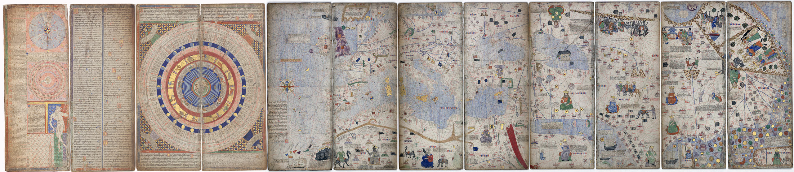
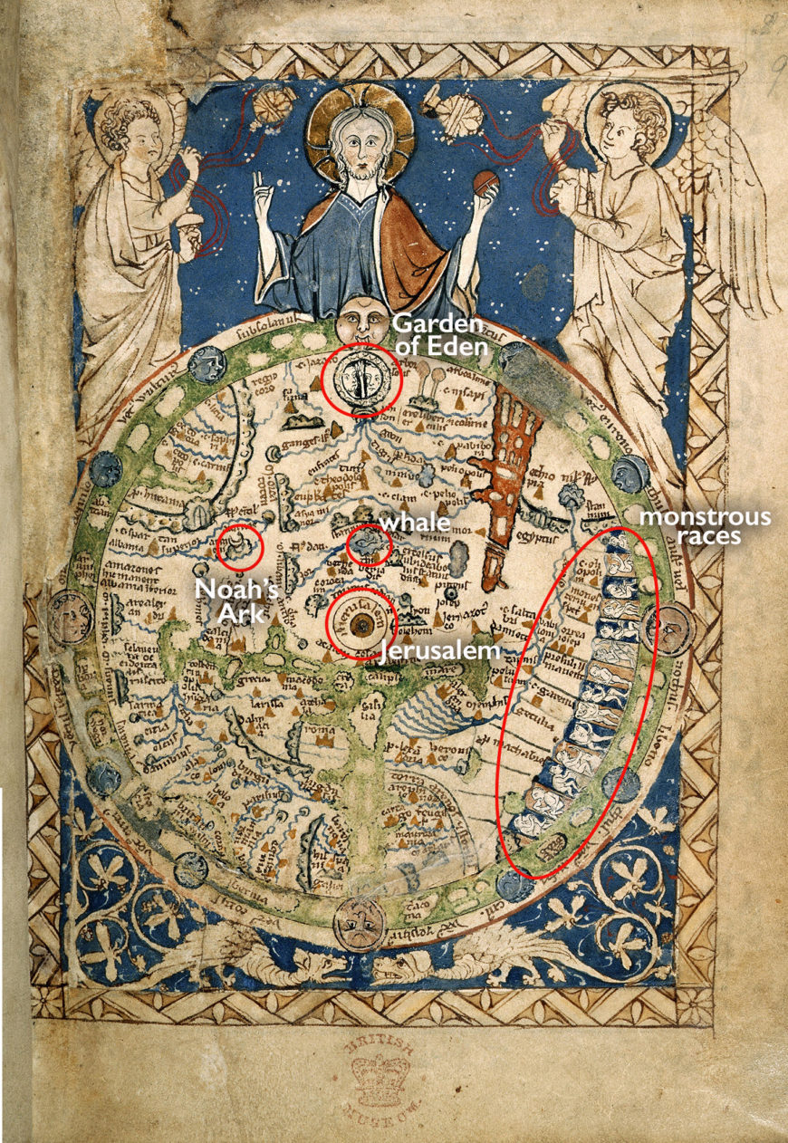
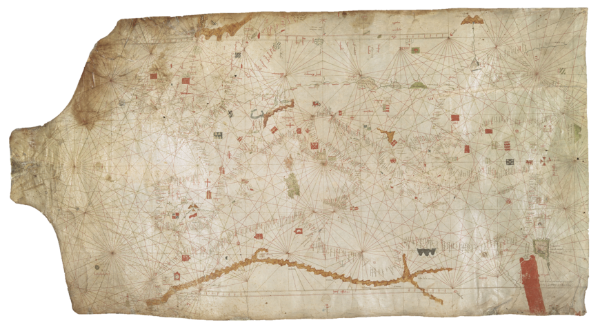
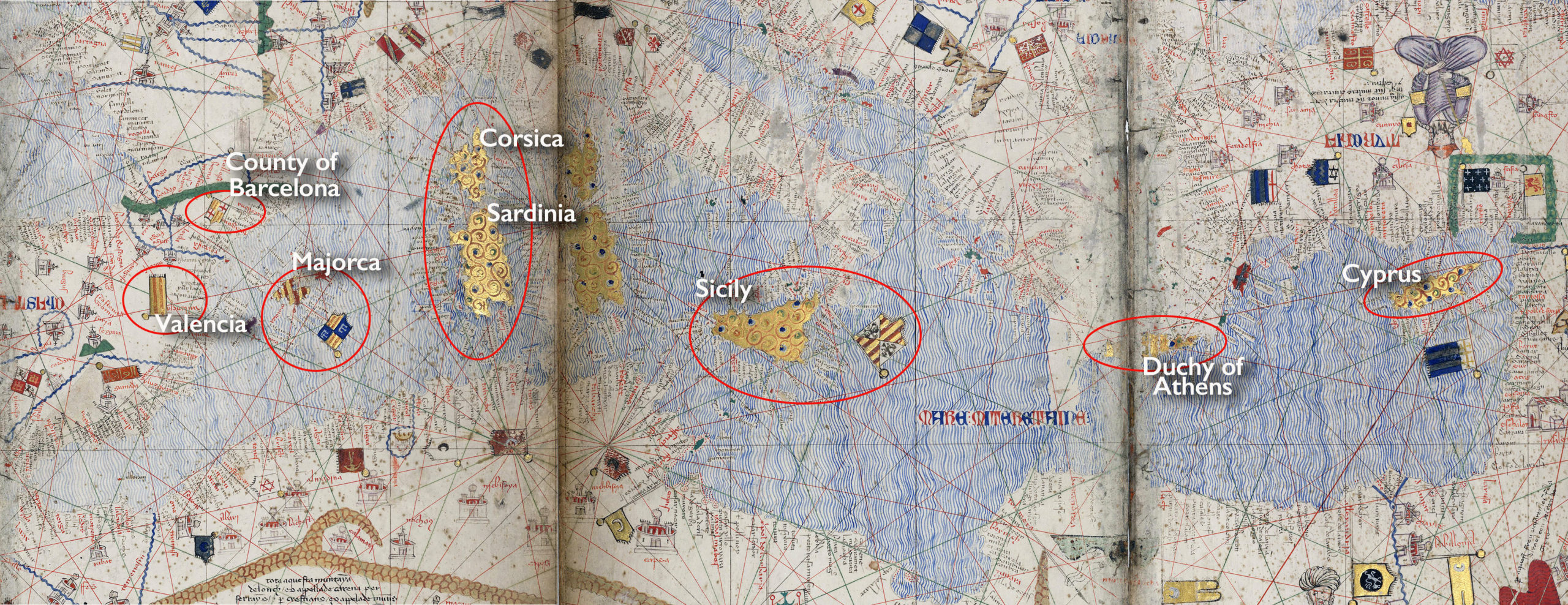
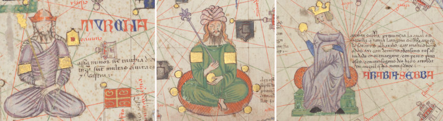
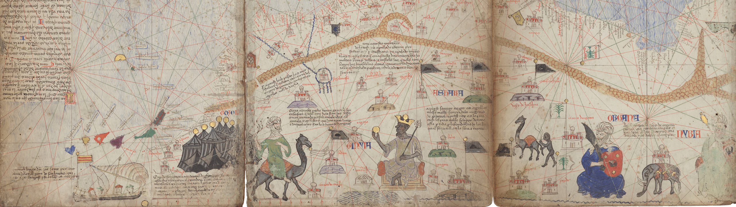
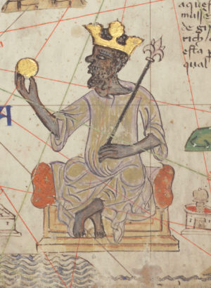
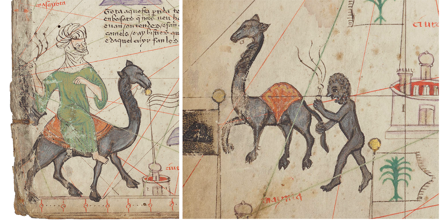

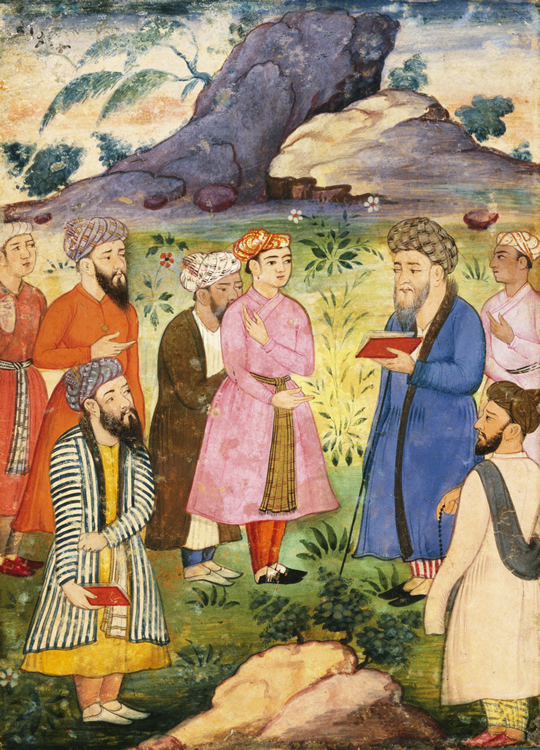
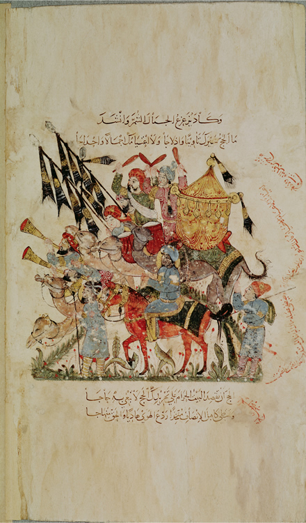
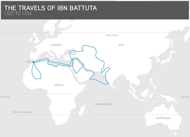


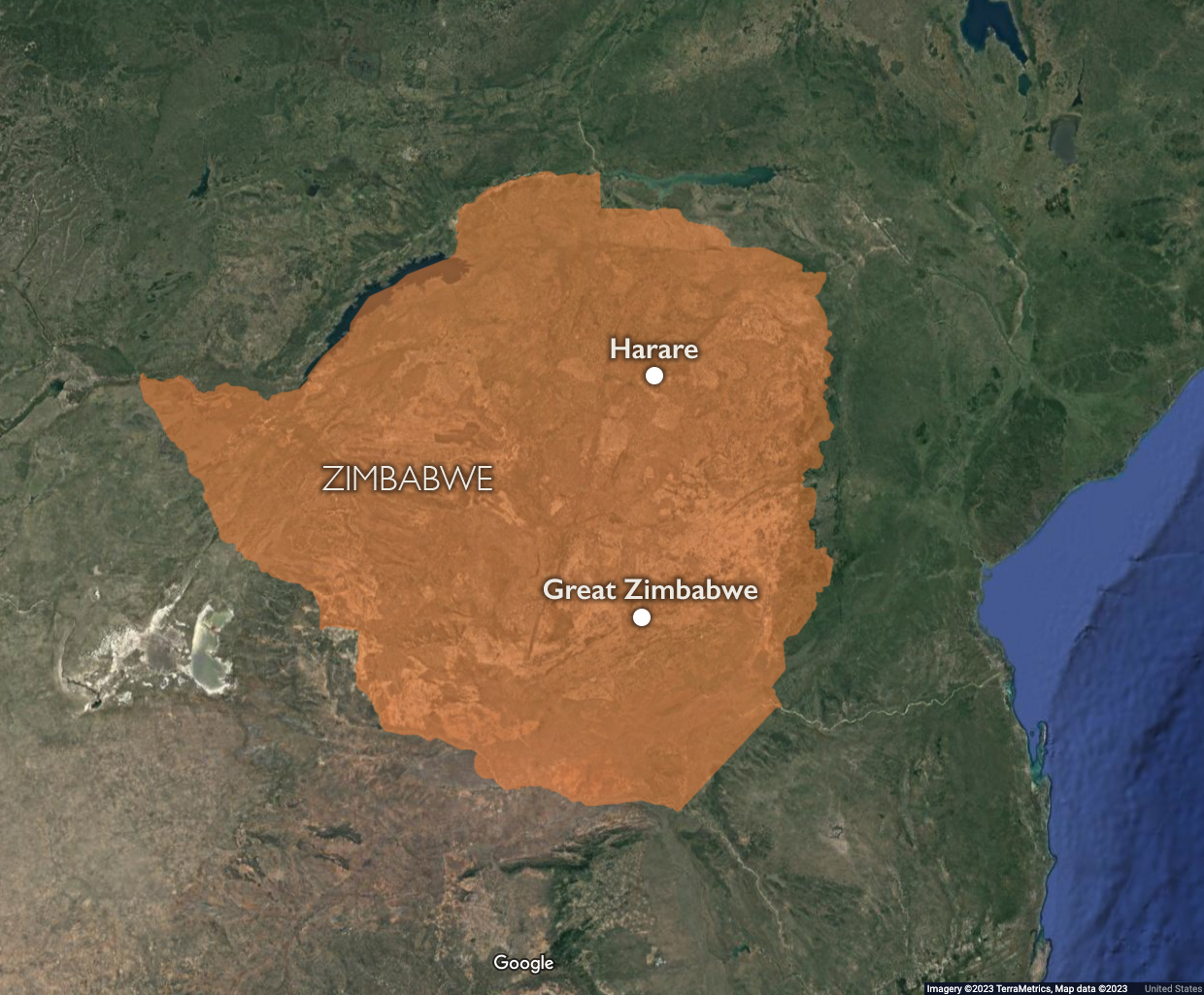
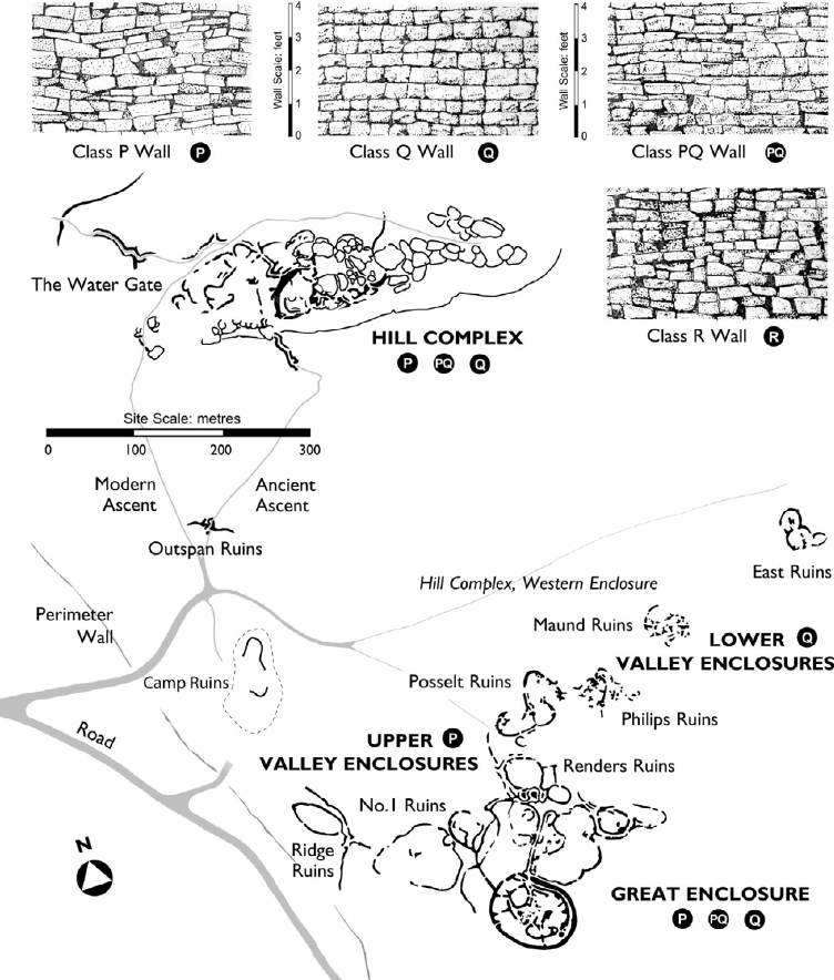


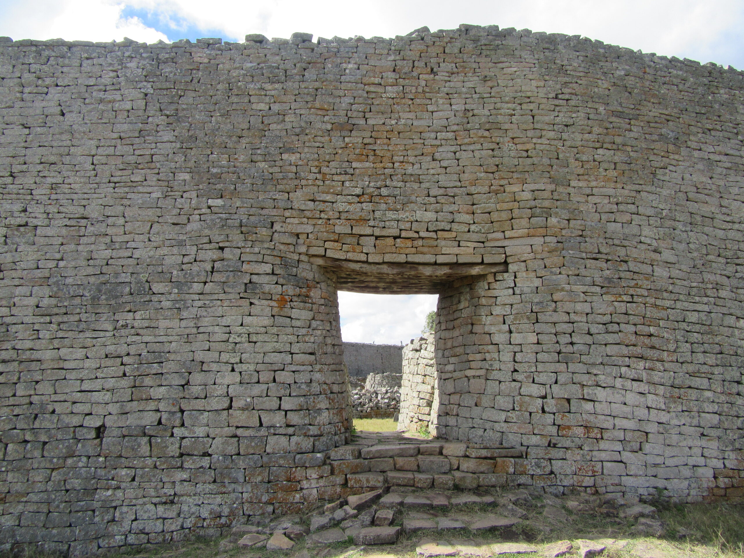


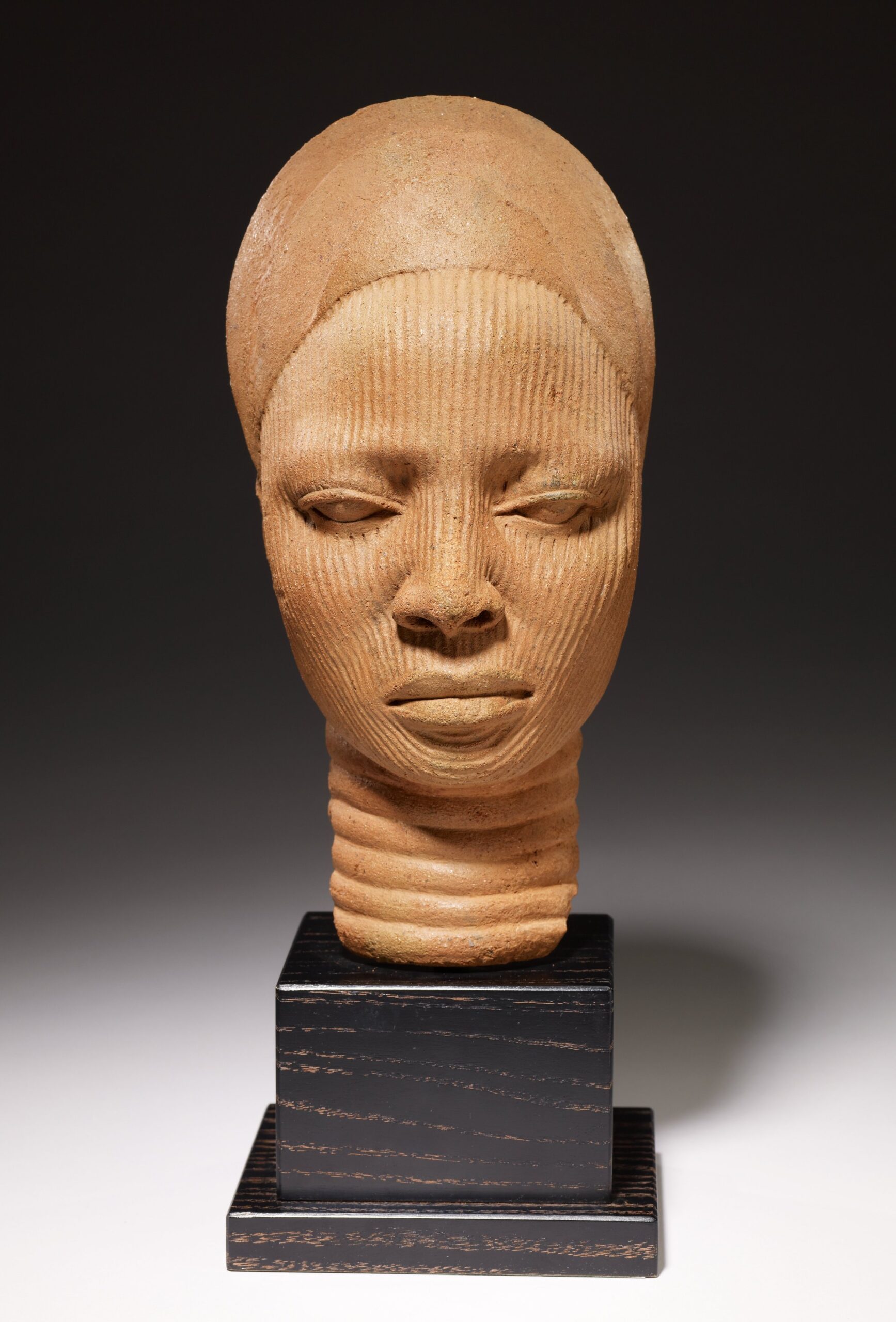
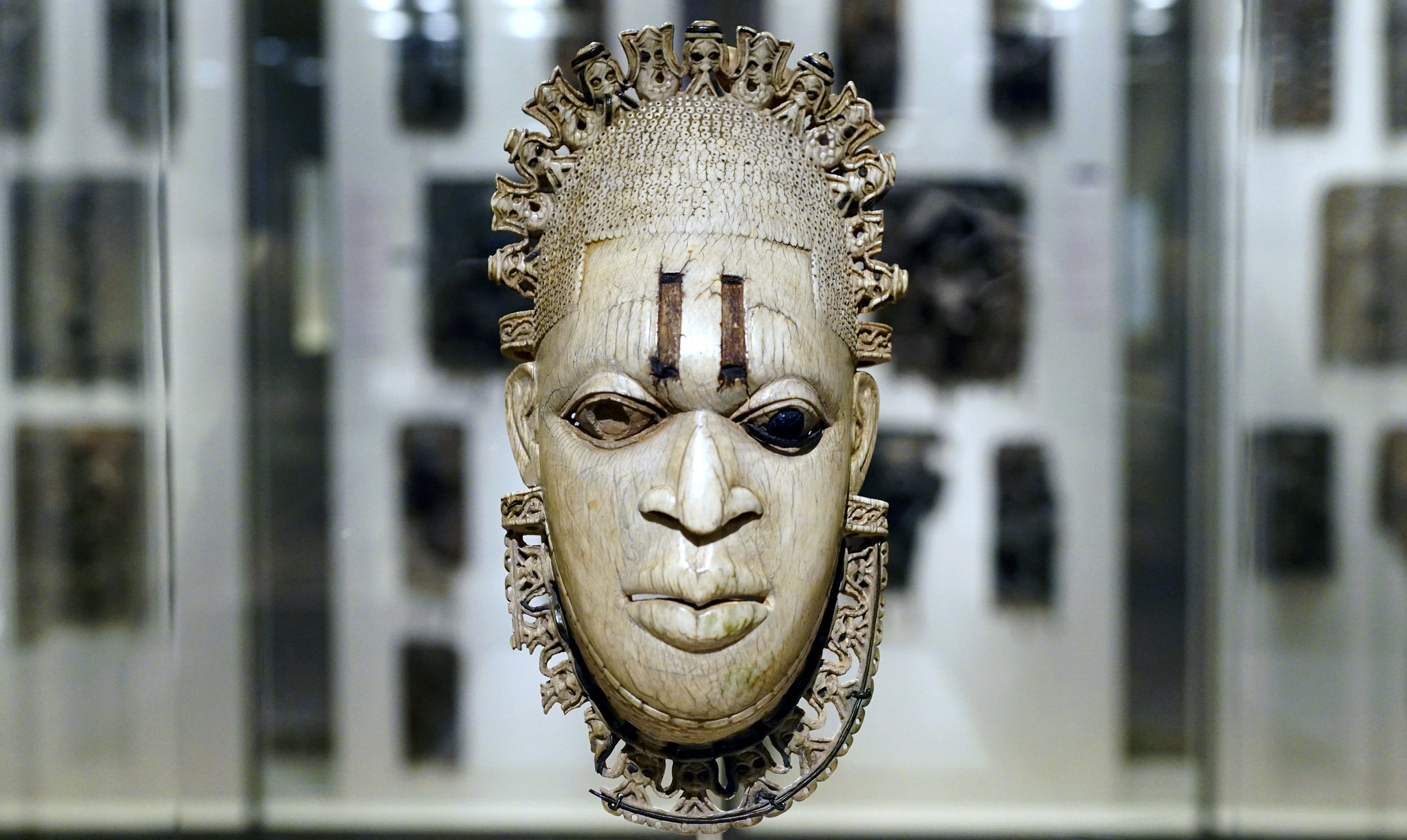
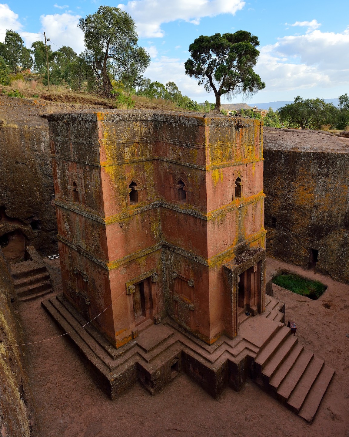
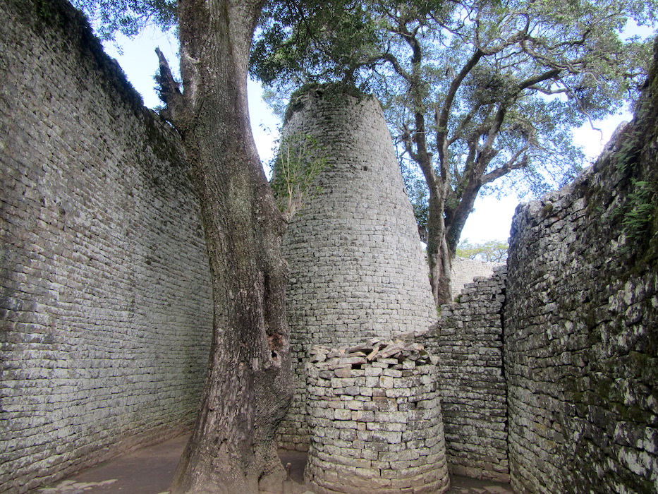
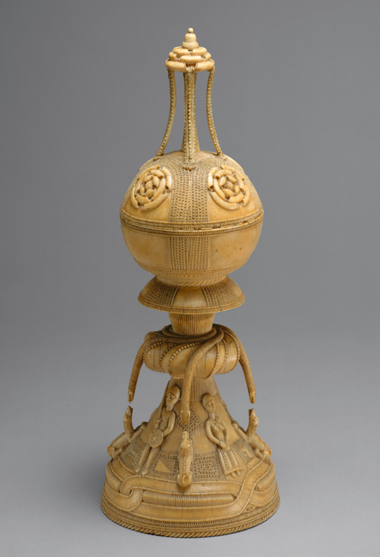
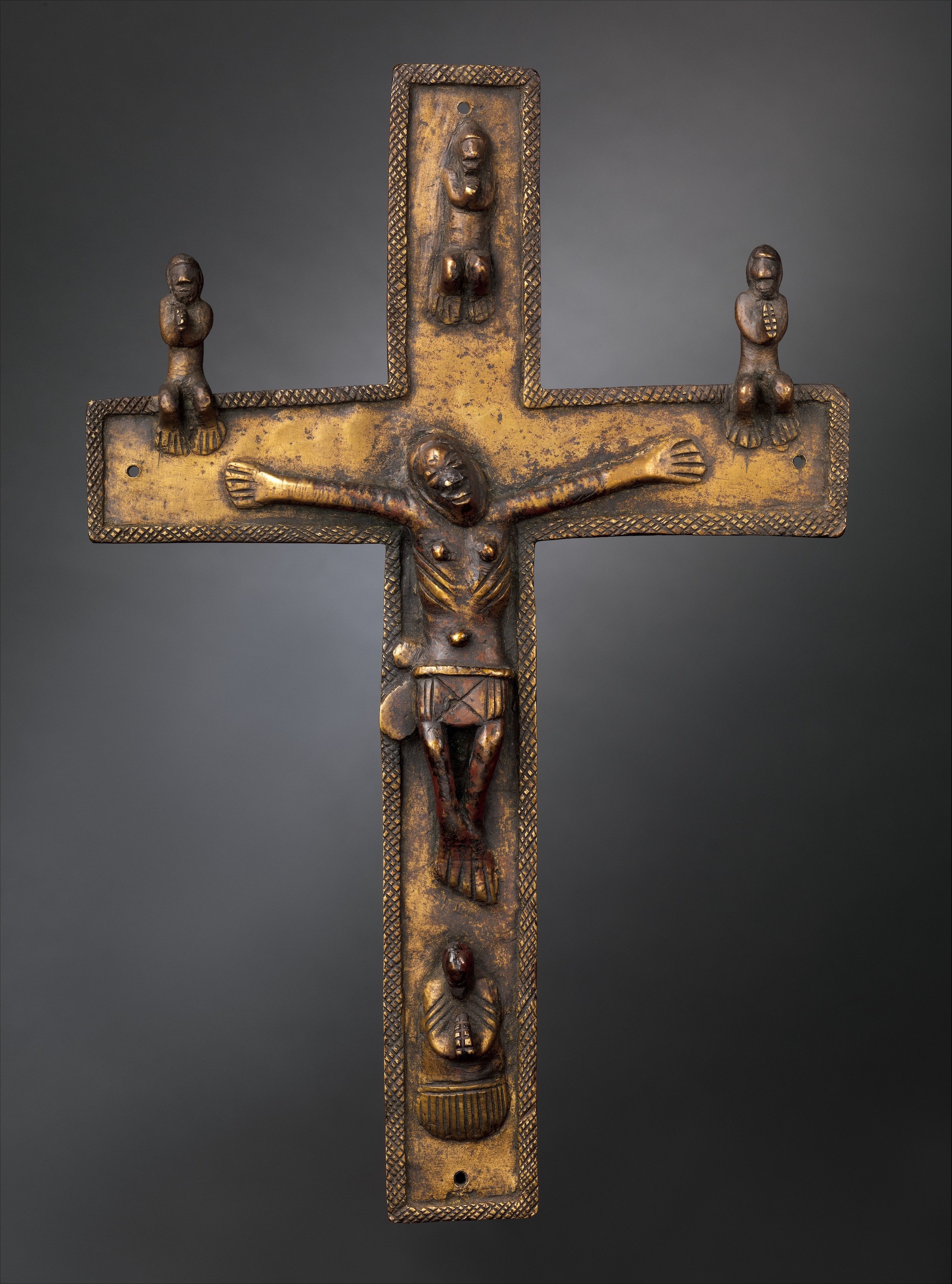
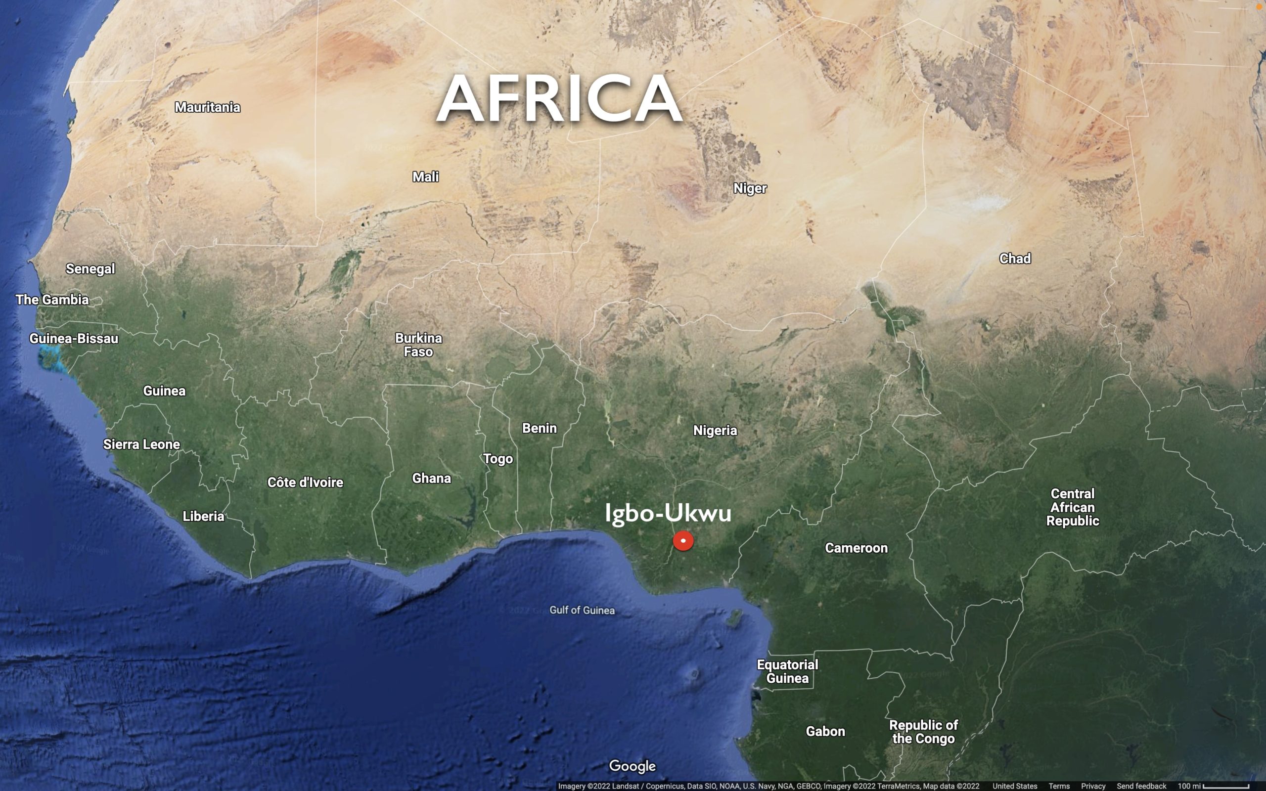

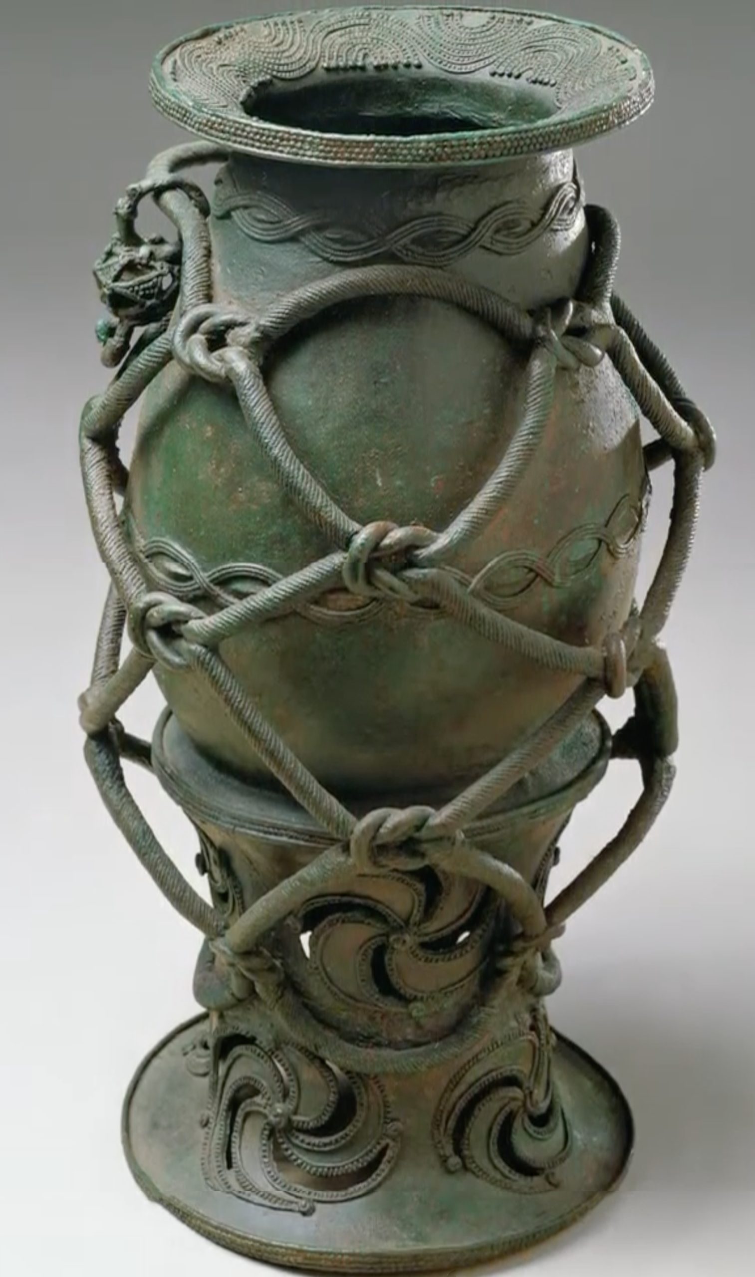

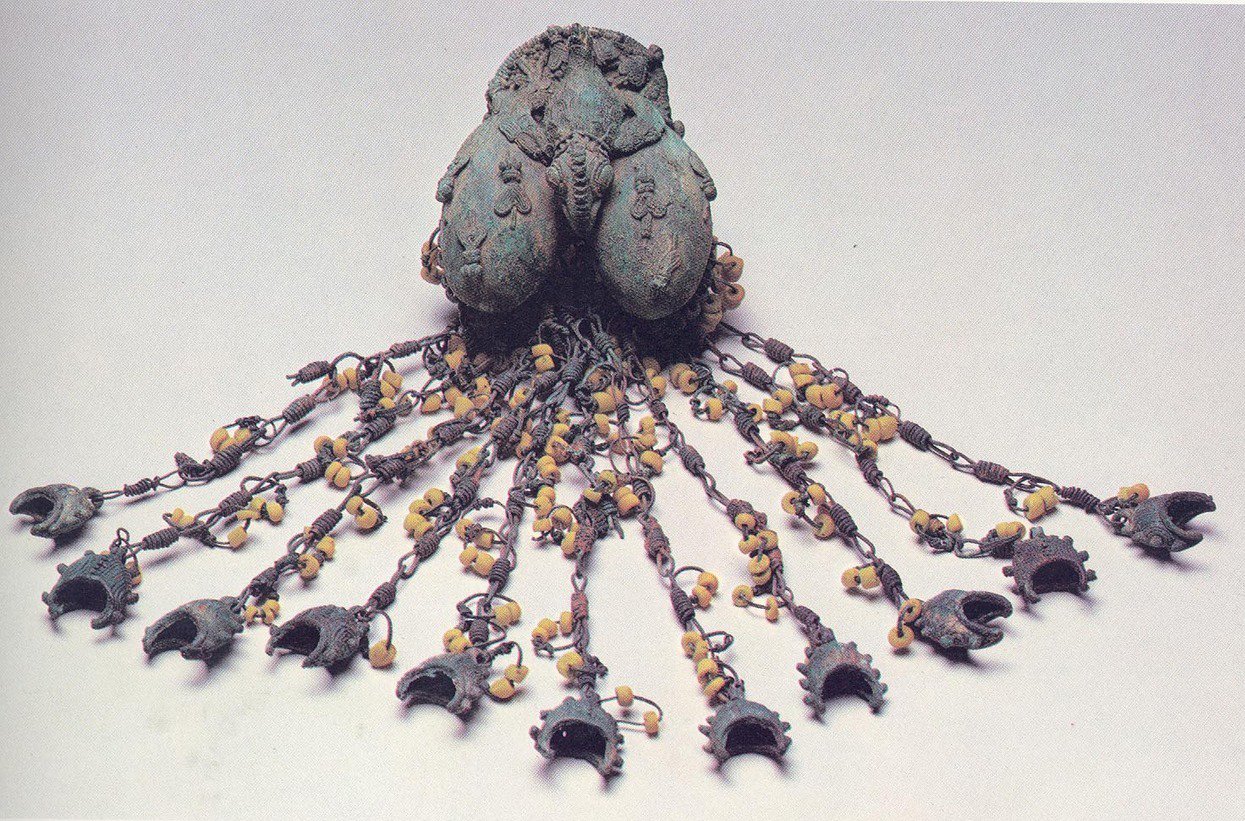
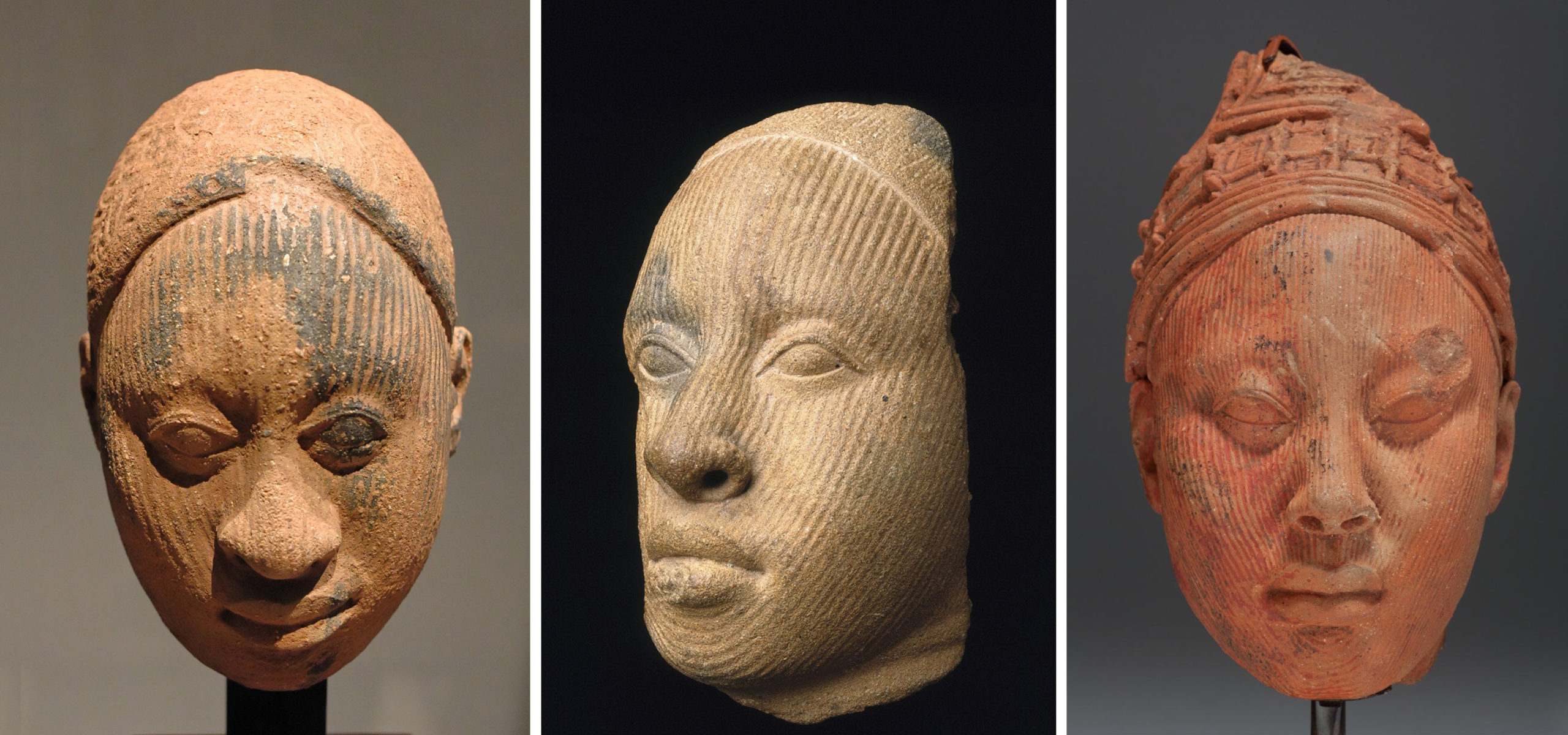
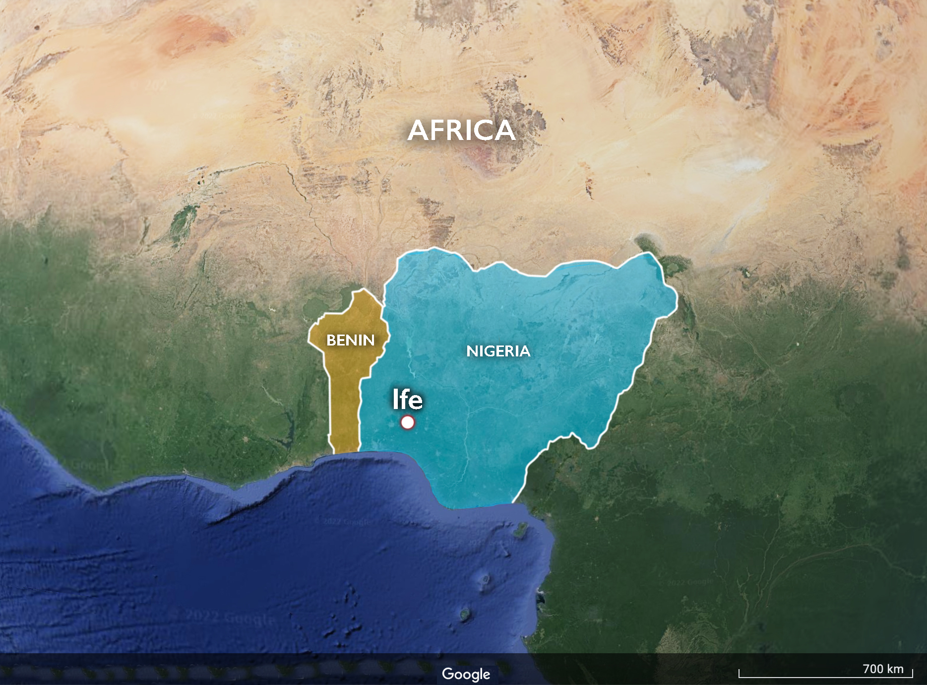
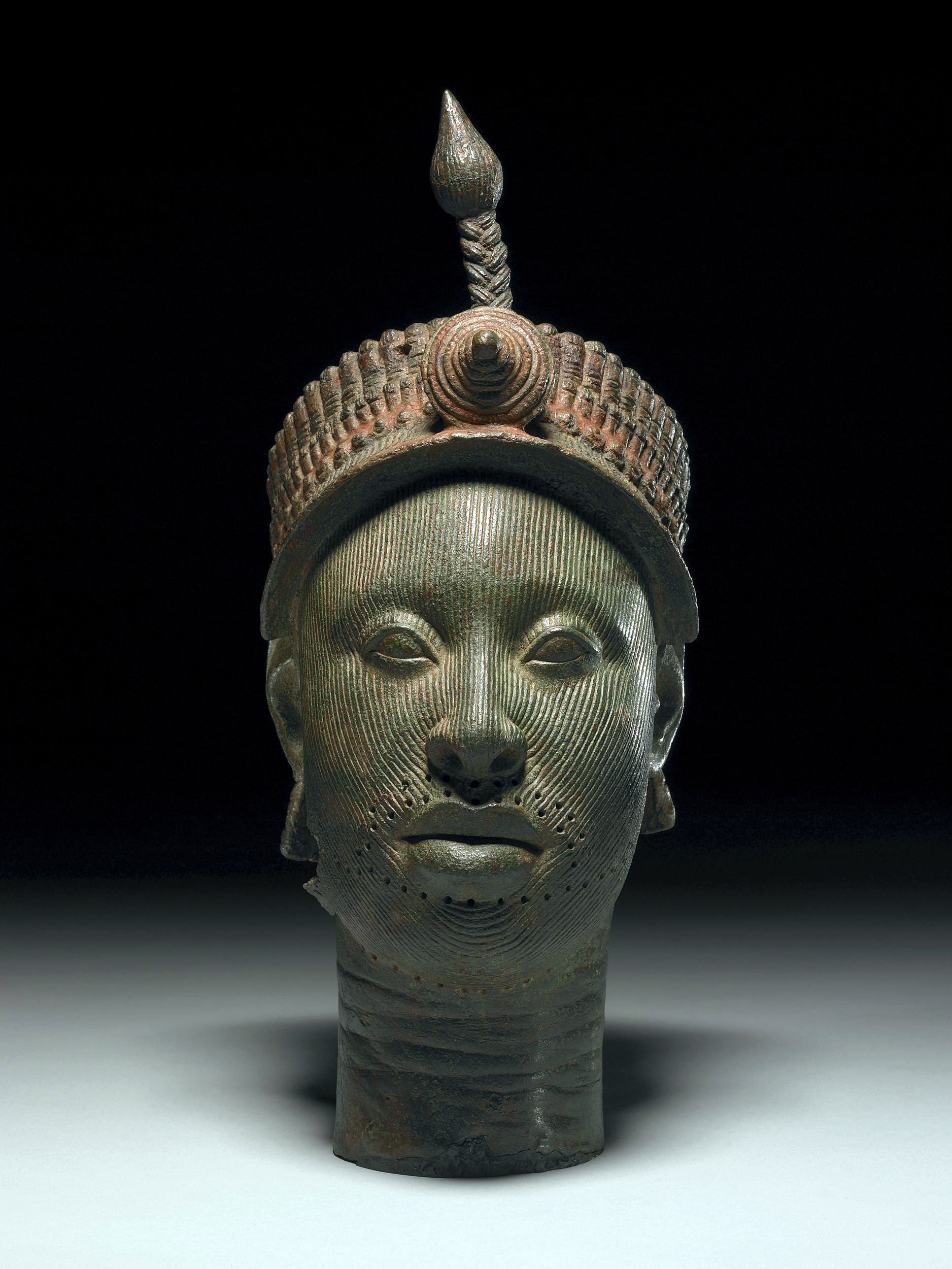
